A remarkably dry airmass over central Australia will move east over the next 72 hours, bringing dangerous fire weather to NSW over the weekend.
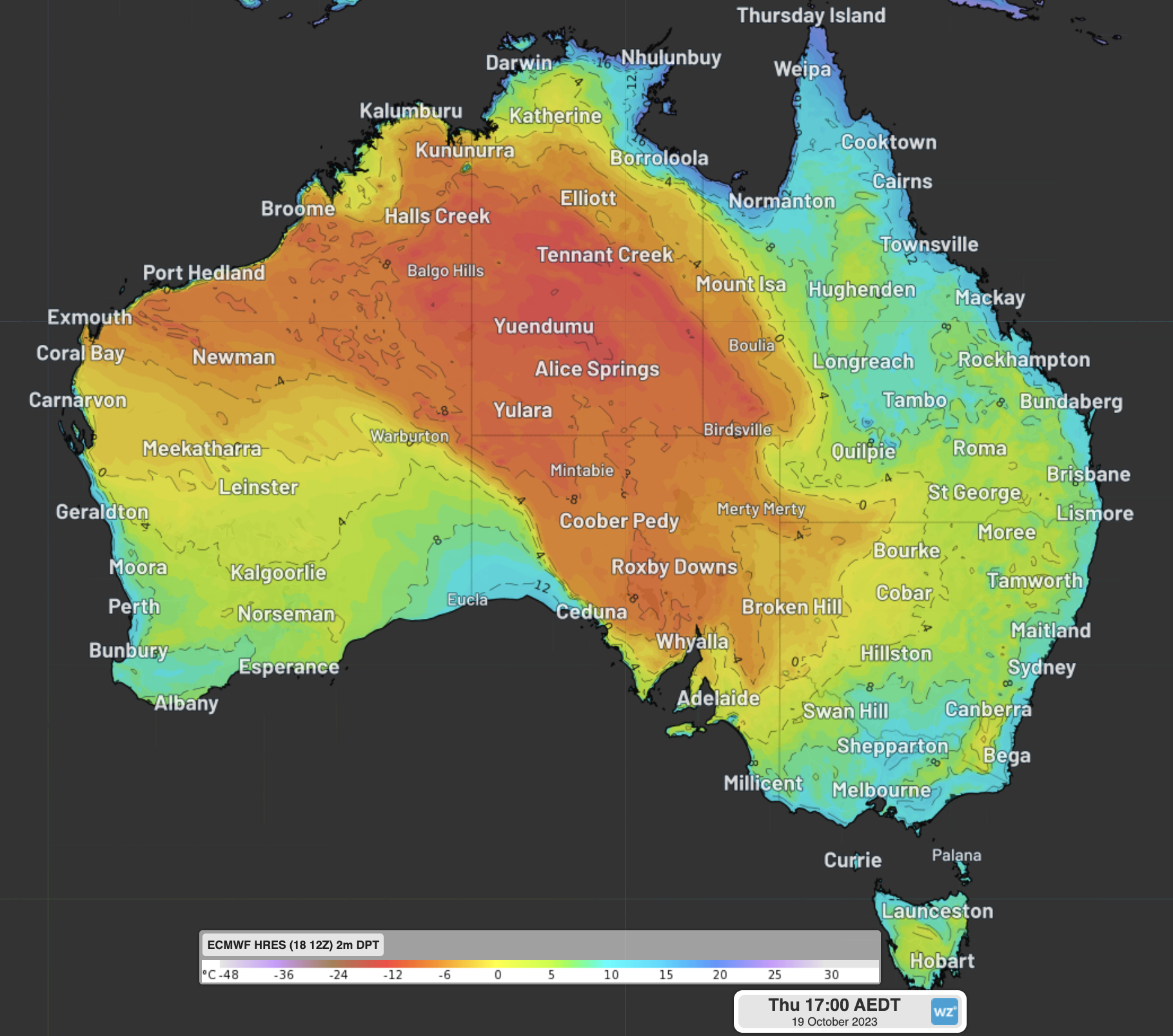
The map below shows the parched air sitting over parts of WA, the NT, SA and Qld on Thursday morning.
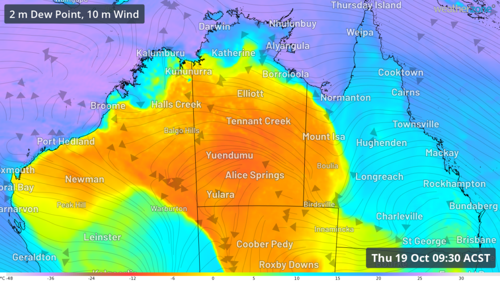
Image: 2m Dewpoint and 10 metre wind observations at 9:30am CST on Thursday October 19
The air over Tennant Creek on Thursday morning was particularly dry with the town recording a dewpoint of –7.5ºC and a relative humidity of 9 percent.
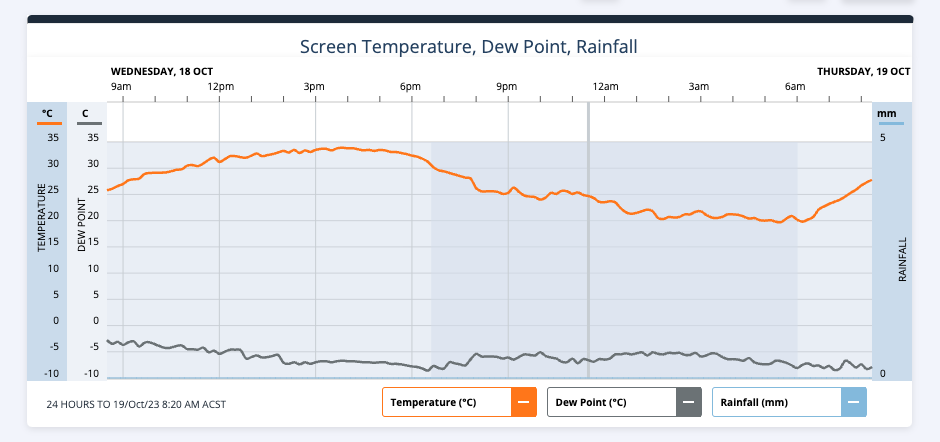
Image: Showing low dewpoints (grey) and warm temperatures (orange) during the 24 hours to 8:20am ACST on Thursday, October 19.
This airmass is unseasonably dry for this time of year, with the average October relative humidity sitting at around 30 percent.
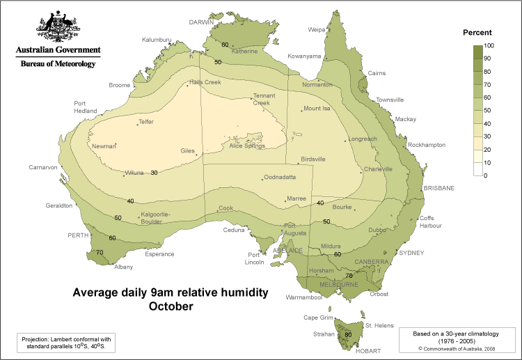
Image: Average daily 9am relative humidity in October, Source: BOM
So, what is a dewpoint?
The dewpoint is the temperature at which air must be cooled to achieve condensation (dew) or 100% humidity. The higher the dewpoint, the greater the amount of moisture in the atmosphere.
High humidity air can make the temperature feel a lot hotter than it is, as it prevents sweat from evaporating off our skin which cools our body temperature down.
A dry airmass will feel a lot cooler than it is, with sweat evaporating freely which cools our bodies.
This is how different dew point temperatures would make you feel if you were accustomed to Australia’s sub-tropical climate;
>24ºC – Oppressive, uncomfortable for most, possible heat stress issues
- 20-24ºC – Muggy and quite uncomfortable
- 15-20ºC – Starting to feel muggy, though still comfortable for most
- 10-15ºC – Comfortable
- 5-10ºC – Dry
- < 5ºC – Very dry
While low dewpoints are generally more comfortable for humans, they can be very dangerous for fire weather.
Low dewpoints can dry vegetation like bark, twigs, grass and leaves out quickly, making it more flammable.
This along with winds speed, rainfall and lightning can all influence the intensity, size and predictability of bushfires.
The dry airmass on Thursday is bringing extreme fire danger to the Ashburton coast in WA and high fire danger to other districts in WA, SA and the NT.
The map below shows the dry airmass central Australia on Friday afternoon.
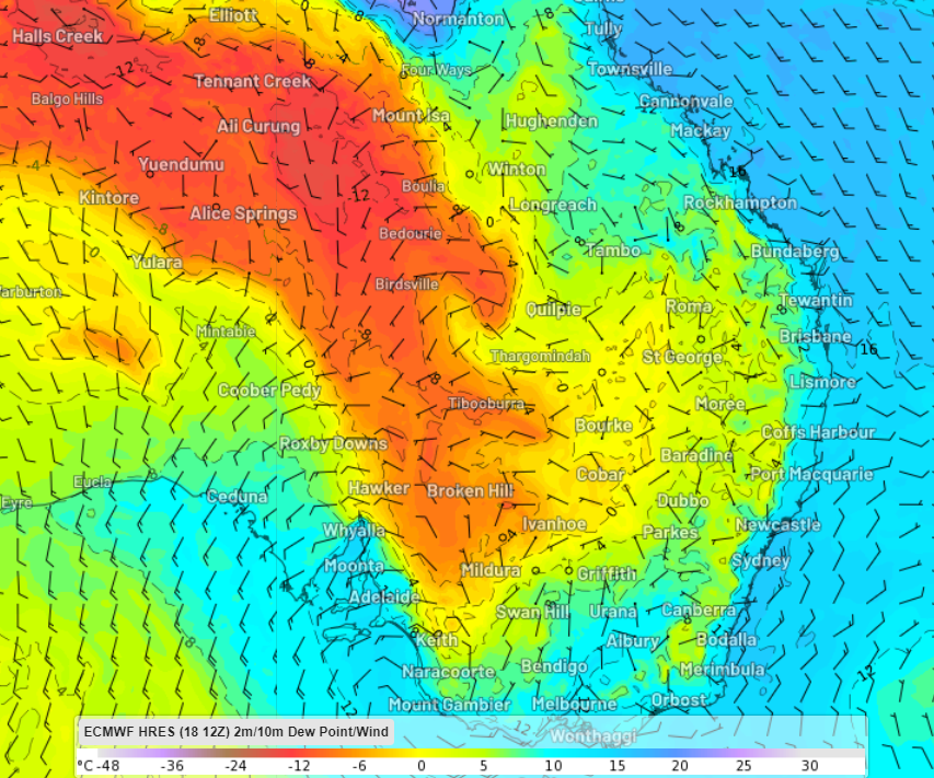
Image: 2m Dewpoint and 10 metre wind forecast at 5pm AEDT on Friday October 20.
The dry air will combine with hot and windy conditions ahead of a cold front that will sweep across the southeast late this week. This will bring high fire danger to multiple states and territories on Friday.
The airmass will continue to move eastward over the weekend, with warm and windy conditions also forecast for parts of NSW, the ACT and Qld.
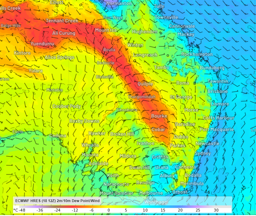
Image: 2m Dewpoint and 10 metre wind forecast at 5pm AEDT on Saturday October 21
On Sunday extreme fire danger is forecast for parts of the Sydney Metro, the Hunter and the northern ranges and western slopes as the hot and dry airmass impacts the region. Dew point temperatures could fall as low as -8ºC as the dry westerly wind change moves through.
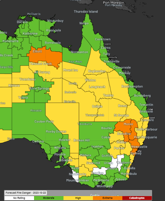
Image: Forecast fire danger on Sunday, October 21, Source: BOM
High fire danger is also expected in the Kempsey NSW and Bundaberg Qld regions on the weekend, where large, out-of-control fires are already burning.
Fire crews are trying to control these fires ahead of the return of warm, dry and windy conditions this weekend. Be sure to keep an eye out for the latest fire warnings here. For more information, please contact us at apac.sales@dtn.com


