
Melbourne saw an unusual spike in temperature last night when the mercury jumped to 21°C at 3am, making the middle of the night feel warmer than an average spring day.
Thursday night started off warm for this time of year as light northerly winds had the temperature sitting on 16°C at 10pm. The mercury then cooled to 14°C by midnight, which is about 6°C above the average minimum temperature at this time of year.
A surge of northerly winds then brought much warmer air into the city from central Victoria. By 3am Melbourne’s temperature had shot up to 21°C, a jump of more than 6°C in under three hours.
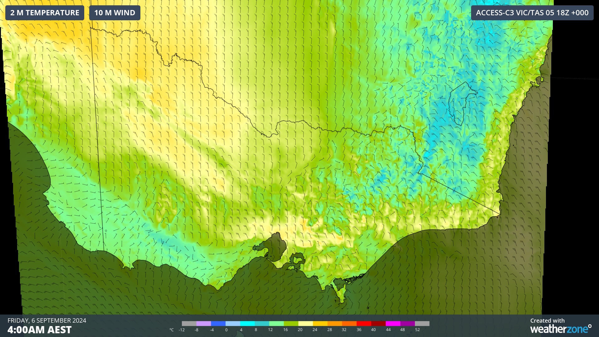
Image: Northerly winds over central Vic at 4am AEST on Friday, carrying warm inland air towards Melbourne.
It’s rare to see overnight temperatures exceeding 20°C in Melbourne at this time of year:
- The city’s average minimum temperature in September is 8°C
- It’s average daytime maximum temperature in September is 17°C
- The warmest September night on record for Melbourne had a minimum temperature of 20.5°C
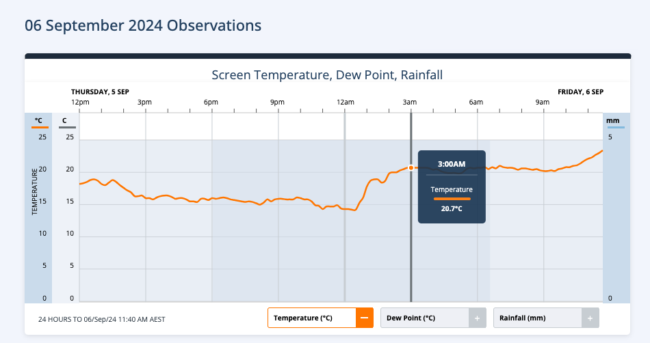
Image: Temperature observations in Melbourne during Thursday night and Friday morning, showing abrupt warming between midnight and 3am.
Melbourne has remained warm throughout Friday morning, although cooler southwesterly winds and showers will drop the temperature in the afternoon following the passage of a cold front.
Damaging winds are also likely to affect parts of eastern Vic on Friday ahead of this cold front, so be sure to check the latest severe weather warnings throughout the afternoon.
OpticastTM V5 is Weatherzone’s cloud-based, consensus forecasting solution that delivers precise weather data to your business, both nationally and globally.
Independently verified to significantly outperform other industry models, Opticast gives you a strategic advantage if weather impacts your enterprise. Armed with the most accurate nowcasting and forecasting data, you can mitigate operational and safety risks, and plan to make the most of severe weather windows.
Opticast is powered by machine learning, intelligently adapting to the local conditions of your site area. Gain a world-leading forecasting system that rapidly responds to changing conditions.
We give you the foresight to make quick and powerful decisions when you need to protect your valuable team and assets, and ensure maximum productivity. For more information, please visit our website or email us at apac.sales@dtn.com.


