
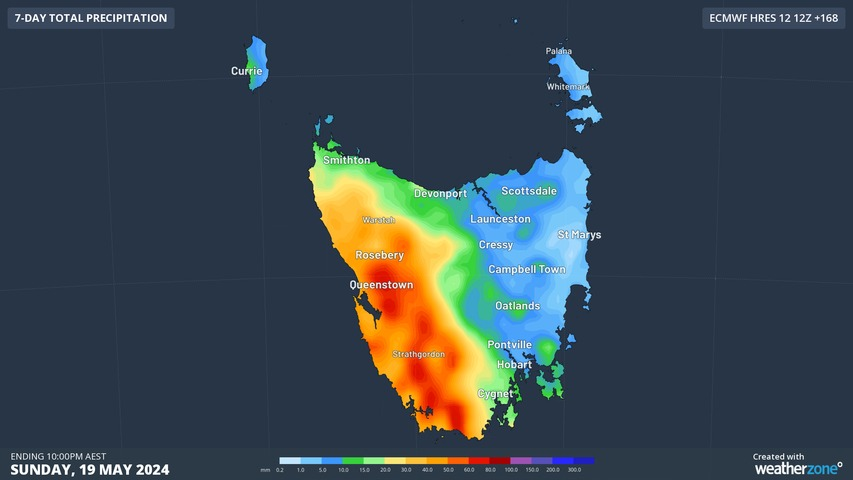
Some much-needed rain will fall across western Tasmania this week, soaking parts of the state that have been running more than 200 mm below their average rainfall over the last six months.
Rainfall has been lacking in western parts of Tasmania since late last year thanks to a dominance of high pressure systems to the south of Australia. These highs have acted like a shield against rain-bearing cold fronts, starving western Tasmania from its usual pre-winter rainfall.
While high pressure and low rainfall are to be expected in Tasmania the warmer months of the year, the last six months have been even drier than usual.
In the six months between November 2023 and April 2024, rainfall was more than 100 mm below normal for much of Tasmania and more than 200 mm below average in parts of the state’s west and south.
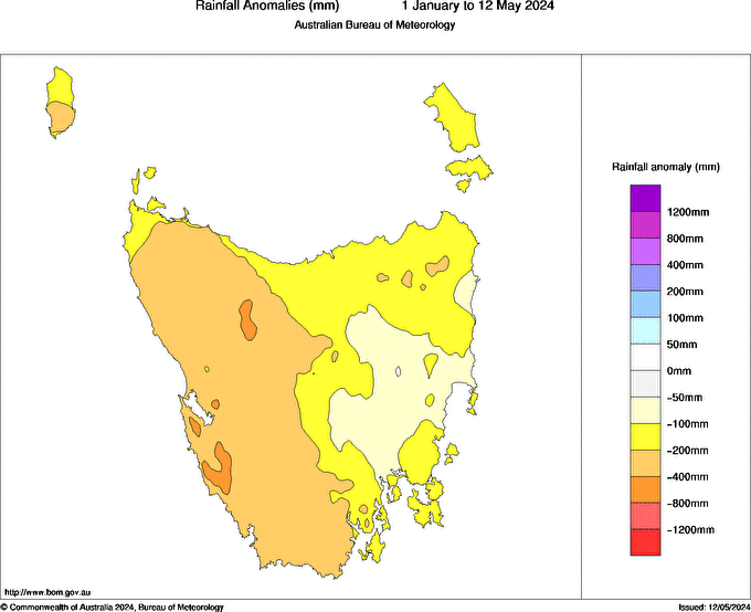
Image: Observed rainfall anomalies between November 1, 2023 and April 20, 2024. Source: Bureau of Meteorology
Even Agfest, Tasmania’s 3-day agricultural field day that is synonymous with rain, was a completely dry event this year.
Hobart’s cumulative rain between January 1 and April 30 this year was only 35.6 mm, making this the city’s driest start to a year since 1984 and its 4th driest on record, with data available back to 1894.
Fortunately, this week will offer a decent bout of wet weather for some western and southern areas in Tasmania.
A series of relatively weak cold fronts embedded in a sustained flow of west to southwesterly winds will cause rain every day in Tasmania this week. The heaviest falls will be in the west, which is the region most exposed to these winds, although most of the state has a chance of some wet weather this week.
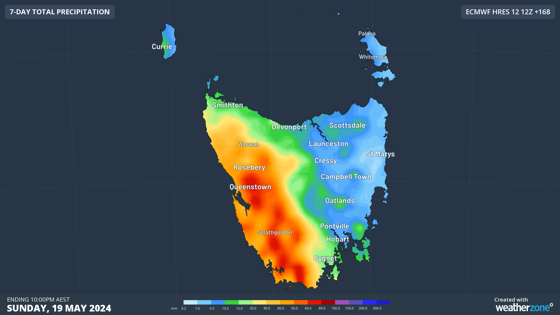
Image: Forecast accumulated rain this week, according to the ECMWF-HRES model.
Hobart is not likely to receive heavy rain in this week’s weather pattern, so the state’s capital city will have to wait until late May or June for some decent rainfall.
Hydropower
Using Opticast’s nowcasting and forecasting capabilities, you will have long-term outlook covering rainfall and extreme heat events out to 12 months. This can significantly improve your planning as you integrate the data with site-specific hydrological parameters.
With renewables making up more of Australia’s energy mix every year, we want to support your business to make informed critical decisions and improve your overall generation and safety.




