
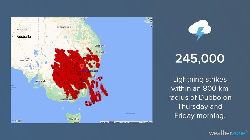
An outbreak of early-spring thunderstorms has caused prolific lightning over Australia’s southeastern states during the last 24 hours.
The animation below shows lightning spreading across central and southeastern Australia on Thursday and Friday morning. These storms were triggered by a large pool of cold air from the Southern Ocean clashing with much warmer air over the Australian continent.
Video: Lightning strikes detected between Thursday morning and Friday morning.
Total Lightning Network detected around 245,000 lightning strikes within an 800 km radius of Bourke during the 24 hours ending at 9am AEST on Friday. The bulk of these strikes were over NSW, although lightning also occurred in Qld, Vic, the ACT, Tas, SA and the NT on Thursday and Friday.
This week’s thunderstorms are a taste of the stormy weather that will becomes more prominent over eastern and northern Australia sin the coming months. The image below shows the average lightning density over Australia during spring, with seasonal lightning hotspots typically found in northeast NSW, southeast Qld and the northern tropics.
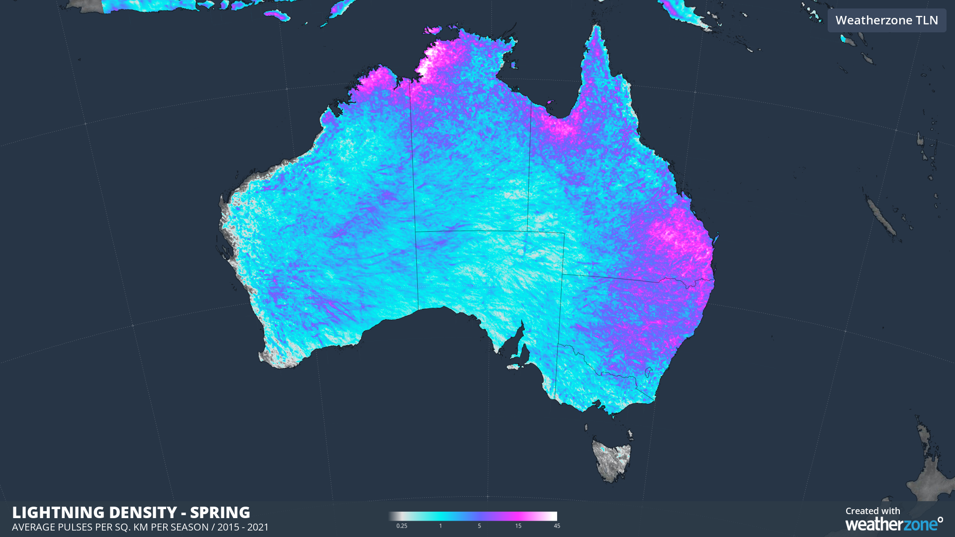
Image: Average lightning density in spring, based on all lightning detected in September, October and November between 2015 and 2021.
Thunderstorms will continue to affect parts of northeast NSW and southeast and central Qld on Friday. While storms have now cleared for most other areas of southeastern Australia, a wintry mix of showers, blustery winds small hail and snow will affect parts of Tas, Vic and southern NSW on Friday. Severe weather warnings have been issued in each of these states.
Weatherzone’s Total lightning Network is your key to precise detection and alerting, giving you time to protect your people and assets.
The shifting climate is bringing increasingly severe weather events, so it’s time to safeguard your business against the potential damage lightning can cause.
Our Total Lightning Network is the intelligent solution that goes above and beyond to increase your lead time before the storm hits.
We ultilise a vast global sensor network, created with our partner Earth Networks. Over 1200 sensors in 40+ countries provide a worldwide view of both intra-cloud (IC) and cloud-to-ground (CG) lightning strikes, enabling businesses to plan and respond with the most precise insight available.
Offering unsurpassed accuracy, with real-time detection to <200m, we integrate with your existing systems to keep your enterprise operating within your defined severe weather thresholds.
Leave nothing to chance. Be confident working outdoors with the most sophisticated lightning alerting system, delivering intelligence to any device across your business network. For more information, please contact us at apac.sales@dtn.com.




