
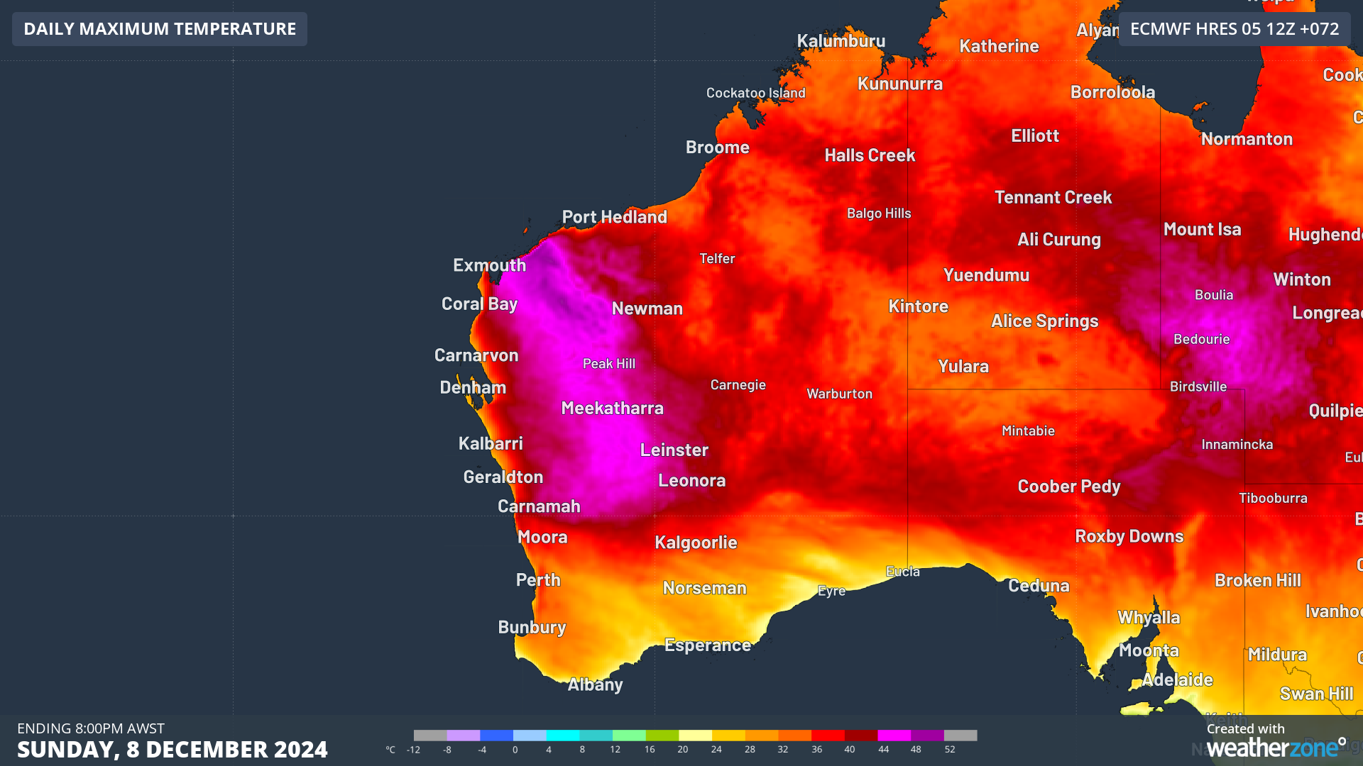
WA is bracing for a brutal heatwave for at least five days, with temperatures soaring into the 40s and heightened fire risks affecting much of the state.
Western Australia is preparing for a relentless heatwave over the next five days, with temperatures climbing into the 40s and fire danger levels rising across much of the state
The prolonged period of heat is being generated by a stubborn high-pressure system and ridge in the Bight, which is directing hot northeasterly winds from Australia’s hot interior all the way to the west coast.
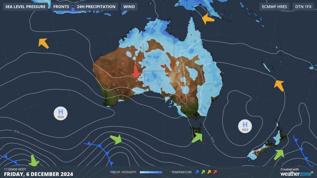
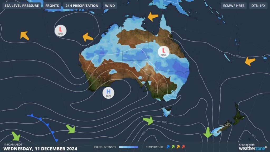
Images: Mean Sea Level Pressure charts (MSLP) showing a stubborn high pressure system and ridge remaining in the Bight for at least 5 days.
Maximum temperatures will reach the low to mid 40s for several days in the Pilbara and Gascoyne regions prompting a severe to extreme heatwave warning to be issued for the three days beginning on Friday, December 6.
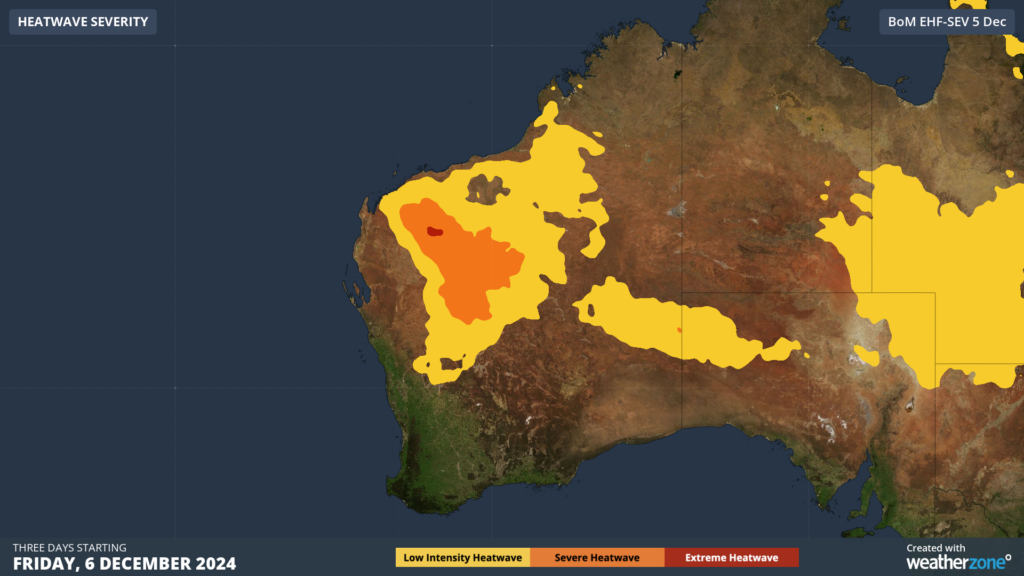
Image: Heatwave severity forecast for WA for three days beginning on Friday, December 6. Source: Bureau of Meteorology
The heatwave conditions over the next six days, will also bring high to extreme fire danger across much of the state. Fortunately, the large out of control fire impacting coastal communities to the north of Perth has been extinguished, however the communities of WA should remain alert.
While each day in the next week will be hot for WA, the hottest days are forecast to be Sunday and Wednesday and Thursday next week.
You can see by mid next week the heat spreads to the south and west, impacting the Central and Lower west regions, including Perth.
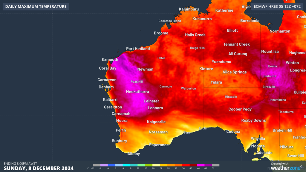
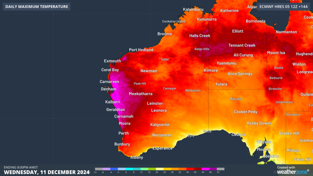 Images: Maximum temperature forecast on Sunday, December 8 (top) and on Wednesday, December 11 (bottom), according to ECMWF
Perth is set to see a run of at least six days at or above 32°C, with temperatures possibly peaking at 37 to 38°C next Wednesday and Thursday.
There are early signs that temperatures should finally drop into the 20s next weekend, with a cooler southerly change forecast to sweep through the city.
There is still some uncertainty around the forecast mid to late next week, with a possible tropical low or cyclone developing off the Pilbara or Kimberley coast. The rain and cloud associated from this system could change the temperature forecast dramatically.
DTN APAC supplies precise weather intelligence to over 75% of the National Energy Market (NEM); and is the trusted provider for the Australian Energy Market Operator (AEMO).
Weatherzone’s next-generation nowcasting and forecasting system, OpticastTM, is independently proven to outperform other industry models, allowing energy traders to respond rapidly to changing conditions. From 14 day forecasting to seasonal outlooks, you have access to complete and powerful weather intelligence giving you the confidence to make the best call.
Meeting the needs of the changing market, Weatherzone utilises high-resolution modelling and local knowledge to provide 5-min granularity observations and forecasts, optimising your market bidding and maximising your profits. These, coupled with briefings from our energy meteorologists, give you full awareness of the associated risk.
Benefit from specialised indices such as apparent temperature, Cooling/Heating Degree Days (CDD/HDD) and Effective Degree Days (EDD) to help accurately predict demand. You can get a clear picture of forecast conditions across the market and quickly assess heat/heatwave potential from 14 days out to 12 months
No matter where your energy trading focus lies, we have the power generation and weather insights to inform your critical decisions, keeping you ahead of the curve. For more information please visit our website or email us at sales.apac@dtn.com.




