Heavy rain has fallen in parts of Victoria overnight, with 100 mm recorded at two weather stations, and flood watches in places for several forecast districts.
Several other locations across the state recorded falls in excess of 50 mm to 9 am Tuesday, as a low pressure system over the Tasman Sea directed moisture onto the southeast corner of the mainland.
Some of the Victorian observations of note to 9 am Tuesday included:
- 19.6 mm at Melbourne Olympic Park (the city’s official weather station) which made it the heaviest daily rainfall total since April.
- 87 mm at Ferny Creek, which was by far the heaviest fall in the Melbourne area.
- 100 mm at Mt Sabine, in the Otway Ranges near the town of Apollo Bay on the Great Ocean Road, west of Melbourne.
- 117 mm at Mt Baw Baw, the heaviest 24-hr total for the site in three years, some of which was snow but most of which was rain.
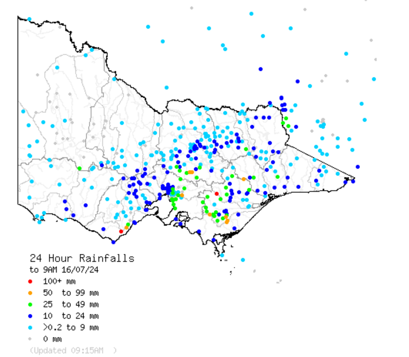
Source: BoM.
The heavy Mt Baw Baw rain would just about have broken the heart of ski resort operators. Baw Baw’s advantage is being the closest ski destination to Melbourne, but its disadvantage – and it’s a biggie – is being the lowest mainland Australian ski resort.
After 15 cm of snow was reported to Monday afternoon at Baw Baw, the weather turned mild and soggy overnight.
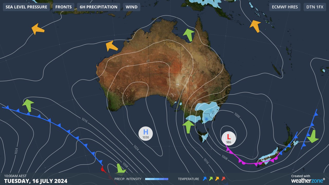
On Monday, we mentioned how the low pressure system centred over the Tasman Sea was dragging relatively warm air towards Tasmania, hence more rain than snow in elevated parts of that state.
That warmer air pushed north overnight, with temperatures at Baw Baw edging above zero after 9:30 pm, which sadly for snow lovers is when the heaviest precipitation kicked in.
The other mainland snow resorts fared slightly better, with decent falls in the range of 10 to 25 cm reported at the NSW resorts, as well as the northern Vic resorts of Falls Creek and Mt Hotham.
Waking up to 24cm of fresh #snow at #Hotham today. Keep it coming! ?????? pic.twitter.com/VOmjwcxozN
— Hotham (@_hotham) July 15, 2024
These places all got lucky to an extent. While their higher altitude was a factor, it also helped that most of the moisture had cleared out when temps started to rise after midnight with the influx of the Tasman Sea air.
Meanwhile as stated earlier, flood watches are in place for several Victorian forecast districts, and there are also flood warnings in place for several Victorian rivers, including the Yarra.
Southern Vic will stay showery for several days and while we shouldn’t see anything as high as the 24-hour totals to Tuesday morning, there’s the likelihood of persistent heavy showers in the east for another day or two, so please keep checking the latest on our warnings page. To find out more, please visit our contact page or email us at apac.sales@dtn.com.


