
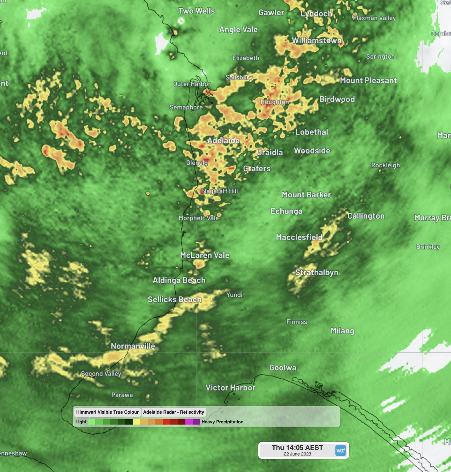
Rain and cold. That’s the super brief synopsis of Adelaide’s weather this Thursday as a slow-moving cloudmass drenches the SA capital.
- A total of 13 mm of rain had accumulated between 9 am and 1:30 pm local time, after 6.6 mm fell in the 24 hours to 9 am. Further rain is expected throughout the day.
Today’s soaking is not the on-again, off-again, showery weather that Adelaide typically sees in winter. Instead it’s a steady, fairly heavy rain stretching across a wide area, as you can see from the early-afternoon radar image below.
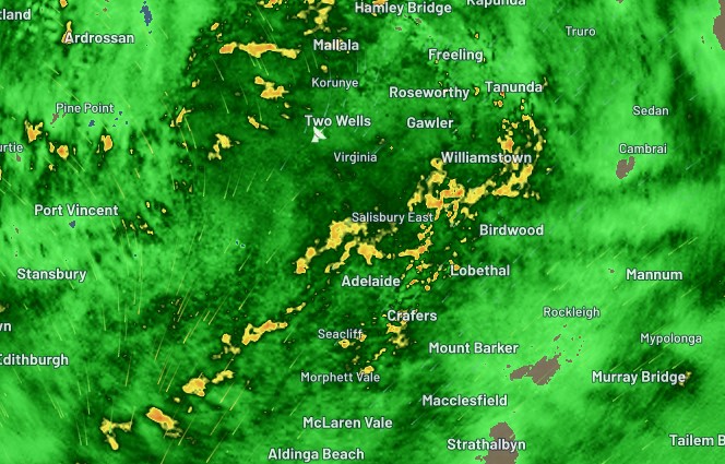
Two other aspects of today’s weather are also slightly unusual: the low temperatures and wind direction.
- It’s cold by local standards in the city today, with temps hovering around just 10°C early in the afternoon, and the June average max of 15.8°C highly unlikely to be reached.
- Yet today’s rain has been blown in over the city by northeasterlies. Adelaide’s chilliest winter weather usually comes from the southwest, so today’s most inclement conditions are coming from the opposite direction to what locals might expect.
So what’s with the weird weather in Adelaide today?
Today’s steady rain has been fuelled by a large northwest cloudband, which you can see streaming across the country in the satellite loop below.
Northwest cloud band streaming over Australia, as the longest night of the year closes in. The June solstice occurs at 00:57 AEST (14:57 UTC) overnight. pic.twitter.com/HbvOKbSOQu
— Andrew Miskelly (@andrewmiskelly) June 21, 2023
Northerly winds ahead of an approaching cold front are producing more rain than usual due to the moisture available from that cloudband.
That’s right, the cold front is approaching, as in it’s not quite here yet.
You might think that today’s chilly weather meant the front had already arrived, but that’s not the case as we write this story. Temperatures thus far today have been kept down by those leaden skies and persistent rain, which haven’t allowed surface-level temperatures to warm up much.
When the front does arrive a little later on, blustery westerly winds should usher in traditional showery wintry weather, rather than the current steady rain. Temps will remain cool even in the sunny breaks between showers, due to the cooler airmass.
Long story short, Adelaide is going to feel pretty wintry for at least the next week, with at least some showers on the cards every day. But today is feeling extra-wintry, albeit because of a slightly unusual combo of factors.
DTN APAC mixes our expert knowledge, data inflows and artificial intelligence to convert our weather forecasts into a forecast of power outages through our Storm Impact Analytics (SIA). This system compares historical outages with a custom high-resolution forecast to determine where, when and how many power outages are expected during an event. Check out our forecast a few days ago for this event here, and to find out more about our services, please email us at apac.sales@dtn.com.




