The tropics flaring to life as the monsoon approaches once again is helping to add some heat to this weekend’s heatwave over SA and Vic.
The diagram below shows how air that originates in the tropics can be transported to southeastern Australia, and via a blocking high, add heat to southeastern Australian heatwaves. Note: here we show a tropical cyclone starting the cycle, but broad scale monsoon troughs and intense tropical lows have been shown to have the same effect.
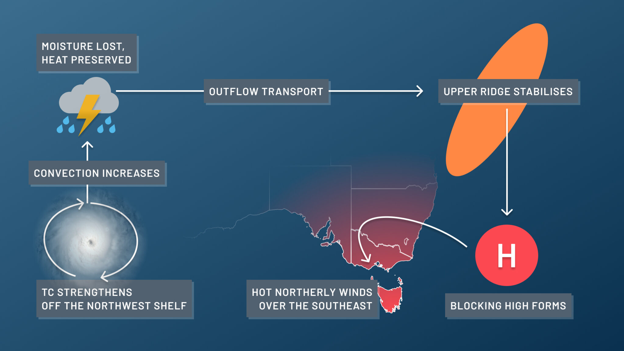
As a tropical low, monsoon or tropical cyclone strengthens off Australia’s northwest shelf, a vast amount of hot tropical air rises and loses its moisture. This drier air, now around 12-15km above sea level, can then get transported in the jetstream towards the southeast of Australia.
Once this air mass arrives over the southeast, it can help create an upper-level high pressure ridge, which acts to stabilise a surface-based high pressure system. This surface high will often then turn into a blocking high, which means it becomes locked in place, making it become very slow-moving, and pushing cold fronts to the south.
The final component is the now dry, but still hot, tropical air accumulated over the upper ridge, which slowly starts to subside and descend to the surface. In extreme heatwaves, this effect (called adiabatic compression) can heat the surface by an additional 15 to 20°C.
The sequence of events outlined above has been instrumental in some of the most intense heatwaves on record in Australia, including the pre-Black Saturday heatwave of 2009 in Victoria, and the record-breaking heatwave of February 2017 in NSW.
A severe heatwave will affect parts of southern and southeastern Australia over the next few days. While this heatwave won’t be as intense as the historic examples mentioned above, activity over the tropics is helping to make this heatwave warmer, most likely by about 2 to 5ºC.
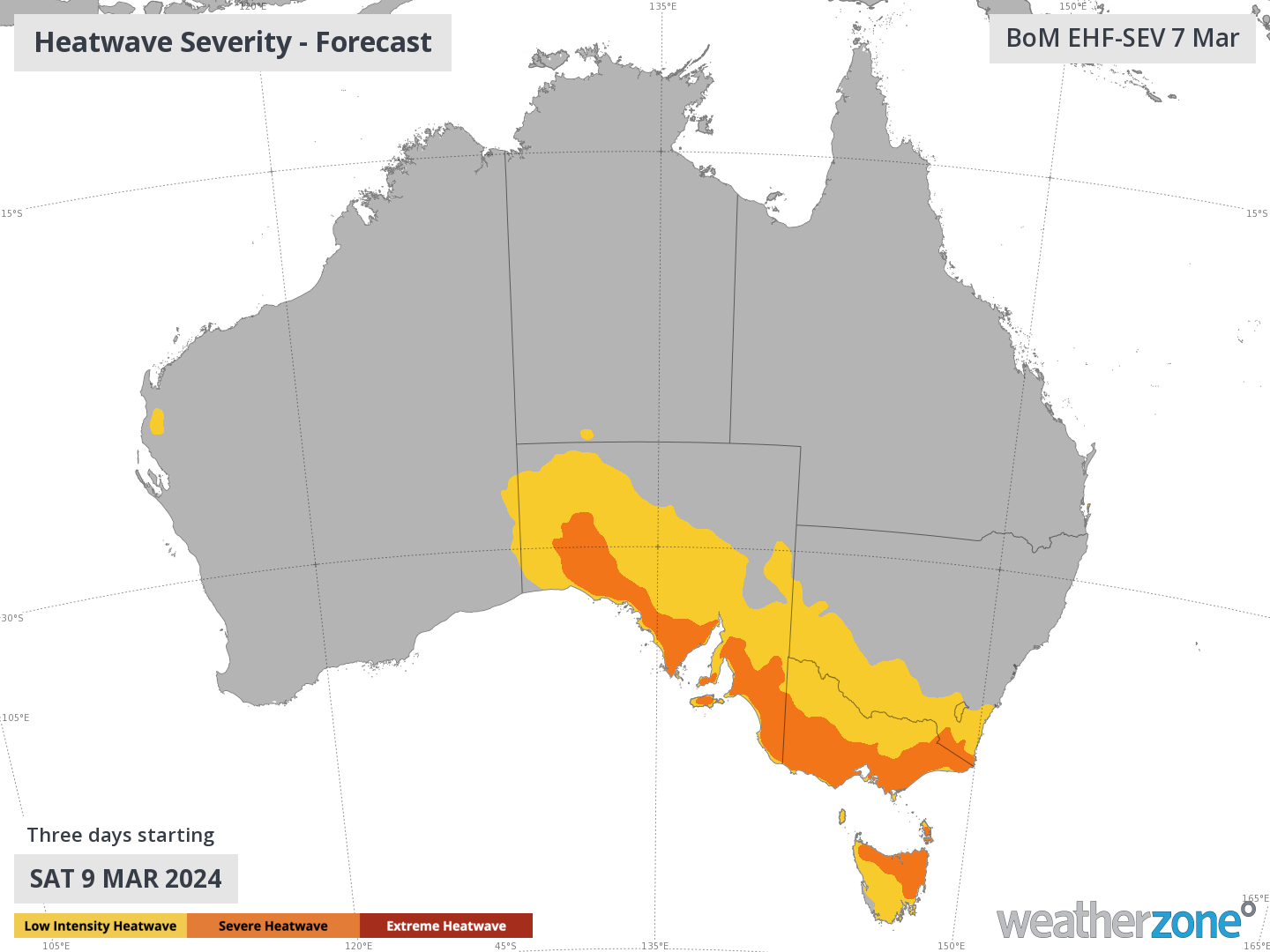
Image: Forecast heatwave severity on Friday, Saturday and Sunday.
Adelaide could reach the high 30s to low 40s from this Saturday to Monday next week, while the Bureau of Meteorology predicts maximums around 38 to 39ºC in Melbourne for these three days. Minimum temperatures will also be well above average in both capital cities for the next few nights.
Your business can benefit from the timely delivery of accurate weather information, allowing informed and effective decision-making. For more information, please contact us at apac.sales@dtn.com.


