
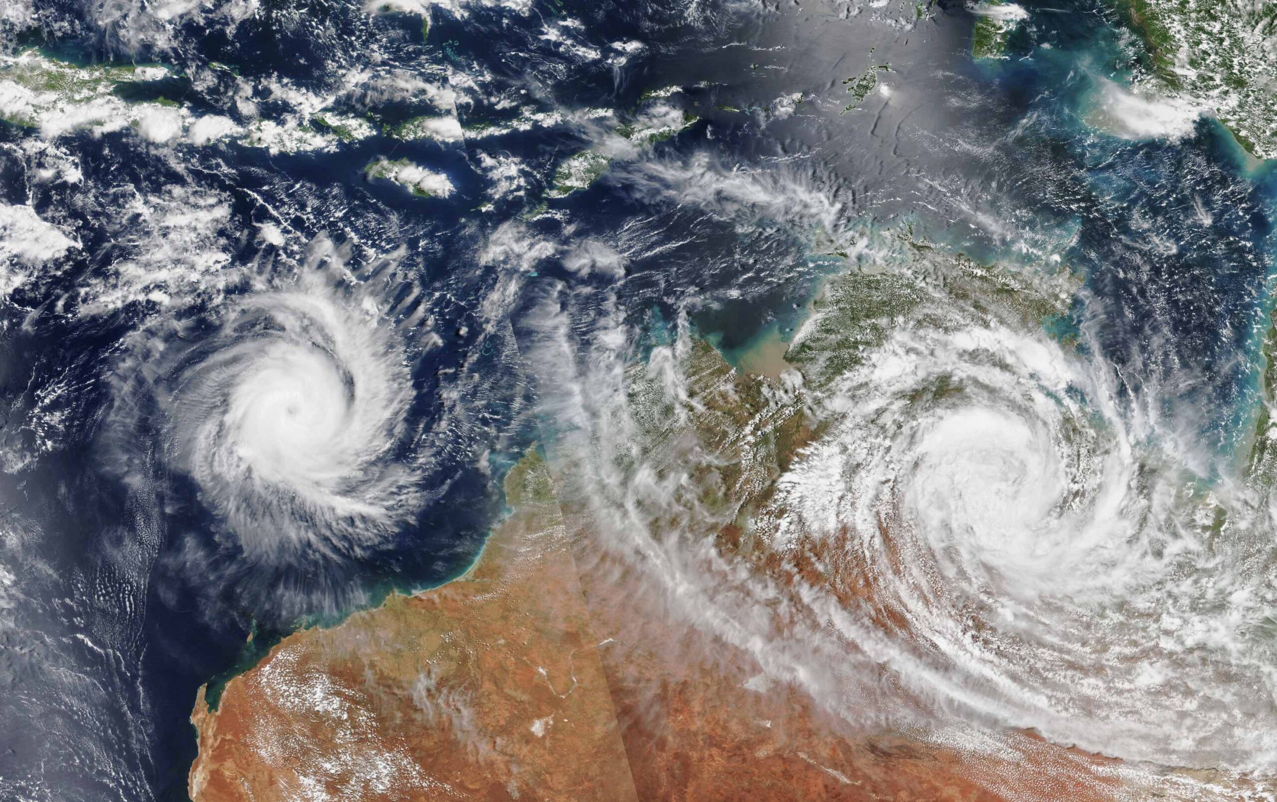
The 2025-26 tropical cyclone season has begun with abnormally warm oceans surrounding northern Australia, signalling an increased risk for severe tropical cyclones in the coming months.
The Australian tropical cyclone season runs from November 1 to April 30. During this six-month period, there are usually about 9 to 10 tropical cyclones in the Australian region, with around half of these typically becoming severe tropical cyclones (category three or higher).
This season has potential to feature an unusually high proportion of severe tropical cyclones due to abnormally warm ocean temperatures near northern Australia.
Read more: Australia’s 2025-26 Tropical Cyclone Outlook
All tropical cyclones need sea surface temperatures at or above 26.5°C to form. Once over this threshold, the rate at which tropical cyclones can intensify generally increases with higher ocean temperatures.
Sea surface temperatures to the north of Australia are currently above 27°C and even higher than 31°C in some areas near the to the Top End and in the Gulf of Carpentaria. These temperatures are about 1 to 3°C above average and rank in the top 10 percent of historical records for this time of year.
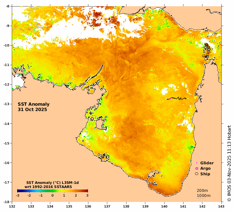
Image: Sea surface temperature anomalies in the Gulf of Carpentaria on October 31, showing warmer-than-normal water for the start of the tropical cyclone season. Source: IMOS
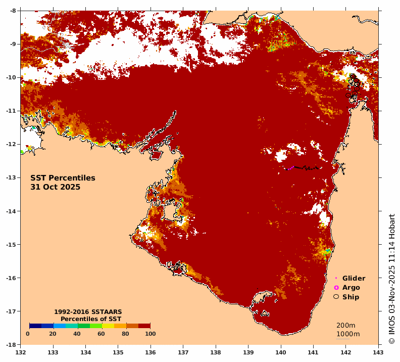
Image: Sea surface temperature centiles in the Gulf of Carpentaria on October 31. The red areas show where temperature area in the highest 10 percent of historical records. Source: IMOS
Having so much warm water near northern Australia at the start of November means there is abundant fuel for tropical cyclone development this season. Tropical cyclones that form in the Australian region in the coming months will have a higher-than-normal potential to strengthen into severe tropical cyclones, thanks to the abnormally warm oceans surrounding northern Australia.
One of the most important things to understand about tropical cyclones is that it only takes one to have a big impact on industries, transportation and the landscape in northern Australia. Regardless of how many tropical cyclones form near Australia this season, if you operate in the tropics DTN APAC’s range of tropical cyclone services are there to support your business with tailored tropical cyclone information this season.
How DTN APAC is helping businesses prepare for the 2025-26 Tropical Cyclone Season
DTN APAC specialises in industry-leading forecast, alerting and threat analysis of tropical cyclones across Australia and Asia, offering you expert, customised solutions when the weather turns wild.
Providing rapid-update forecast information, we alert you to any low-pressure system gaining power within your region and, unlike other providers, can track its development out to 7 days. This gives you the time to prepare and safeguard your staff, sites and assets.
You will have the most precise weather intelligence charting rainfall, wind speeds and potential storm surges to help you make critical decisions quickly. Whether it’s adjusting key work schedules, protecting your staff or securing your site, we have the alerting capability to keep you steps ahead of the storm.
As the climate delivers increasingly severe weather events, their potential to impact your business operations grows.
Whether it’s preparing for the coming season’s tropical storm potential, or rapid-response forecasting with a typhoon approaching, or simply ensuring your operations team is equipped to confidently make decisions ahead of severe weather, our weather Risk Communicators are here for you.
Our weather risk communicators deliver short- to long-term guidance from:
- hourly-event weather monitoring (alerting you of impending destructive winds and heavy rain ahead of a tropical cyclone).
- week to month operational planning based on likely timing of increased monsoonal rain or periods of reduced cyclone activity.
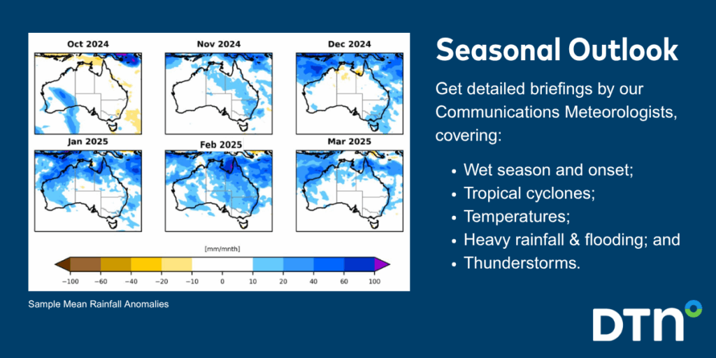
- seasonal long term planning based on climate drivers and the likely trends across the coming months.
We deliver clear and comprehensive weather data, personalised risk assessments and briefings to you and your team, so that your critical decisions can be made with confidence.
We are available 365 days a year, so you always have the timely guidance you require, especially when severe conditions hit.
You have our insights to rely on to see you through complex situations, minimising potential loss of profit and maximising the safety of your staff and assets.
Learn more about our large range of industry leading products and services or email us at sales.apac@dtn.com




