
A negative phase of the Southern Annular Mode (SAM) has developed in the Southern Hemisphere and it’s going to influence weather patterns in the Southern Hemisphere, including the Australian region, in the opening week of October.
What is the Southern Annular Mode?
The SAM is an index that monitors the position of the westerly winds flowing from west to east between Australia and Antarctica. When the SAM is negative, these westerly winds, and the cold fronts and low pressure systems they carry, are located further north than usual for that time of year. When the SAM is positive, the westerly winds, cold fronts and low pressure systems are located further south than usual for that time of year.
A negative SAM started to emerge towards the end of September and this signal has strengthened over the past week. The graph below shows the clear negative SAM signal at the end of September, with forecasts suggesting that it will persist into the opening week of October.
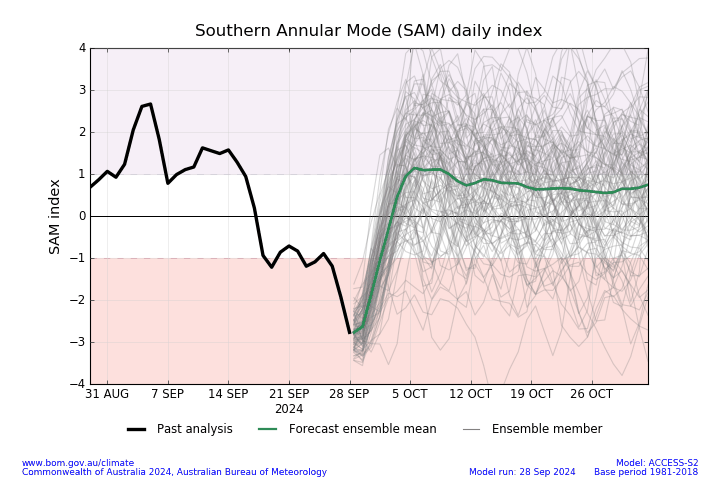
Image: SAM observations and forecast from the Bureau of Meteorology.
What does a negative SAM mean for Australia?
The impacts of a negative SAM change throughout the year. In winter, a negative SAM typically increases wind and rainfall over southern Australia and causes drier-than-average weather in the nation’s east. In summer, a negative SAM increases the likelihood of drier than average weather over much of eastern and southeastern Australia, while increasing the chance of rain in western Tas.
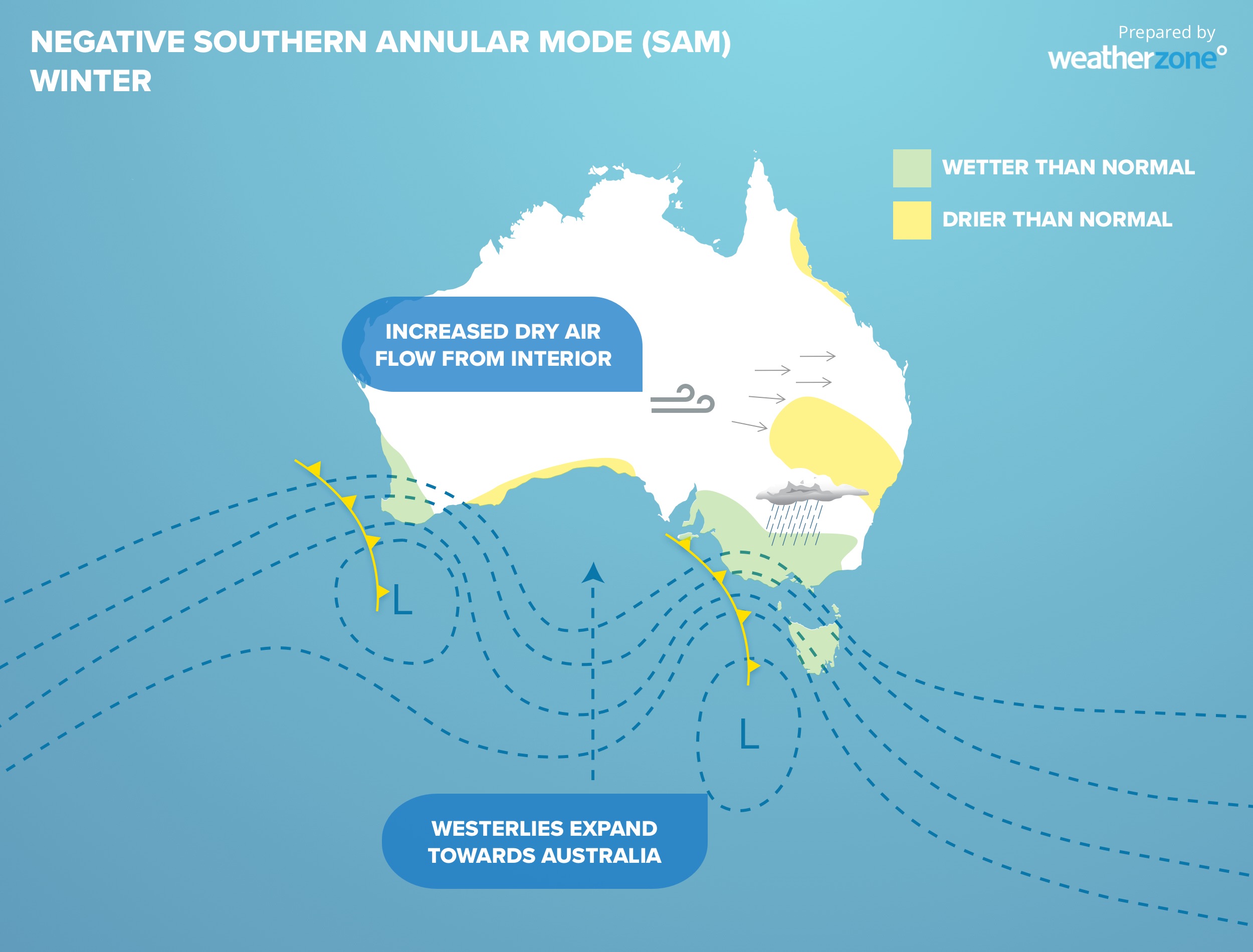
Image: Typical negative SAM impacts during winter.
As we are still in the first half of spring, this week’s negative SAM will increase the likelihood of rain and wind in southern and southwestern Australia and promote drier weather in the east.
The maps below show how the current negative SAM will influence rain and wind this week. The first map shows the forecast accumulated rainfall during the next seven days, with southern Australia being the focus of this week’s rain. The second map
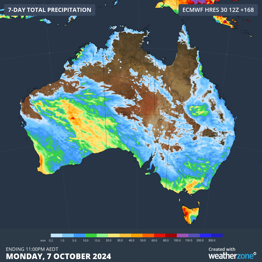
Image: Forecast accumulated rain during the seven days starting on Tuesday, October 1, 2024.
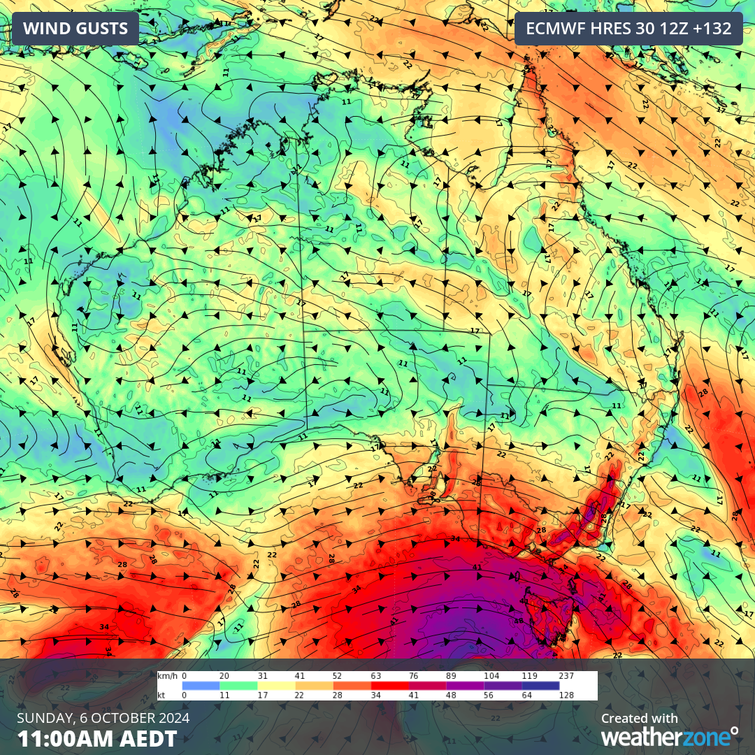
Image: Forecast wind gusts at 11am AEDT on Sunday October 6, 2024.
The current negative SAM event is expected to be short-lived, with models suggesting a return to neutral SAM by the second week of October.
DTN APAC delivers industry-leading weather and power generation forecasting and real-time alerting to inform your critical decision-making. Together we can keep your staff and assets safe, and efficiency high.
With lightning strikes, severe weather, flood and fire posing risk to wind farms across Australia, we have tailored solutions that can significantly improve your oversight and response.
Total Lightning Network comprises of regional and global sensors to detect intra-cloud (IC) and cloud-to-ground lightning (CG) strikes within your proximity thresholds. It provides unparalled detection accuracy (<200m) and real-time lightning alerts to any device across your operations team.
Your customizable Energyzone interface and Weatherguard app will provide access to the Total Lightning Network as well as centralized data from state and territory fire agencies, the Bureau of Meteorology, and over 30 national and international private and state organisations. This enables full situational awareness of weather conditions and fire risk, as well as severe weather alerting via text, email and phone call, so your staff can respond effectively when required. For more information, please visit our website or email us at apac.sales@dtn.com.


