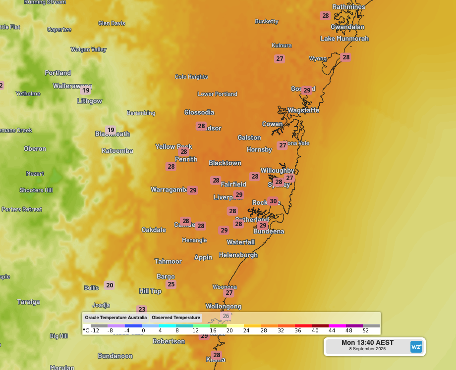
Sydney Airport reached 30.1°C at 1:40pm on Monday, just eight days after winter, as a surge of early spring warmth baked the east coast in a blustery northwesterly airstream.
In summer, Sydney’s west is often considerably hotter than the coastal suburbs on days when winds have a westerly aspect. But in springtime – and especially early in the season – the city’s east (where the airport is located) can be as warm as the west, or even slightly warmer.
That’s the situation this Monday, with the mercury topping 29°C at several locations in the city’s west and similarly warm conditions near the coast. Only the airport registered a reading of 30°C or higher.
The highest temperature recorded at Sydney’s official weather station at Observatory Hill was 29.0°C.
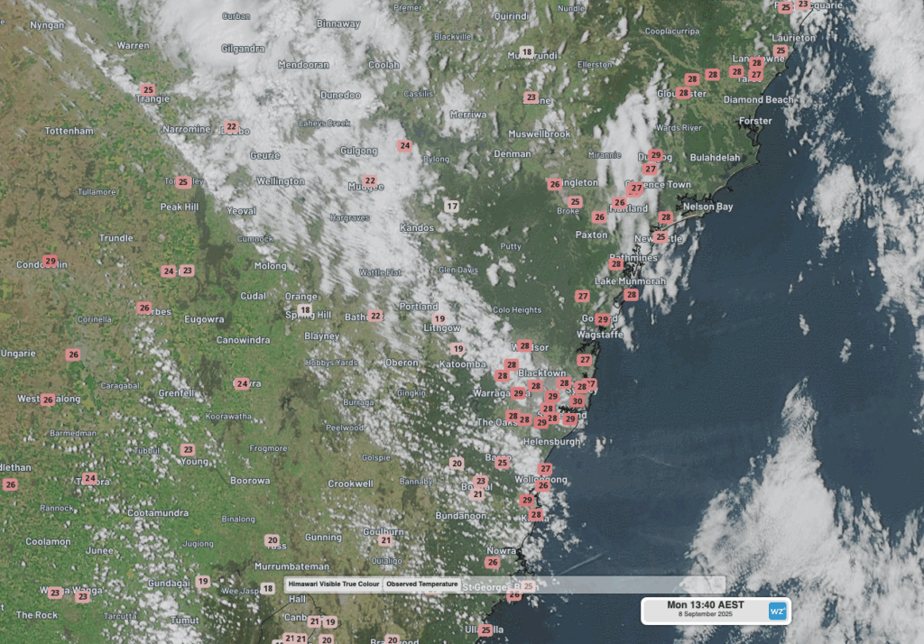
Image: Satellite image with live temperatures across the Sydney basin and nearby parts of NSW at 1:40pm (AEST) on Monday, September 8, 2025, as shown on the DTN Stormtracker dashboard.
It’s worth noting that the Sydney Airport weather station sits on a grassy area to the side of the runways to minimise the “heat island effect” generated by the large areas of asphalt.
Why is Sydney so hot today, and is 30 degrees unusual so soon after winter?
Those blustery northwesterly winds mentioned earlier (gusts today have topped 60 km/h at several weather stations in the Sydney area) are pushing warm air from the interior of the country towards the east coast.
Days of 30-degrees or slightly higher in the Sydney basin are not unknown this early in the season. Indeed, Sydney Airport reached 31.5°C almost exactly a year ago, on September 6, 2024. The city’s maximum that day was 29.7°C.
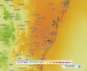
Image: Live temperatures across the Sydney basin and nearby parts of NSW at 1:40pm (AEST) on Monday, September 8, 2025, as shown on the DTN Stormtracker dashboard.
Sydney temperatures will start to drop as the week progresses, bringing maximums much closer to the September average of 20.2°C. Rain should arrive later on Wednesday and persist into Thursday, when a maximum of just 18°C is expected.
DTN APAC has grown to become the outright leader within the Australian energy market, serving wind, solar, hydro, trading, utilities and network companies.
You can’t control the weather, but you can gain precision insights to optimise your response. What lights us up is providing your energy business with tailored weather information to reduce your risk and keep you moving ahead of the curve.
Our services cover all aspects – from wind and solar generation to demand forecasts, wholesale markets to retail so, no matter where your company sits, we have solutions for you. We have worked closely with market participants to create products that meet the evolving needs of the sector, aiming to increase safety and profitability for our customers.
Your customisable Energyzone interface can assess heat/heatwave potential from 14 days out to 12 months. It allows you to benefit from specialised indices for CDD/HDD/apparent temperature/sunshine hours to help accurately predict the demand for electricity. This, along with high-resolution modelling and local knowledge, gives you the most precise information available to make the critical decisions that bolster your production.
Benefit from the timely delivery of accurate weather information, allowing informed and effective decision-making.
Learn more about our large range of industry leading products and services or email us at sales.apac@dtn.com


