
Sydney is set to sizzle this Saturday, especially in the city’s west, where temperatures are expected to reach 44°C for the first time in almost four years.
- The last time western Sydney saw temps of 44°C or higher was during the Black Summer of 2019/20.
- On February 1, 2020, Richmond on the city’s northwest fringe sweltered through a tar-melting 46.8°C.
- Around a month earlier – on January 4, 2020 to be precise – Penrith in the city’s outer west recorded an almost unbelievable 48.9°C, which still stands as the hottest temperature ever recorded in any suburb of an Australian capital city.
Saturday will begin warm in Sydney, with the overnight temperature failing to drop below 23°C, which is nearly 6°C above the minimum temperature average for Sydney observatory Hill.
Sydney’s hottest suburbs during summer hot spells are almost always low-lying suburbs like Penrith and Richmond on the Hawkesbury-Nepean floodplain at the foot of the Blue Mountains.
That will again be the case this Saturday, with both locations tipped to reach 44°C (Richmond is not shown on the map below but is located right next to Windsor.)
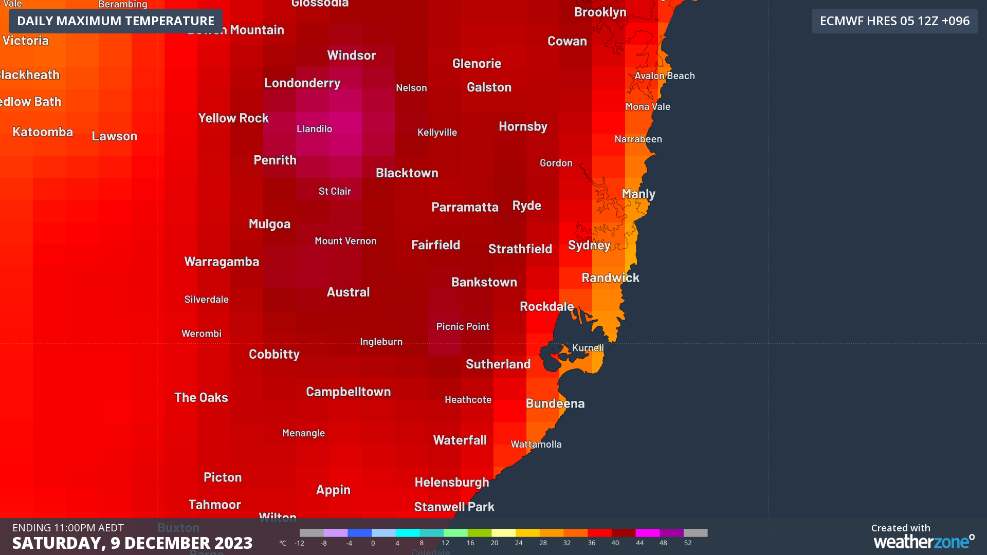
As for the city and areas closer to the coast, that’s much tougher to predict. At some point, the sea breeze will almost certainly kick in, moderating conditions dramatically near the coast. The question is when.
There is the likelihood of what meteorologists call a delayed or even prevented sea breeze. At this stage, the city is forecast to reach 38°C, however it could top 40 degrees depending how things play out.
It’s notoriously difficult to forecast Sydney’s maximum temperature when you have an arm wrestle between the hot northwesterly stream and the cooling sea breeze. Even an hour or two of delayed sea breezes can mean several extra degrees of afternoon warming.
And it’s worth noting that in December 2022 during La Niña, Sydney didn’t reach 30 degrees on a single day, with the hottest temp for the month 29.7°C on Christmas Eve. For more information, please contact us at apac.sales@dtn.com.




