Here it comes: a brief burst of wintry weather set to lash southeastern Australia over the next 24 hours or so.
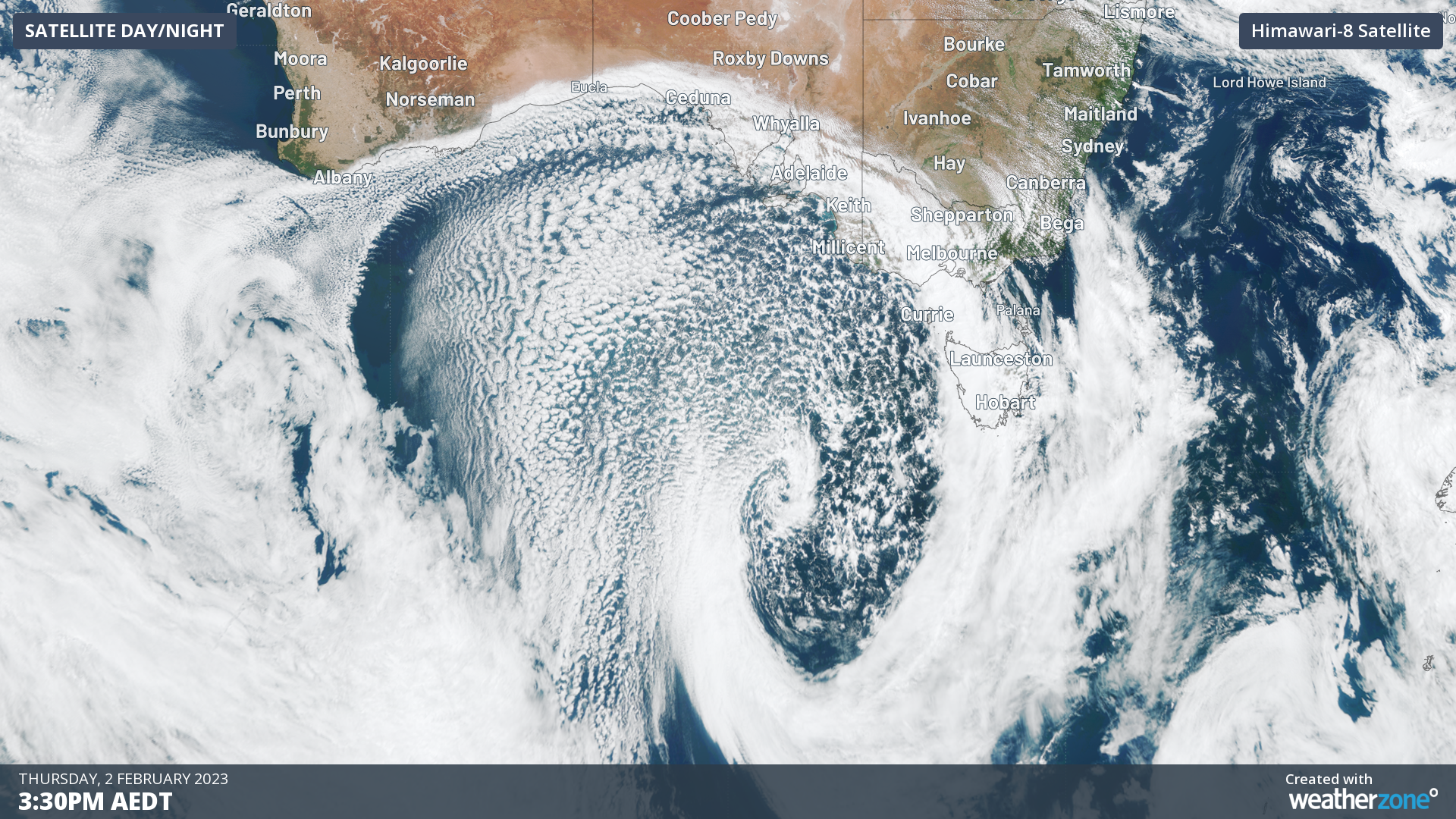
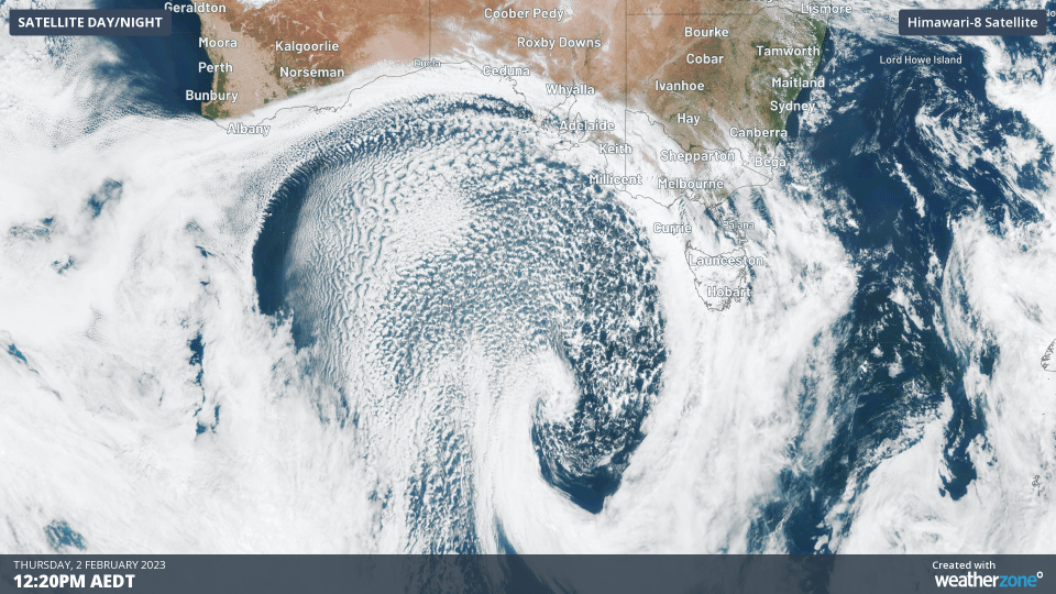
See the huge speckled airmass down in the Great Australian Bight? It’s a feature which indicates cold, polar air.
As Weatherzone meteorologist Ben Domensino wrote a couple of years ago:
“These clouds form when very cold air moves over a relatively warm area of ocean, causing a large number of individual cumulus clouds to develop over a broad area. Each of these cloud cells can produce rain, hail, snow and thunderstorms, with patches of clear sky in between.”
The polar airmass has already passed through southern South Australia, leaving unseasonably cold temperatures in its wake. For example:
- Mt Lofty in the Adelaide Hills was just 10.9°C at midday on Thursday, and the way things are going, it may not exceed that by much today. The average February maximum at the 685m-elevation weather station is 22.5°C.
- Adelaide was just 19.8°C at midday, and it also looks unlikely to gain more than a degree or two on top of that. Its average February maximum is 28.5°C.
- Further down into SA’s southeast corner, Mt Gambier was just 13°C at midday.
- Just over the Victorian border in Warrnambool, temps dropped from 18°C at midday to just 12°C at 12:30 pm, indicating both the strength of the cold airmass, and the location of the cold change early on Thursday afternoon.
So what happens next?
It gets increasingly chilly across most of Victoria, southern NSW, and the ACT as the front marches east. You can see its progress in the loop below, with that tell-tale speckle cloud surging northwards.
Virtually the whole of Victoria will see top temperatures below 20°C on Friday, which is significantly below average for this time of year.
Light snow showers can also be expected for around 24 hours from Thursday evening in both the Victorian Alps and the Snowy Mountains of NSW. The snow level should be around 1500 metres with temps dipping well below zero for at least two nights.
How unusual is a cold summer outbreak?
If you’re a regular reader of the Weatherzone news feed, you’ll know that summer snow in the high country of Vic, Tas, and NSW is far from uncommon.
There were several snowfalls in early December 2022, and while airmasses with Antarctic origins penetrate north less frequently in late summer, it still happens. The weather right now is evidence of that.
Meanwhile despite the cold air, the bushfire danger remains serious in at least four states, due to dry vegetation and strong winds accompanying the passage of this front. Please follow the links in yesterday’s bushfire story for more info.
To find out more about DTN APAC’s temperature, snow and all other sorts of weather, please visit our website or email us at apac.sales@dtn.com.


