Two bursts of heat will impact Sydney and NSW in the coming week, driving high energy demand and a forecast Lack of Reserve Level 2 (LOR2) issued by AEMO.
Bursts of springtime heat moving east
The DTN forecast for Sydney below, generated by our professional team of weather risk analysts, shows two spikes in heat over the coming week.
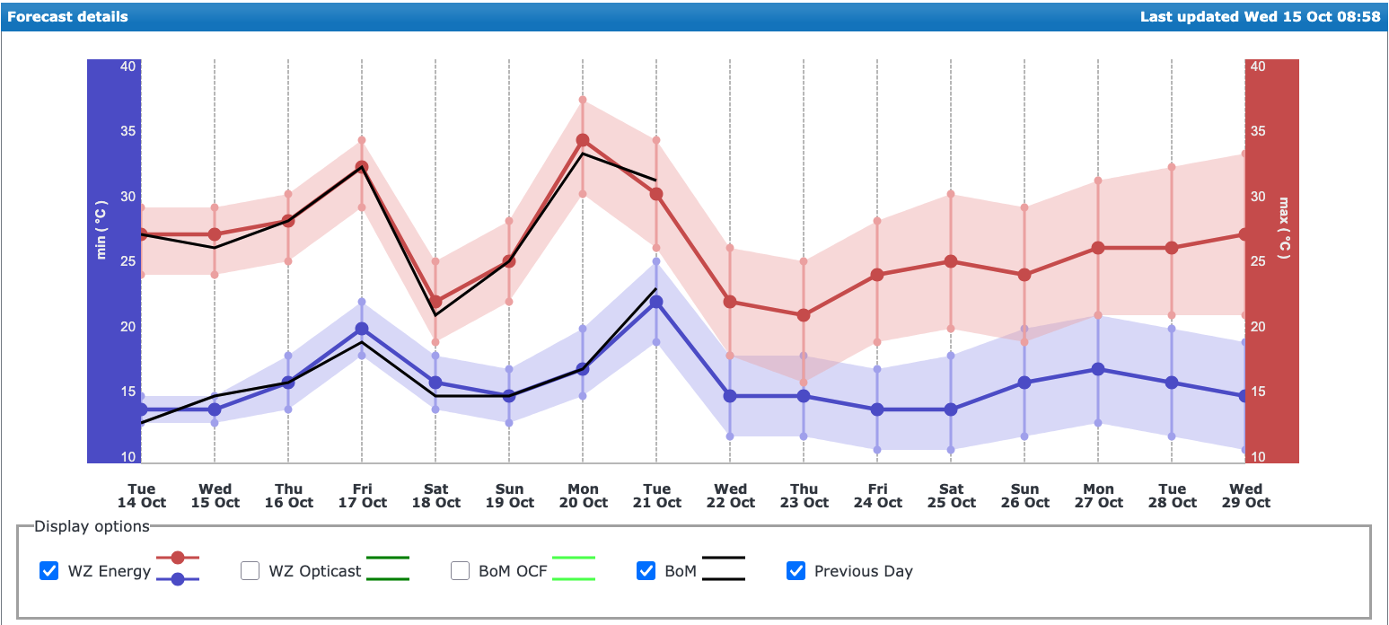
Image: DTN APAC’s 14-day analyst-altered Opticast data, updated daily (red and blue) for Sydney, with comparison to the Bureau of Meteorology forecast in black.
These bursts of heat come as very hot inland air reaches east ahead of troughs and cold fronts. Friday should see the mercury climb to about 31-32°C in the city, but cloud cover and possible thunderstorms in the afternoon could cool off Sydney quite rapidly. This burst of heat will be short-lived with an evening southerly change bringing more definite cooling into the weekend.
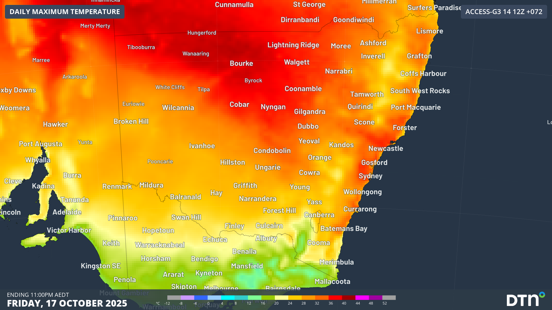
Image: Maximum temperatures across NSW on Friday, October 17, 2025.
A very hot inland airmass will be drawn into NSW at the start of next week. Hot and dry northwesterly winds on Monday are expected to bring maximum temperatures reaching 33-34°C in the city, and closer to 37-38°C in the western suburbs.
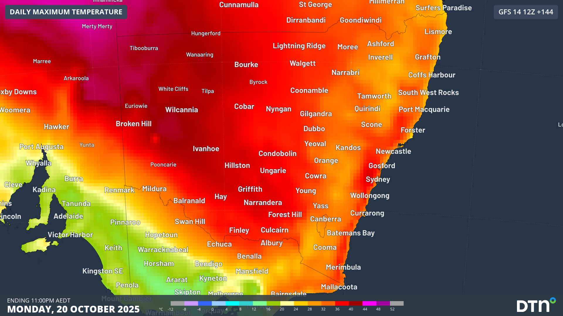
Image: Maximum temperatures across NSW on Monday, October 20, 2025.
Eastern suburbs may benefit from a cooling afternoon seabreeze, but much of the metropolitan basin will rely on air conditioning and high electricity demand to keep cool during the daytime. Fortunately, the sunny skies compounding this heat will generate solar power, with wind power also being generated by strong winds across the state, helping meet this high energy demand.
Unlike Friday, cooling relief will be delayed as cloud cover moves over eastern NSW later on Monday, bringing a very warm night extending into Tuesday. Temperatures will remain in the high-20s until late Monday and will only drop to a minimum of about 22-23C, keeping energy demand elevated across the period.
AEMO issues a Forecast Lack of Reserve Level 2 (LOR2)
According to data from the Australian Energy Market Operator (AEMO) 7-Day Outlook on Wednesday morning, NSW’s Scheduled Demand is forecast to exceed its Scheduled Capacity on Monday and Tuesday, with a deficit of 1,445 MW and 992 MW, respectively.
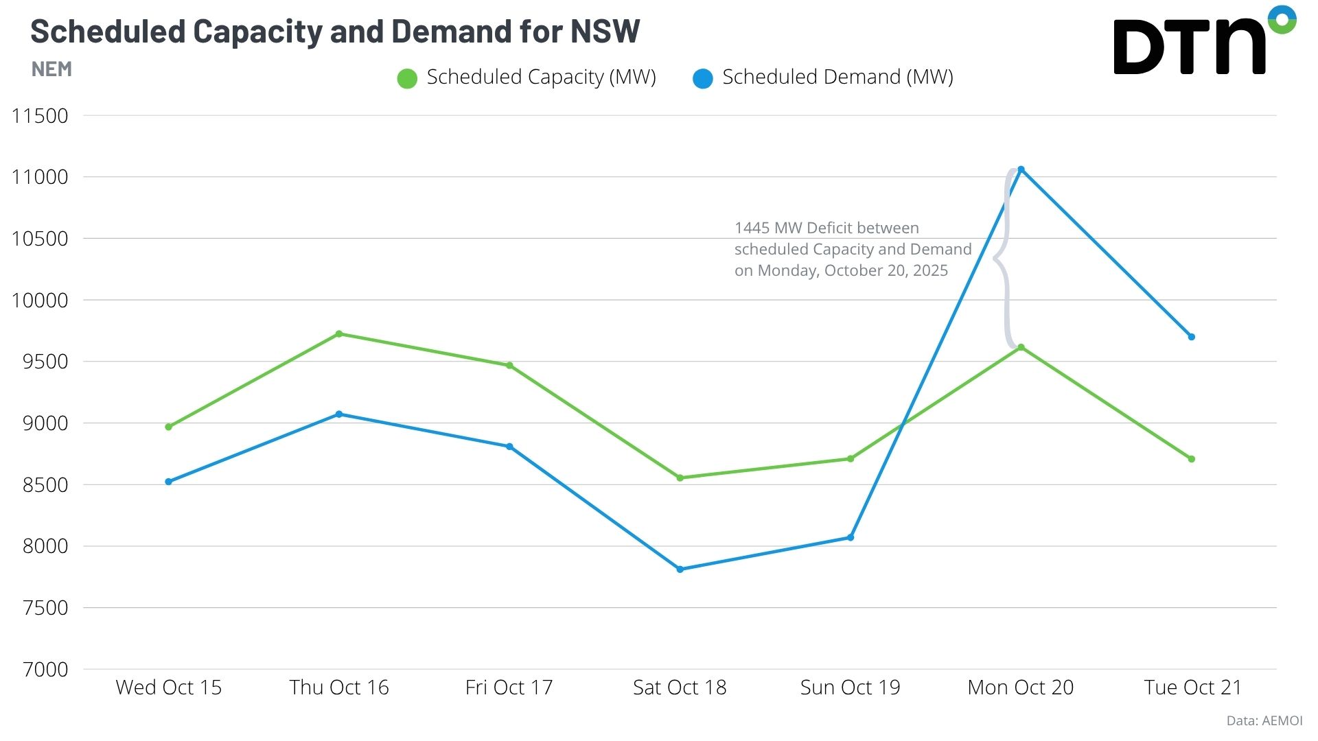
Image: Scheduled Demand and Scheduled Capacity over the next week according to AEMO’s 7-Day Outlook. Data source: AEMO.
To mitigate the risk of NSW’s energy demand outweighing supply, the Australian Energy Market Operator (AEMO) issued a Forecast Lack of Reserve Level 2 (LOR2) notice on Wednesday morning, calling on the market to improve the supply-demand balance for Monday, October 20. This can happen by energy generators increasing supply levels, or large industrial and commercial consumers decreasing their demand. The AEMO can also draw power from interstate if necessary. At this level, there is no impact to the power system, but supply could be disrupted if a large incident occurred. AEMO has since cancelled the Forecast LOR2, with a Lack of Reserve Level 1 (LOR1) still forecast on Monday.
Models are still undecided on the exact timing of cooling on Tuesday with the arrival of the next southerly change, with potential for another day reaching into the 30s across the region. However, cooler temperatures are likely from Wednesday, bringing relief to Sydneysiders and the power grid.
DTN APAC has grown to become the outright leader within the Australian energy market, serving wind, solar, hydro, trading, utilities and network companies.
You can’t control the weather, but you can gain precision insights to optimise your response. What lights us up is providing your energy business with tailored weather information to reduce your risk and keep you moving ahead of the curve.
Our services cover all aspects – from wind and solar generation to demand forecasts, wholesale markets to retail so, no matter where your company sits, we have solutions for you. We have worked closely with market participants to create products that meet the evolving needs of the sector, aiming to increase safety and profitability for our customers.
Your customisable Energyzone interface can assess heat/heatwave potential from 14 days out to 12 months. It allows you to benefit from specialised indices for CDD/HDD/apparent temperature/sunshine hours to help accurately predict the demand for electricity. This, along with high-resolution modelling and local knowledge, gives you the most precise information available to make the critical decisions that bolster your production.
Benefit from the timely delivery of accurate weather information, allowing informed and effective decision-making.
Learn more about our large range of industry leading products and services or email us at sales.apac@dtn.com


