
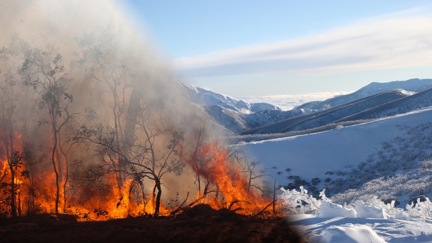
If you live in the southern half of Australia, take extra care when deciding what to wear this week because temperatures will bounce around like a seesaw.
September is always a time of contrasting temperatures across Australia as warm continental air masses battle much colder air arriving from the Southern Ocean. The chart below shows one of these air mass clashes projected to take place on Thursday this week.
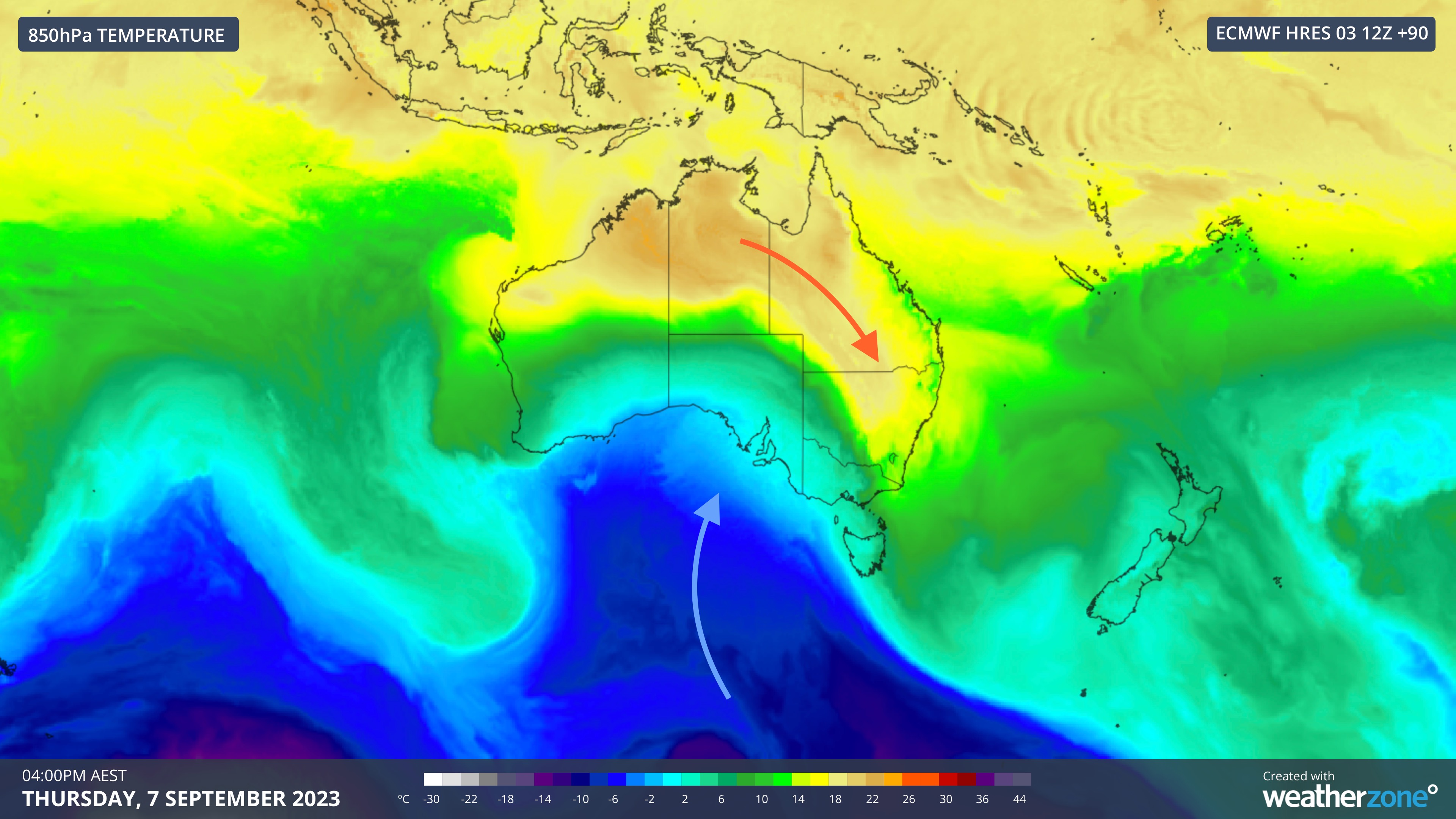
Image: Modelled 850 hPa temperature at 4pm AEST on Thursday, September 7, according to the ECMWF-HRES model. The image has been annotated with arrows to help show the movement of warm and cold air masses.
Aside from helping to produce thunderstorms, generate blustery winds and elevate fire danger ratings, these contrasting air masses also make it hard to know what to wear from day to day.
Maximum temperatures will swing by more than 10ºC in less than 24 hours in parts of Australia this week.
Melbourne will start the week warm, cool down by Tuesday, warm up again on Wednesday and then plunge back into wintry weather from Thursday into Friday. Daily maximum temperatures could reach the low twenties on Monday and Wednesday, but only hit 12-15ºC on Tuesday and Friday.
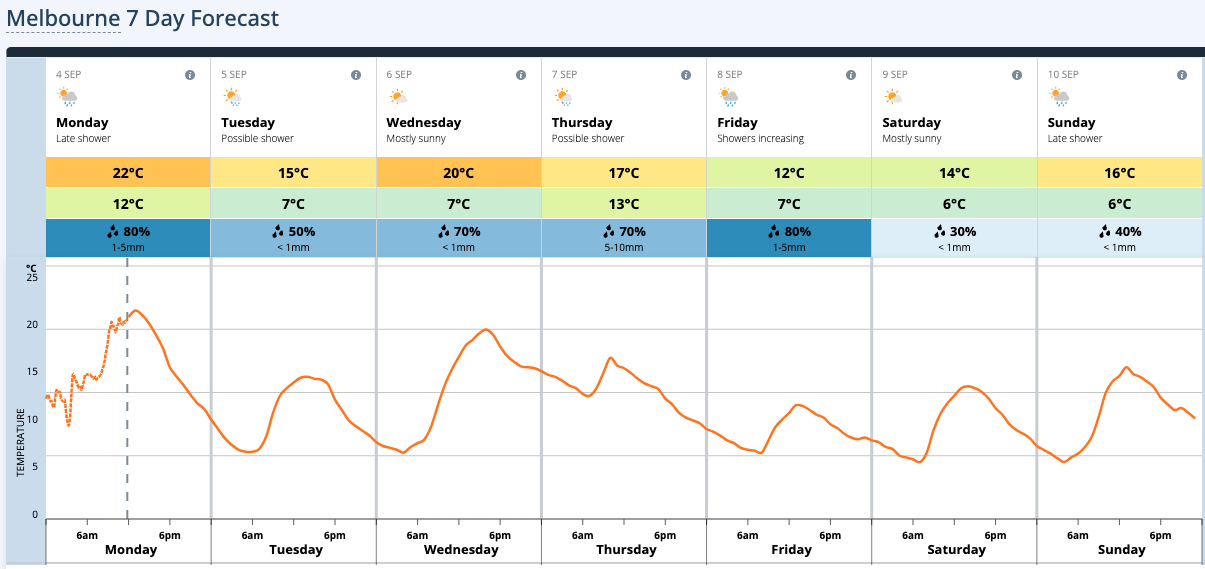
Image: Forecast temperature graph for Melbourne this week.
Adelaide will be mild on Monday and Tuesday, very warm on Wednesday and then cool down again on Thursday and Friday. Maximums are forecast to range from 15ºC to 24ºC within 24 hours between Wednesday and Thursday.
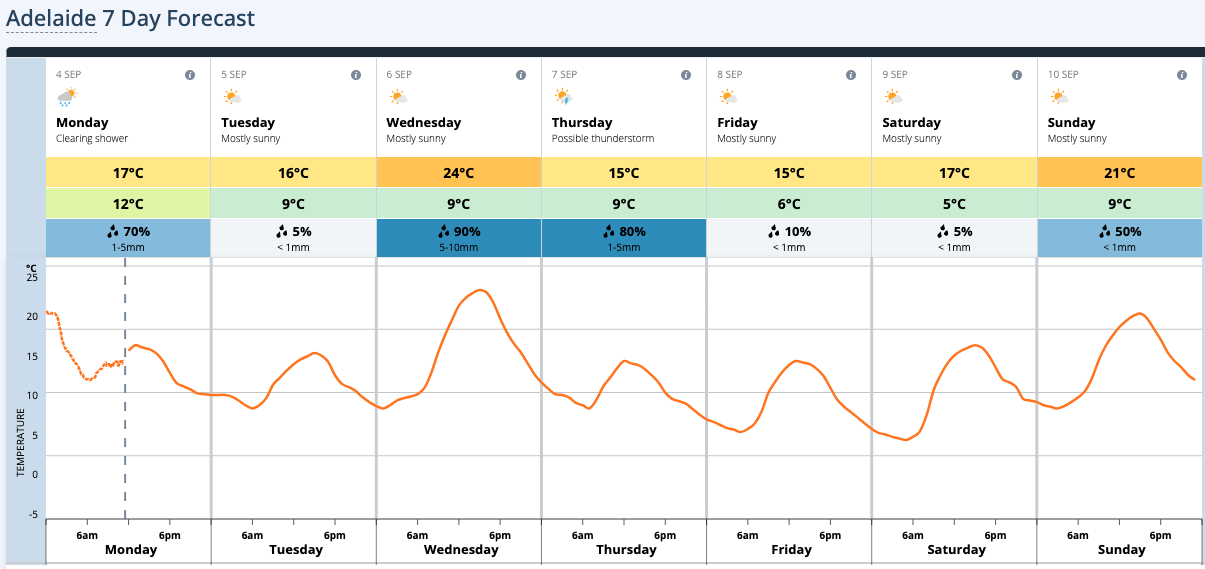
Image: Forecast temperature graph for Adelaide this week.
Canberra’s temperatures will also jump up and down throughout the week, with the biggest shift in maximums happening between Thursday (23ºC) and Friday (12ºC).
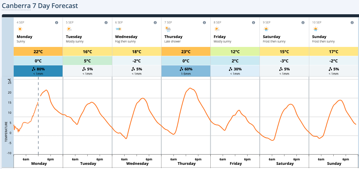
Image: Forecast temperature graph for Canberra this week.
Sydney, Brisbane, Perth and Hobart will also experience temperature swings this week, with maximums changing by 3 to 7ºC in 24 hours.
This week’s drastic contrast in temperatures could see snow and fires occurring concurrently in different parts of the country.
Catastrophic fire danger ratings are forecast to affect Qld’s Darling Downs and Granite Belt district on Monday, while Extreme fire danger ratings could also affect parts of the state on Monday Tuesday and Thursday.
Meanwhile, snow is likely to settle in parts of southeastern Australia on Tuesday, Thursday and Friday, possibly reaching low levels in some states on Friday.
DTN APAC can give you access to a wide variety of tools to manage fire risk at all timeframes. Some services include:
• tools to enable bushfire spread prediction
• thunderstorm climatology to evaluate long-term lightning risk
• bushfire and flood alerting
• post-event reports
• severe weather nowcasting and forecasting
• 14 day outlooks
• fire and flood emergency advice and much more.
For more information on the severe weather season, please visit our website or contact us at apac.sales@dtn.com.




