Temperatures will bounce around in southeastern Australia this week as contrasting air masses battle it out in a seasonal tug-of-war.
Early spring is typically a time for variable temperatures in southern parts of Australia as hot continental air masses interact with much colder pools of air moving up from the south.
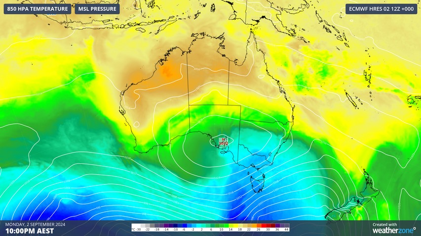
This temperature see-saw is even more noticeable than usual this year due to an abnormally hot air mass that built up over the Australian continent in the final weeks of winter.
Sydney is one place that will see large temperature variations this week, with a brief period cool weather today following a bout of record-challenging warmth late last week.
The city experienced one of its warmest winter days on record when the temperature reached 30.3°C on Friday last week. This was followed by maximums of 27.4°C on Sunday and 25.4°C on Monday, which were around 5 to 7°C warmer than average for the opening days of spring.
Looking ahead, maximum temperatures are forecast to bounce up and down in Sydney during the rest of this week:
- 19°C on Tuesday
- 22°C on Wednesday
- 29°C on Thursday
- 29°C on Friday
- 25°C on Saturday
- 23°C on Sunday
Melbourne’s week is looking similarly variable and equally difficult to plan what clothes to wear from day-to-day:
- 17°C on Tuesday
- 21°C on Wednesday
- 23°C on Thursday
- 26°C on Friday
- 18°C on Saturday
- 19°C on Sunday
Adelaide won’t escape the turbulent temperatures this week either:
- 20°C on Tuesday
- 26°C on Wednesday
- 27°C on Thursday
- 22°C on Friday
- 18°C on Saturday
- 17°C on Sunday
Hobart’s temperature range will also be noticeable with a mix of warm and cool days ahead:
- 15°C on Tuesday
- 20°C on Wednesday
- 21°C on Thursday
- 19°C on Friday
- 15°C on Saturday
- 16°C on Sunday
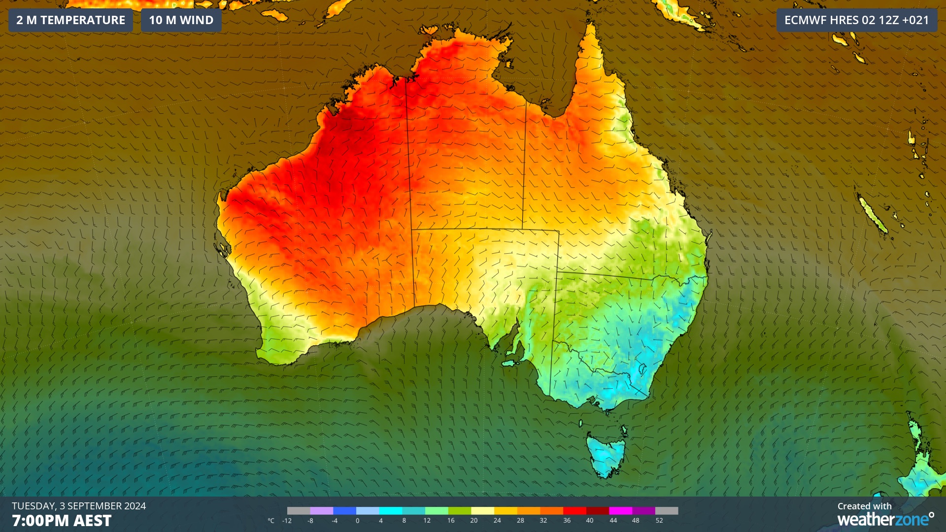
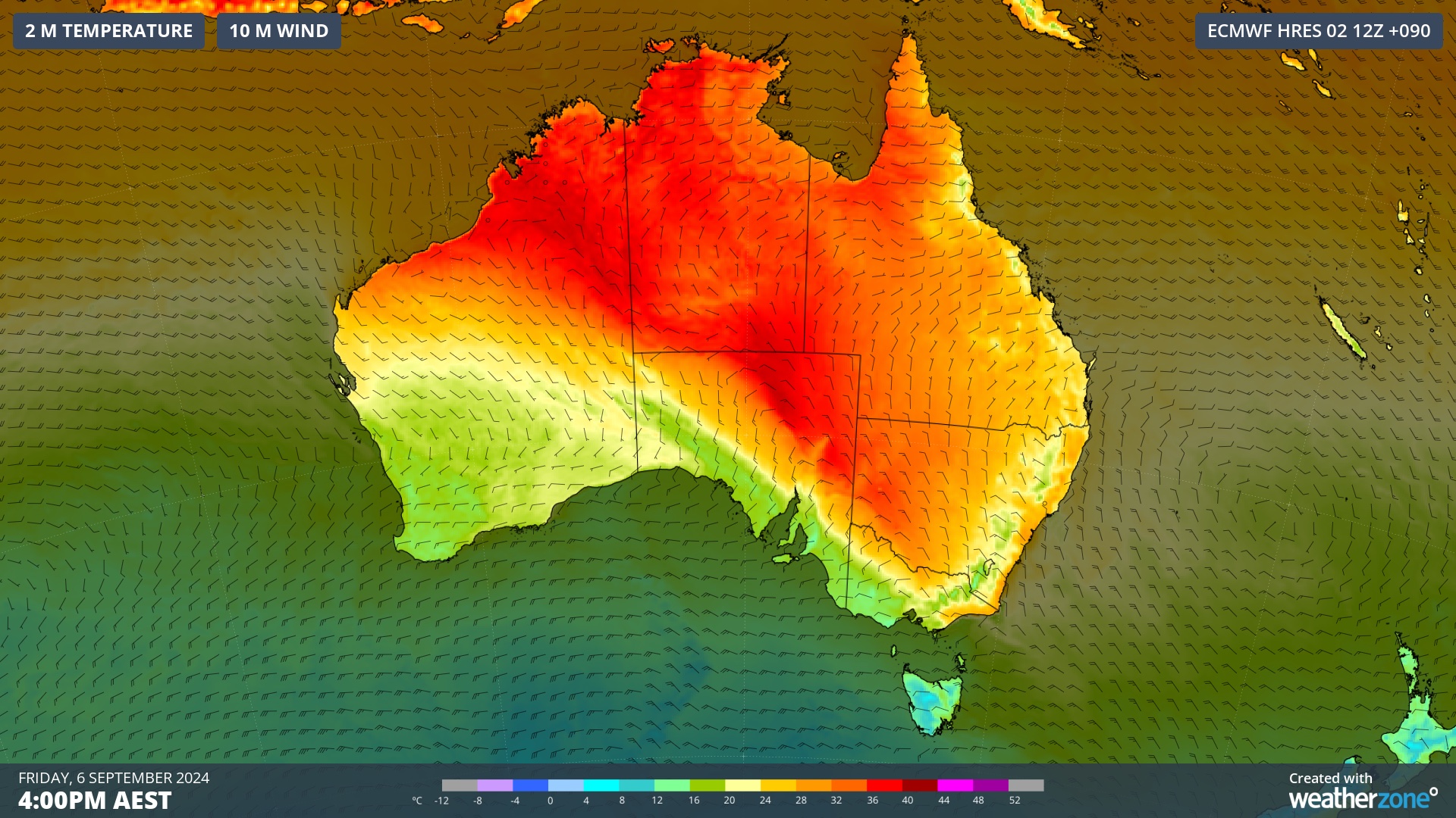
Images: Forecast temperature and wind on Tuesday (top) and Friday (bottom) this week, showing a transition from cool to warm weather in southeastern Australia.
The contrasting air masses that produce large temperature fluctuations in southern Australia at this time of year can also produce blustery winds and outbreaks of rain and storms. Be sure to keep an eye out for a burst of wet, stormy and windy weather in southern and southeastern Australia later this week.
Weatherzone Business has grown to become the outright leader within the Australian energy market, serving wind, solar, hydro, trading, utilities and network companies.
You can’t control the weather, but you can gain precision insights to optimise your response. What lights us up is providing your energy business with tailored weather information to reduce your risk and keep you moving ahead of the curve.
Our services cover all aspects – from wind and solar generation to demand forecasts, wholesale markets to retail so, no matter where your company sits, we have solutions for you. We have worked closely with market participants to create products that meet the evolving needs of the sector, aiming to increase safety and profitability for our customers.
Benefit from the timely delivery of accurate weather information, allowing informed and effective decision-making. For more information, please visit our website or email us at apac.sales@dtn.com.


