
The extreme heat which baked Victoria and interior parts of the continent on Monday has tracked east, with outer western Sydney currently hotter than anywhere in southern Australia.
Penrith, at the foot of the Blue Mountains, could peak at 42°C this Tuesday afternoon, making it the first 40-degree day in the Sydney region in the latter half of 2024 (it hit 39.9°C in November).
But relief is coming.
A southerly buster is roaring its way up the NSW south coast and will drop temperatures significantly across Sydney within a short period of time, with cooler conditions to prevail for the rest of the working week.
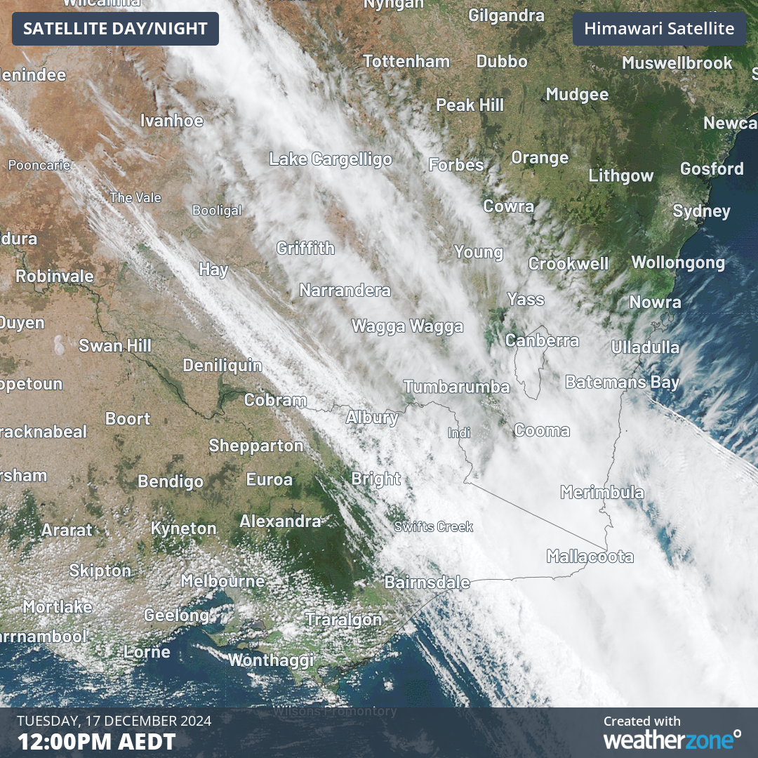
Image: Position of the southerly buster heading northwards up the NSW coast at midday on Tuesday, December 17, 2024.
What is a southerly buster?
- ‘Southerly buster’ started off as a slang term used by Sydneysiders but has evolved into an official piece of BoM terminology.
- It basically refers to an abrupt southerly change that roars up the New South Wales coast, generally reaching maximum intensity between Nowra and Newcastle, and occurring mostly between October and February.
- The BoM classes a southerly change as a southerly buster when southerly winds gust in excess of 29 knots (54 km/h), and a temperature drop of at least 5°C occurs within a three-hour period.
- Temperature changes are often much more dramatic than five degrees, with drops of 10–15°C often occurring in the space of an hour.
- Sydney receives an average of about five southerly busters each year, with the stronger ones usually arriving in the late afternoon or early evening after several days of hot weather.
The buster due in Sydney this evening meets pretty much all of the key elements mentioned above – especially the rapid temperature drop.
The mercury at Penrith should plummet by about 15 degrees within three hours.
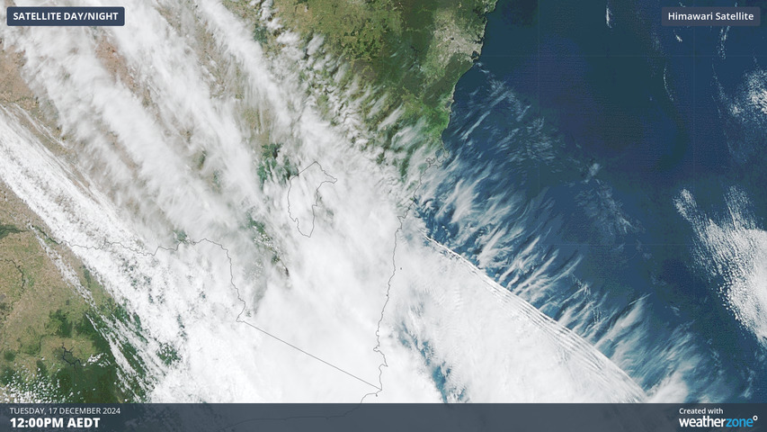
One spectacular meteorological phenomenon often (but not always) associated with southerly busters is “roll clouds” – low level, horizontal clouds which run perpendicular to the coastline.
The image below shows a closer satellite view of today’s southerly buster, with a few distinct lines of cloud at the northern edge of the cloudmass.
“Roll clouds often accompany a strong southerly change due to the sharp clash of contrasting air masses, wind shear, and dynamic uplift at the leading edge of the change,” Weatherzone meteorologist Yoska Hernandez explains.
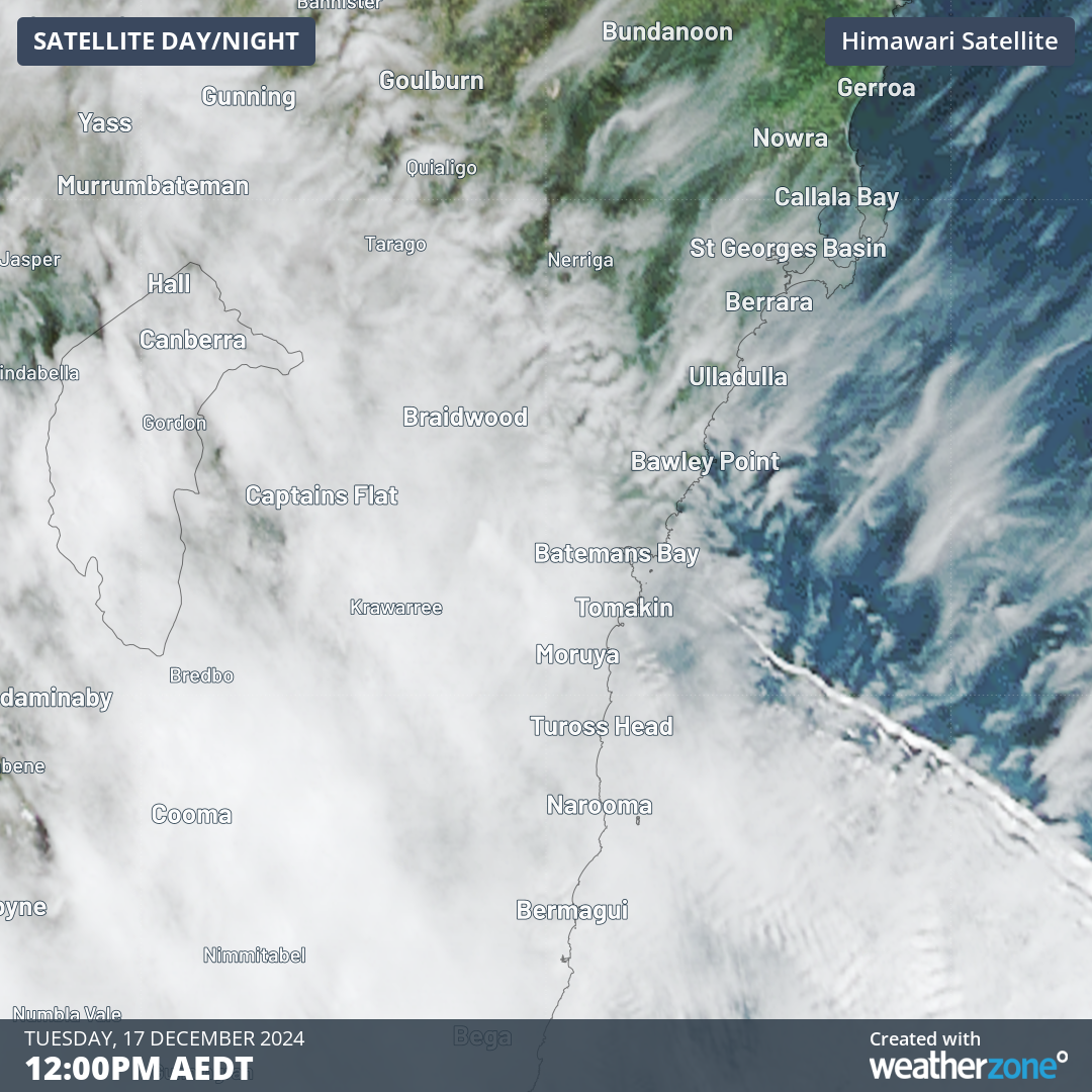
Image: Close-up of the southerly buster heading northwards up the NSW coast at midday on Tuesday, December 17, 2024.
“As the cooler, denser southerly air rapidly undercuts the warmer, less dense air ahead, the warm air is forced upwards, leading to condensation and cloud formation. Significant wind shear at the boundary between these air masses creates horizontal rolling motions, forming the distinct tubular shape of the roll cloud.”
When you see roll clouds for real (rather than just from a satellite), they are always crowd-pleasers on Instagram.
But few things will please Sydneysiders more than a burst of cool air later this Tuesday after several days of high humidity and building heat, culminating in a Tuesday afternoon scorcher – especially in the city’s west where temps had already reached 38°C at numerous suburbs at 1pm.
As for rainfall, this looks like being a mostly dry event. Only a few millimetres at best are likely, with showers lagging several hours behind the change.
DTN APAC supplies precise weather intelligence to over 75% of the National Energy Market (NEM); and is the trusted provider for the Australian Energy Market Operator (AEMO).
Weatherzone’s next-generation nowcasting and forecasting system, OpticastTM, is independently proven to outperform other industry models, allowing energy traders to respond rapidly to changing conditions. From 14 day forecasting to seasonal outlooks, you have access to complete and powerful weather intelligence giving you the confidence to make the best call.
Meeting the needs of the changing market, Weatherzone utilises high-resolution modelling and local knowledge to provide 5-min granularity observations and forecasts, optimising your market bidding and maximising your profits. These, coupled with briefings from our energy meteorologists, give you full awareness of the associated risk.
Benefit from specialised indices such as apparent temperature, Cooling/Heating Degree Days (CDD/HDD) and Effective Degree Days (EDD) to help accurately predict demand. You can get a clear picture of forecast conditions across the market and quickly assess heat/heatwave potential from 14 days out to 12 months
No matter where your energy trading focus lies, we have the power generation and weather insights to inform your critical decisions, keeping you ahead of the curve. For more information please visit our website or email us at sales.apac@dtn.com.




