
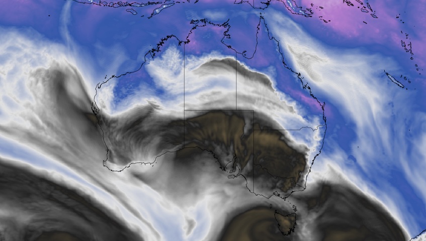
Thunderstorms will develop over a broad area of NSW and Qld on Thursday afternoon, with severe storms likely in some areas.
Thursday’s storms will be triggered by a low pressure trough interacting with an unstable atmosphere and moisture over eastern Australia. An upper-level trough above eastern Australia will also enhance wind shear in some areas, which is the change in wind speed and direction with height. These ingredients will produce copious lightning and elevate the risk of damaging winds and large hail for some areas.
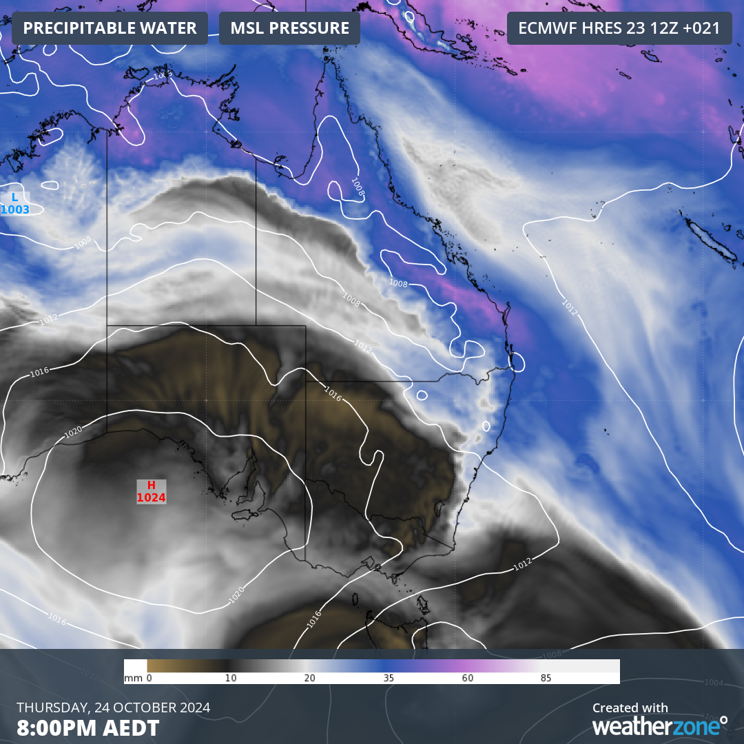
Image: Forecast precipitable water and mean sea level pressure over eastern Australia on Thursday evening, showing a low pressure trough interacting with abundant atmospheric moisture.
In NSW, thunderstorms are most likely to occur from the Hunter up to the Northern Rivers and inland to the North West Slopes and Plains. While severe storms are possible throughout northeast NSW on Thursday, they are most likely near the coast and ranges to the north of Port Macquarie.
In Qld, thunderstorms are likely to develop over the central and southeast inland during Thursday, extending from the Wide Bay and Burnett district up through the Central Highlands and Coalfields district and surrounding areas. Rain and a few storms will then spread towards the coast into the evening.
The map below shows the forecast accumulated rainfall for the 36 hours ending at 11am AEDT on Friday, giving an indication of where the rain and storms will occur on Thursday afternoon and night.
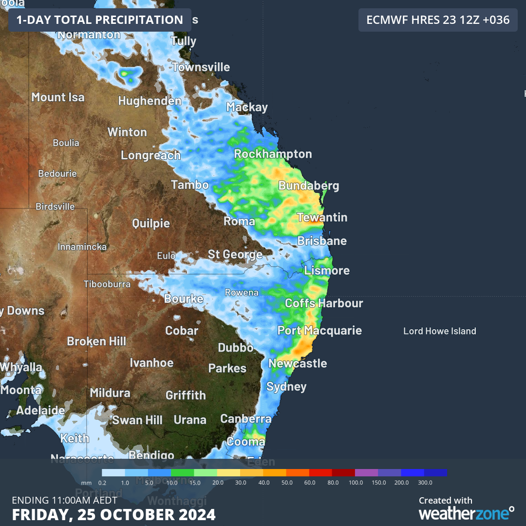
Image: Forecast accumulated rain during the 36 hours ending at 11am AEDT on Friday, October 25, according to the ECMWF model.
Any thunderstorms that develop over eastern Australia will be dangerous because they produce lightning. However, thunderstorms are only considered severe in Australia when they produce at least one of the following:
- large hail – 2 cm in diameter or larger
- damaging wind gusts – 90 km/h or greater
- tornadoes
- heavy rainfall that may lead to flash flooding
A severe thunderstorm warning will be issued if an active thunderstorm is expected to produce any of the above phenomena. Be sure to check the latest warnings throughout the afternoon for the most up-to-date information.
Stormtracker is a severe weather solution that can assist you in observing, in real-time, any storm or event that has the potential to impact your business.
Embedded in DTN APAC’ industry interfaces, the system gives you a time advantage when monitoring conditions developing over your infrastructure and location.
Stormtracker is our Global Information System (GIS) tracking tool, providing multiple weather layers and zoom controls overlaid on a map of your location and infrastructure. You can choose a snapshot or full screen view, depending on your requirements. The maps allow you to monitor all weather, and specifically any systems likely to cause risk for your business. You also have the capacity to observe:
- real time lightning and thunderstorm alerts
- localised lightning strike frequency
- official warnings for storm, cyclone, wind, flood and fire
- sentinel hotspot fires and fire agency current incidents
Stormtracker’s radar imagery updates every 10 minutes, so you are always able to respond rapidly to changing conditions. You can customise alerting to notify you when your staff or infrastructure are under threat. With increased situational awareness, your ability to make informed decisions quickly is optimised.
DTN APAC’ experience and intelligence gives you a clear path through complex situations. Let us assist you, offering actionable insight when extreme weather poses risk to your business. Please visit our website or email us at apac.sales@dtn.com.




