Violent thunderstorms will pummel parts of NSW, Queensland, Victoria and the ACT over the next couple of days, with potential for supercells and a dangerous squall line late on Wednesday. These thunderstorms have the potential to cause power outages like Vic experienced on Sunday, when dangerous storms lashed the state.
An upper-level pool of cold air crossing southeastern Australia on Wednesday and Thursday will interact with a cold front, low pressure trough and moisture-laden air to create an ideal environment for dangerous thunderstorms.
This setup is likely to cause rain and thunderstorms from Qld down to Vic on Wednesday, with a few storms also possible in Tas and SA. Storm activity will persist overnight Wednesday into Thursday in some areas, with further storms expected to develop over parts of NSW and Qld during Thursday and possibly Friday.
Wednesday has the potential to be one of the most dangerous thunderstorm days we have seen so far this summer due to the ample instability and potential for supercells and a squall line. Damaging winds, large hail and heavy rain are all likely, with destructive winds and giant hail also a chance.
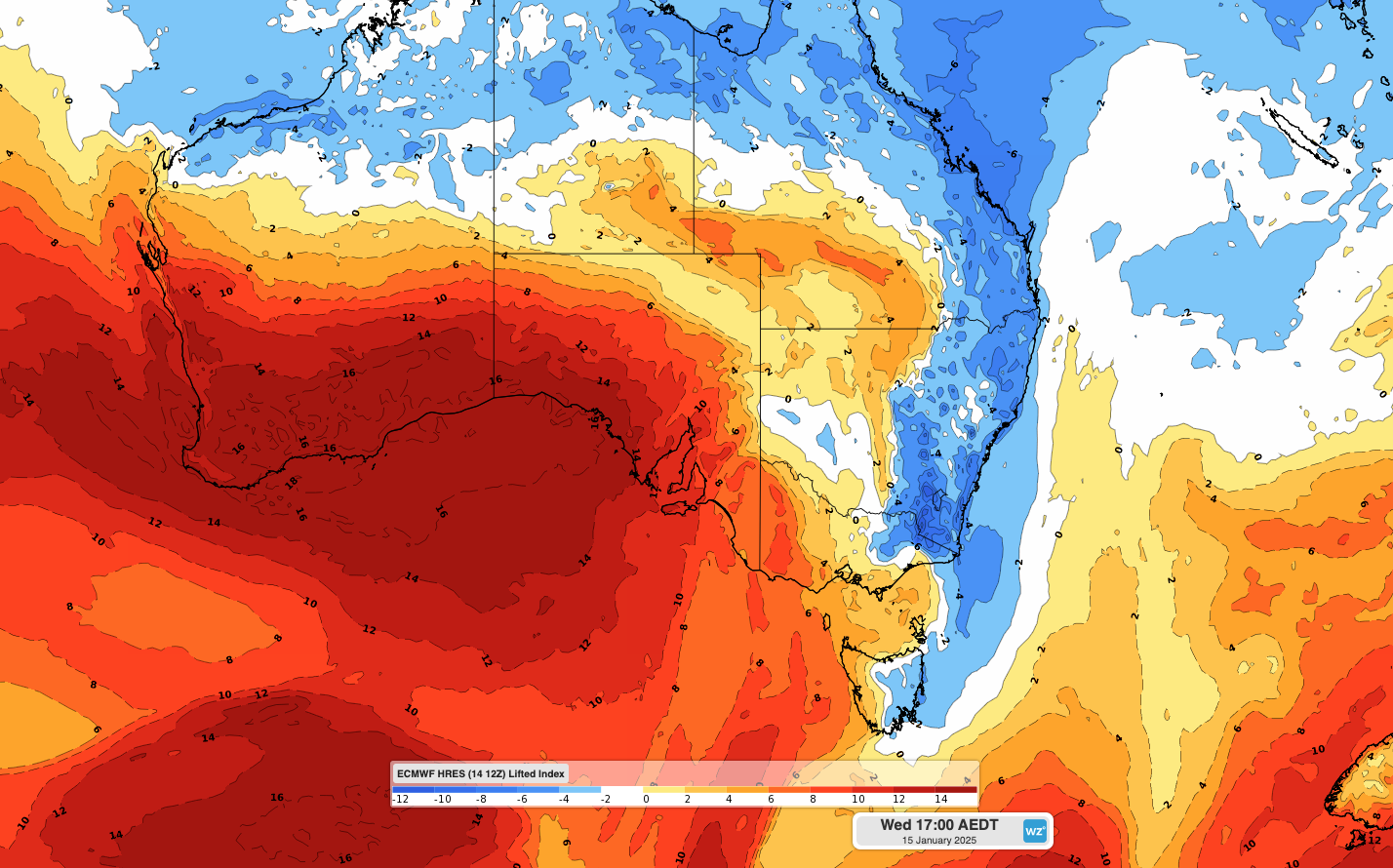
Image: Modelled lifted index values over southeastern Australia at 5pm AEDT on Wednesday, January 15. The lifted index is a storm risk parameter, with negative values (shaded blue) showing regions that have increased thunderstorm potential.
Supercell thunderstorms refer to rotating individual storm cells that have the potential to produce destructive winds, very heavy rain, giant hail and tornadoes. Supercells often move in a different direction to other surrounding storms cells and can last longer than less intense storms.
A squall line refers to an elongated line of thunderstorms cells that can cover a broad area, sometimes spanning hundreds of kilometres. Squall lines are often associated with heavy rain and damaging straight-line winds.
While there is a good chance of severe thunderstorms over a broad area of eastern and southeastern Australia on Wednesday, the greatest risk of supercells and squall lines will be over southern NSW and the ACT, most likely in the late afternoon and evening.
Dangerous storms will continue over parts of eastern Australia on Thursday, although the focus of the storms will contract to northeast NSW and southeast Qld.
DTN APAC, a DTN company, offers precise weather intelligence and alerting to protect your utilities network when severe weather, floods and fires threaten.
Over 80% of Australian transmission and distribution networks already rely on our proven nowcasting and forecasting out to 15 days. You can rest assured yours is protected by market-leading analysis. With this foresight you can gain lead time to prepare for possible outages, reduce risk and protect your people and profits.
You will never be left in the dark when conditions suddenly worsen. We deliver reliable, up-to-the-minute weather forecasts and analytical tools that give you the power to enhance your operational management and response to weather risk. Our Total Lightning Network is a globally proven solution that accurately identifies and alerts you to lightning strikes within your defined thresholds, supporting the safety of your team.
Your customisable interface has GIS mapping, showing multiple weather layers over your utilities network and offering full situational awareness. You can quickly recognise any threat to your assets in real-time. 24-hour asset monitoring allows you to track lightning, bushfires and other severe weather systems that approach your service territory.
Advanced and actionable analytics allow you to act decisively and improve your planning and outage response strategy. For more information contact us at sales.apac@dtn.com
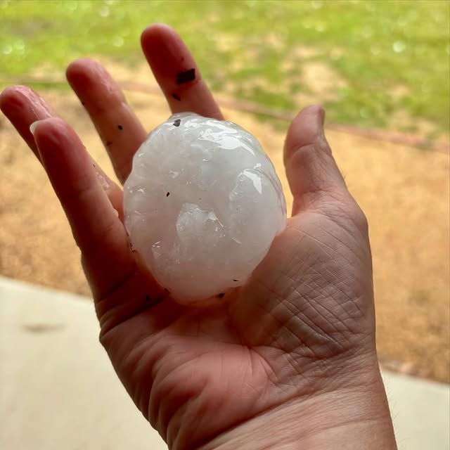
Thumbnail image: @smashleaduff / Instagram.


