
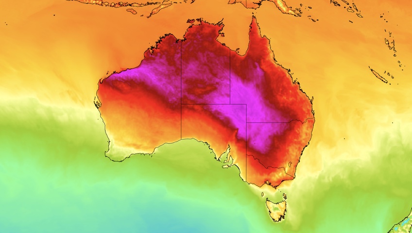
A hot air mass will cause temperatures to soar across large areas of Australia this week, making the northern half of Australia one of the hottest places in the world.
November is always a hot time of year in Australia as increasing intensity of the sun enhances solar heating across the continent. This hot weather is most pronounced in central and northern Australia, where exposure to the sun is greater and seasonal monsoon cloud cover is yet to develop, allowing for uninterrupted heating. This makes the northern half of Australia home to some of the highest surface air temperatures in the world at this time of year.
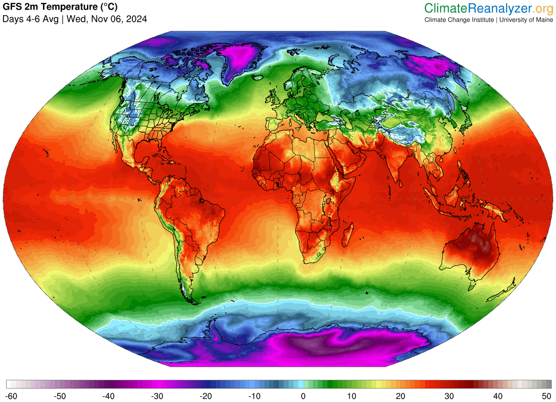
Image: Forecast average temperature for the three-day period beginning on Wednesday, November 6, 2024, according to the GFS model. Australia stands out as having the highest temperatures in the world for this three-day period. Source: ClimateReanalyzer.org
A mass of hot air will spread across Australia this week, causing temperatures to climb in parts of every state and territory.
As usual, the highest temperatures will occur over the interior and in northern parts of Australia, although even the southern states and some coastal areas will feel the pre-summer warmth.
Maximum temperatures should get above 40°C in NSW, Qld, SA, the NT and WA this week and possibly in northwest Vic on Wednesday. If the Mildura area does manage to reach 40°C mid-week, this would be Victoria’s earliest 40°C day since 2009.
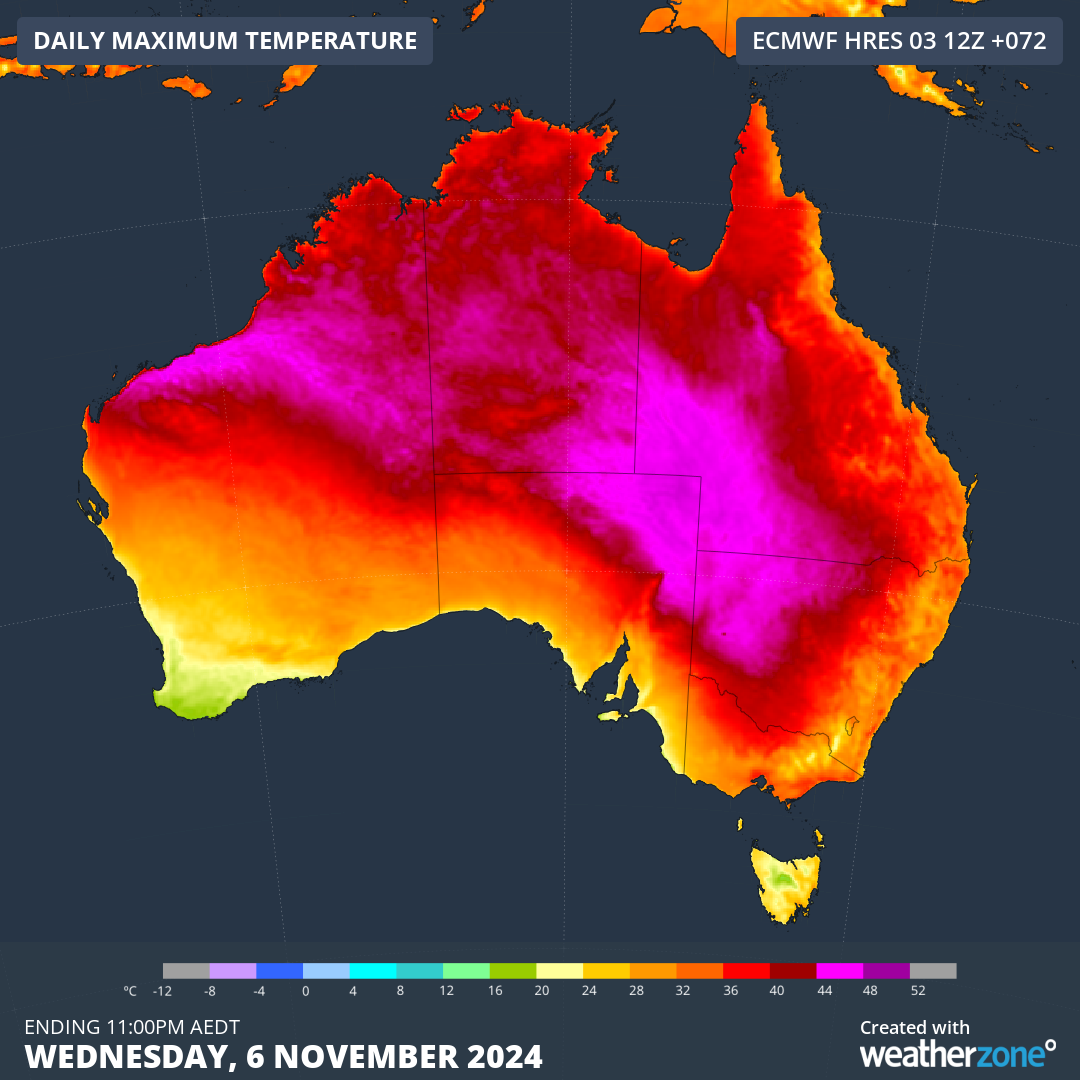
Image: Forecast maximum temperature on Wednesday, November 6, according to the ECMWF-HRES model.
While hot weather is common in Australia at this time of year, this week’s heat will be above average for this time of year during both days and nights. This will cause severe heatwave conditions in several states, particularly in Qld.
In Australia, a heatwave occurs when the maximum and minimum temperatures are unusually hot over a three-day period, compared to the local climate and past weather. Severe heatwaves are likely to be challenging for vulnerable people, including elderly members of the community and those with pre-existing medical conditions.
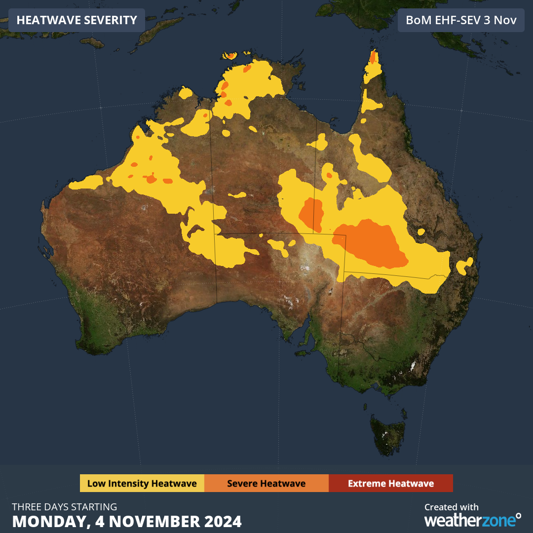
Image: Heatwave forecast for the three days starting on Monday, November 4.
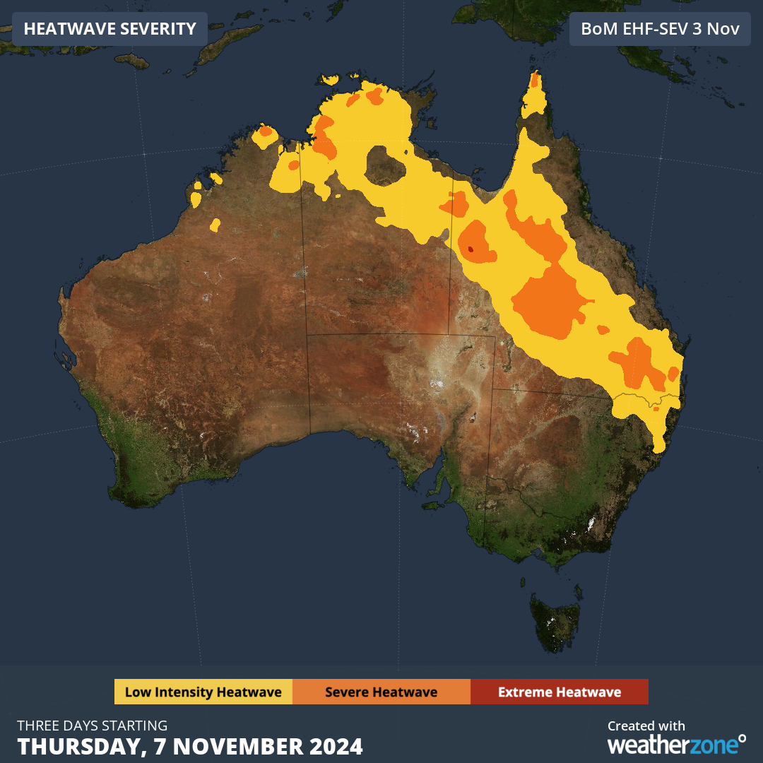
Image: Heatwave forecast for the three days starting on Thursday, November 7.
Some of Australia’s state capital cities will get a taste of this week’s heat as the inland air mass spreads across the country’s south and east.
- Adelaide will exceed 30°C on Tuesday.
- Hobart is forecast to reach 29°C on Wednesday.
- Melbourne should reach the high-twenties on Tuesday and about 33 to 34°C on Wednesday.
- Canberra should have two days in the low-thirties on Wednesday and Thursday.
- Sydney is tipped to reach the low-thirties on Thursday and high-twenties on Friday.
- Brisbane could reach 30 to 33°C every day this week, with most overnight minimums also staying up in the low-twenties.
Weatherzone Business has grown to become the outright leader within the Australian energy market, serving wind, solar, hydro, trading, utilities and network companies.
You can’t control the weather, but you can gain precision insights to optimise your response. What lights us up is providing your energy business with tailored weather information to reduce your risk and keep you moving ahead of the curve.
Our services cover all aspects – from wind and solar generation to demand forecasts, wholesale markets to retail so, no matter where your company sits, we have solutions for you. We have worked closely with market participants to create products that meet the evolving needs of the sector, aiming to increase safety and profitability for our customers.
Benefit from the timely delivery of accurate weather information, allowing informed and effective decision-making. For more information please visit our website or email us at apac.sales@dtn.com.




