Parts of southwestern Australia endured their coldest day in 3-6 years on Monday following the passage of a cold front, with another burst of cold air on the way this Thursday.
A cold front crossed southwestern WA on Sunday evening and Monday morning, bringing widespread rainfall of 20 to 40 mm across the south and west of the South West Land Division. The cold front quickly cleared east on Monday, leaving behind a cold airmass and clear early morning skies.
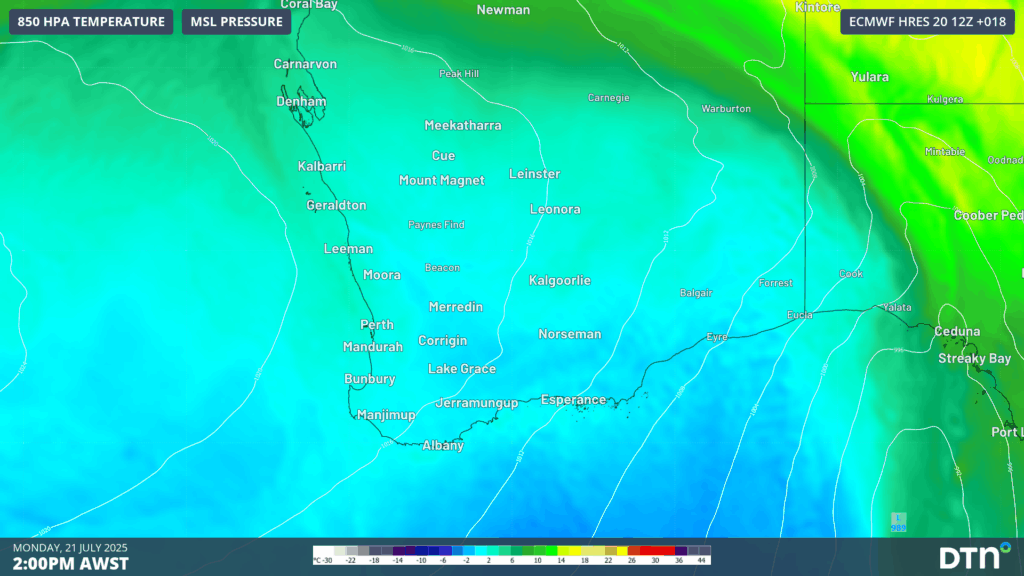
Image: 850 hPa temperatures (approximately 1.5 km up in the atmosphere) on the afternoon of Monday, July 21, 2025.
A chilly morning was felt across the southwest, with the temperatures dropping to 3.2°C at Perth, about 5 degrees below the average July minimum temperature. It was also the coldest morning in about 2 years for a number of weather stations, including Rottnest Is (7.8°C), Gooseberry Hill (4.7°C), Bunbury (1.8°C), Wagerup (2.8°C), and about 12 other locations.
Daytime temperatures did not warm up much either, with cold southwesterly winds blowing cloud over land from the Indian Ocean. Perth climbed to a maximum temperature of 15.2°C, tying for the coldest day of the year to date. The average maximum temperature for this time of year is 18.5°C for Perth. Elsewhere across the region saw temperatures limited to the low-teens, including the coldest day in:
- 6 years at Red Rocks Point (13.9°C)
- 3 years at Garden Island (13.5°C)
- About 2 years across over 20 weather stations, including Geraldton Ap (15.9°C), Esperance (13.1°C), Rottnest Island (13.9) and Mandurah (13.4°C).
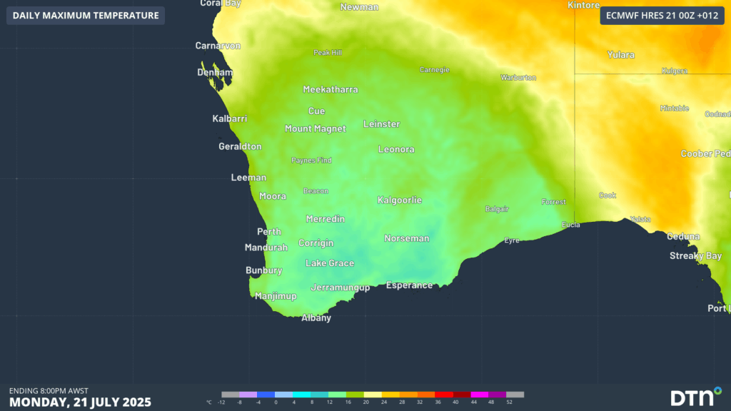
Image: Maximum temperatures across southwest WA limited to the low-to-mid teens on Monday, July 21, 2025.
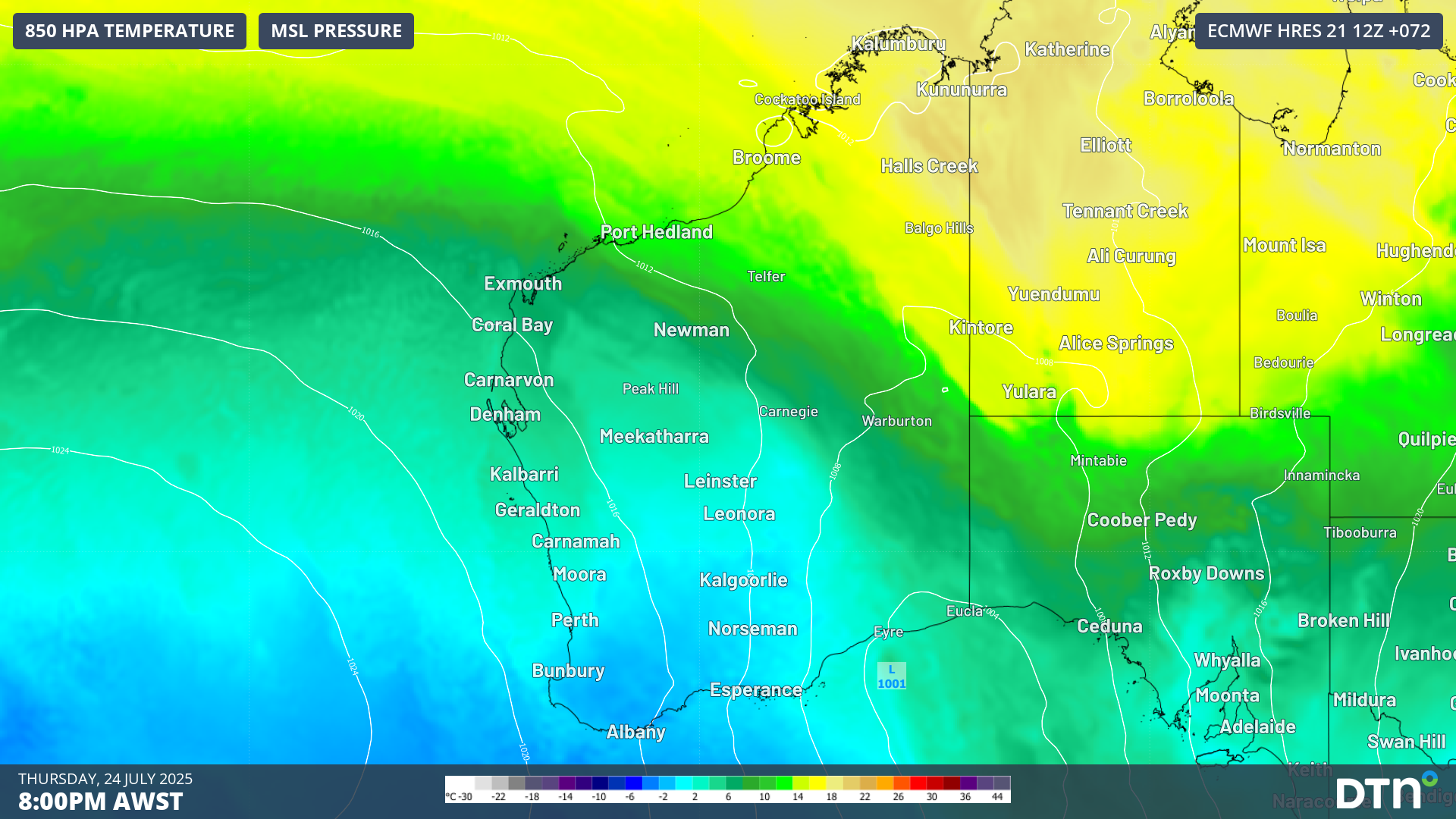
Another burst of cold coming on Thursday
A pair of milder days will follow with westerly winds bringing showers and rain on Tuesday and Wednesday. However, late on Wednesday and into Thursday, another cold front will cross into the region, bringing another burst of cold temperatures. Cold air will surge north from deep in the Southern Ocean, more than 2000 km to the south, bringing this burst of cold.
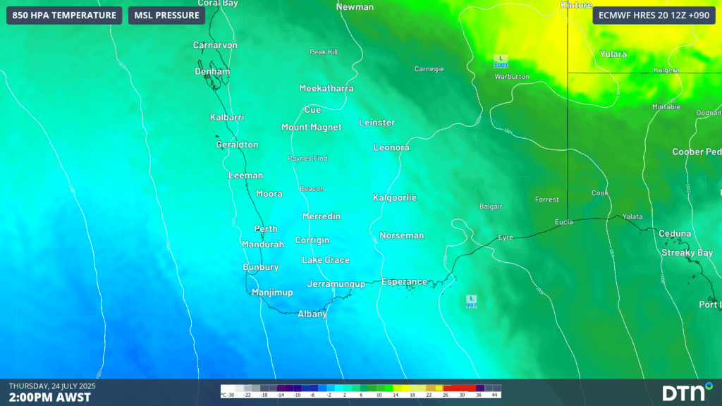
Image: 850 hPa temperatures on the afternoon of Thursday, July 24, 2025.
Temperatures will be limited to the low-to-mid teens again on Thursday, with Perth forecast to only reach a maximum of 14°C — which could end up being the coldest day so far this year. If the mercury remains below 14.5°C, it’ll be Perth’s coldest day since August 2023.
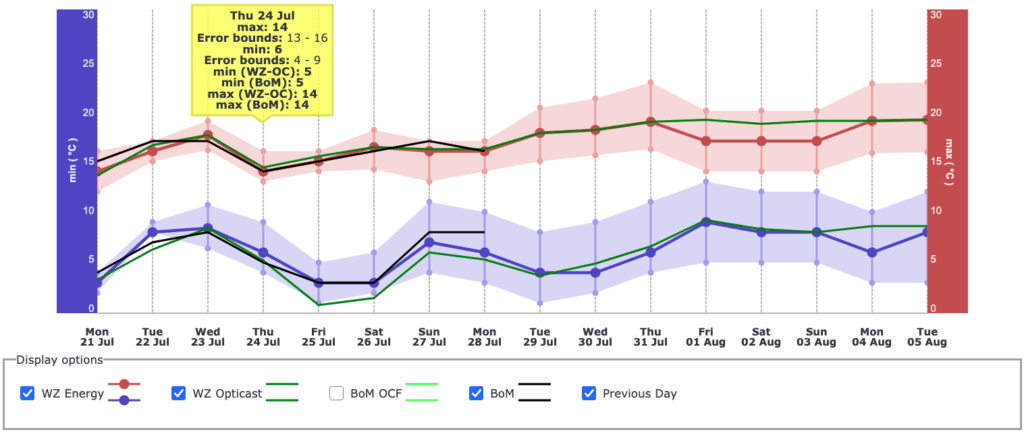
Image: Daily forecast maximum and minimum temperatures for Perth over the coming 14 days, as seen on the DTN APAC Energy Dashboard.
Cloud cover will clear later on Thursday, leading to another round of cold mornings on Friday and Saturday, with the mercury forecast to drop down to about 3°C in Perth. The cold air will also reach into northern WA, with broad parts of the state’s interior and southwest experiencing minimum temperatures in the low-to-mid single digits.
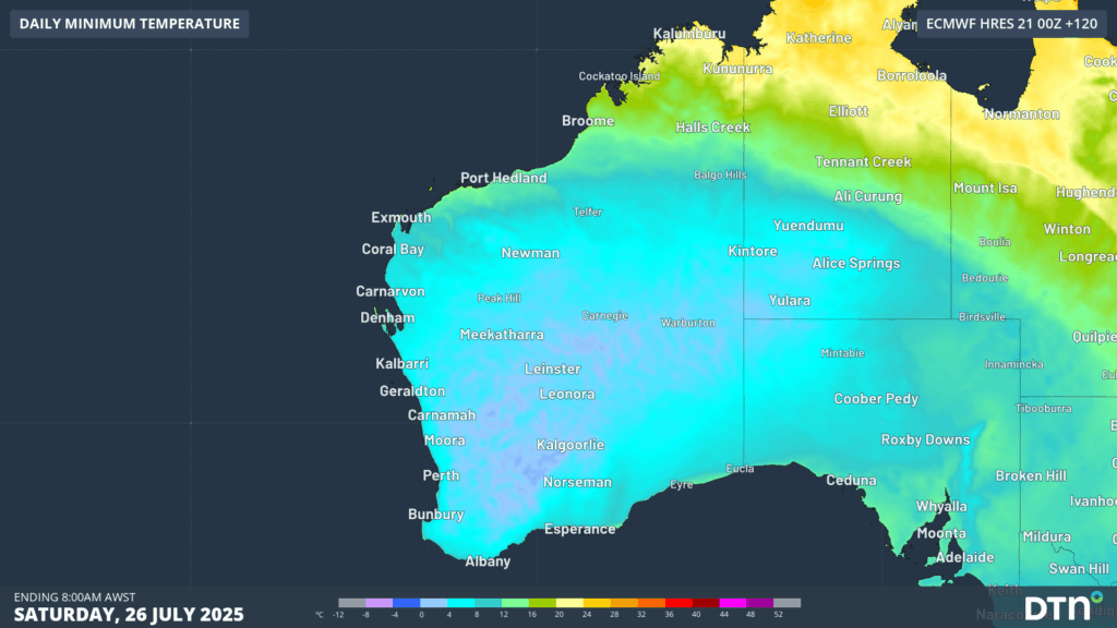
Image: Forecast minimum temperatures on Saturday, July 26, 2025.
Milder temperatures are expected on Sunday, extending into early next week, for southwestern WA.
How DTN APAC services the energy sector
DTN APAC supplies precise weather intelligence to over 75% of the National Energy Market (NEM); and is the trusted provider for the Australian Energy Market Operator (AEMO).
DTN APAC’s next-generation nowcasting and forecasting system, OpticastTM, is independently proven to outperform other industry models, allowing energy traders to respond rapidly to changing conditions. From 14 day forecasting to seasonal outlooks, you have access to complete and powerful weather intelligence giving you the confidence to make the best call.
Meeting the needs of the changing market, DTN APAC utilises high-resolution modelling and local knowledge to provide 5-min granularity observations and forecasts, optimising your market bidding and maximising your profits. These, coupled with briefings from our energy meteorologists, give you full awareness of the associated risk.
Benefit from specialised indices such as apparent temperature, Cooling/Heating Degree Days (CDD/HDD) and Effective Degree Days (EDD) to help accurately predict demand. You can get a clear picture of forecast conditions across the market and quickly assess heat/heatwave potential from 14 days out to 12 months.
No matter where your energy trading focus lies, we have the power generation and weather insights to inform your critical decisions, keeping you ahead of the curve.
Learn more about our large range of industry leading products and services or email us at sales.apac@dtn.com


