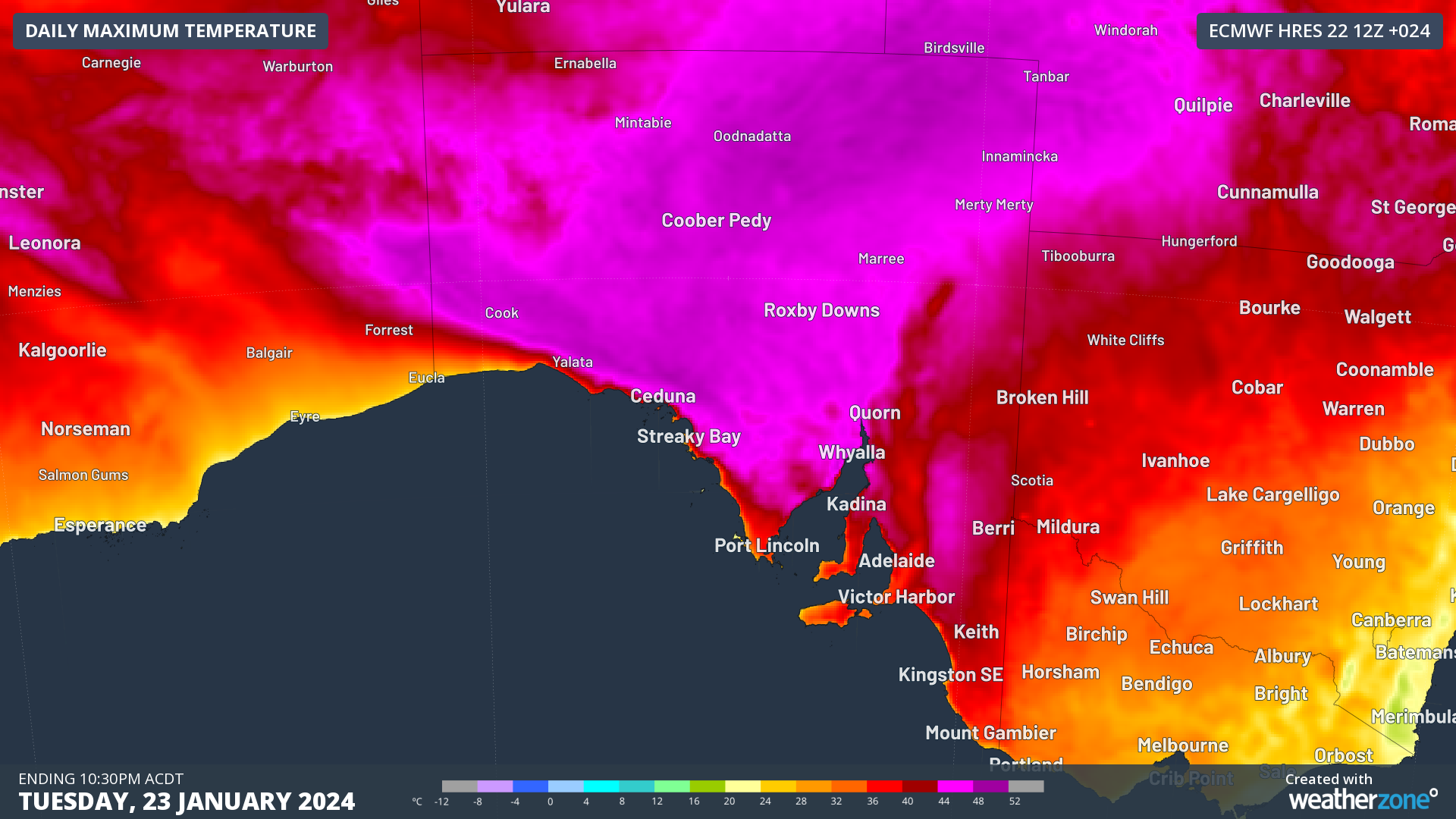
Temperatures will soar across SA on Tuesday, with temperatures expected to reach the mid to high 40’s in some areas.
This heat is being driven by an extremely hot airmass ahead of a low-pressure trough near the state on Tuesday.
The day began hot for many SA towns, with the mercury at Oodnadatta hitting 35.9°C at 7:42am ACDT on Tuesday morning.
Adelaide also sweltered through a warm night with the lowest temperature of 24.6°C recorded at 6:43am. The warm morning has given the temperature a healthy head start across much of SA, with Adelaide already over 30°C at 9am.
The temperature is set to climb to around 41°C in Adelaide, while some areas will see temperatures climb into the mid to high 40’s.
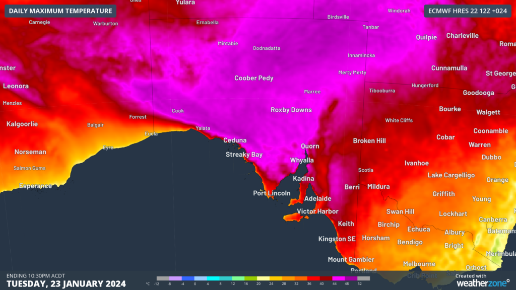
Image: Maximum temperature forecast on Tuesday, January 23, according to the ECMWF model
These maximum temperatures along with very warm minimum temperatures are creating severe heatwave conditions across northern SA. Extreme heatwave conditions are forecast in the Northwest Pastoral district.
The map below shows the heatwave severity for three days starting Tuesday, January 23.
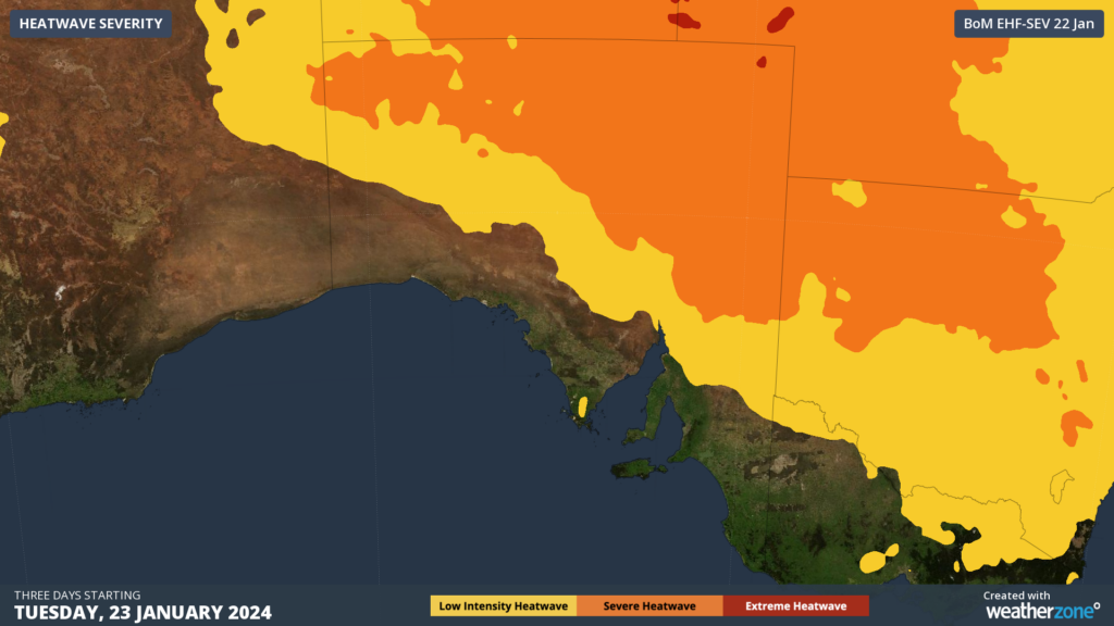
Image: Heatwave severity for the three days starting Tuesday, January 23
Thunderstorms and showers are forecast to develop along the low-pressure trough in the north and west on Tuesday afternoon and evening. The cloud associated with the trough and storms should trap the heat in overnight across northern parts of SA.
For those in Adelaide, a weak southerly change is forecast to move through the city between 4-6pm ACST, which will unfortunately provide little relief to the sweltering city.
This means that the temperature in Adelaide should remain above 35°C until around 8-9pm ACST, before the temperature finally drops below 30°C between 10:30-11:30pm ACST.
The red line in the map below shows Adelaide’s temperature forecast in the next 24 hours.
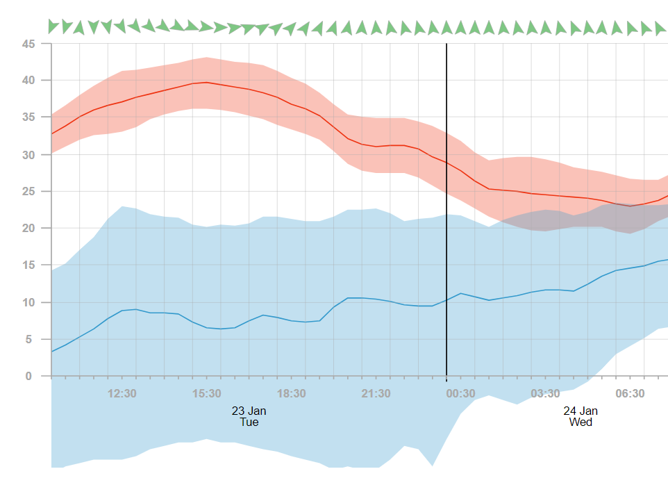
Image: Temperature (red line) and dewpoint (blue) and confidence interval spread (red shade temperature, blue shade dewpoint) for Adelaide in ACST.
The chart shows that the minimum temperature in Adelaide early Wednesday morning will fail to drop below 23°C.
The maximum temperature on Wednesday will be around 10°C cooler than Tuesday, with a top of 31°C forecast.
While Adelaide is slightly cooler on Wednesday, northern parts of SA will remain in the mid to high 40’s until later this week. For more information, please contact us at apac.sales@dtn.com.


