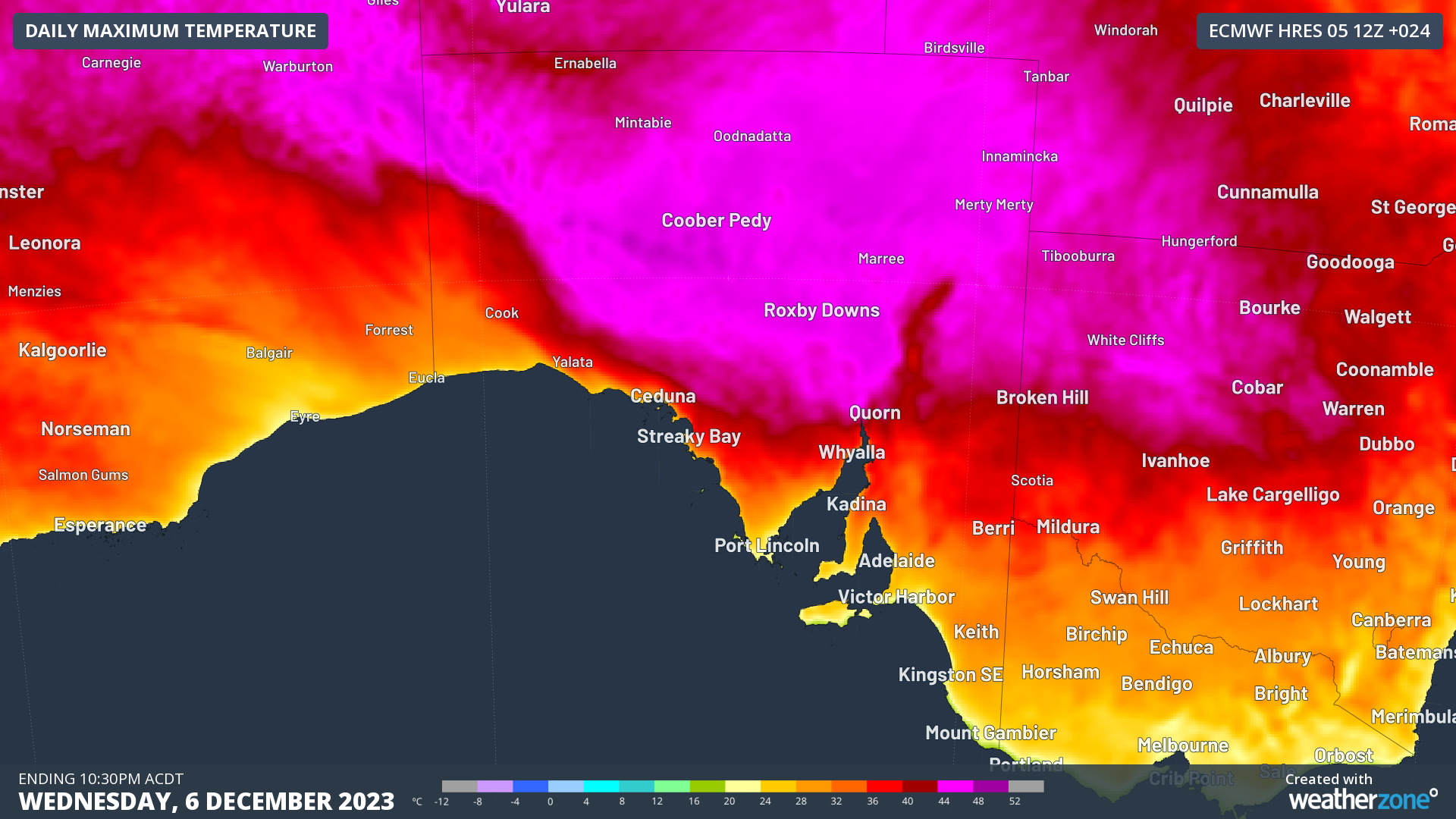
The early summer heatwave continues in South Australia, especially in the north of the state, with tops of 46°C expected this Wednesday at some locations in the North West Pastoral and North East Pastoral forecast districts.
Adelaide and southern parts of the state will duck the worst of this heatwave, although temps in the state capital should still rise to a toasty 33°C on Thursday and Friday.
Then as the weekend arrives, the South Australian weather picture changes dramatically.
During the coming weekend and into the new week, an upper-level cut-off low looks likely to stall over South Australia, causing a mix of dangerous weather – possibly including heavy rain, severe thunderstorms and damaging winds.
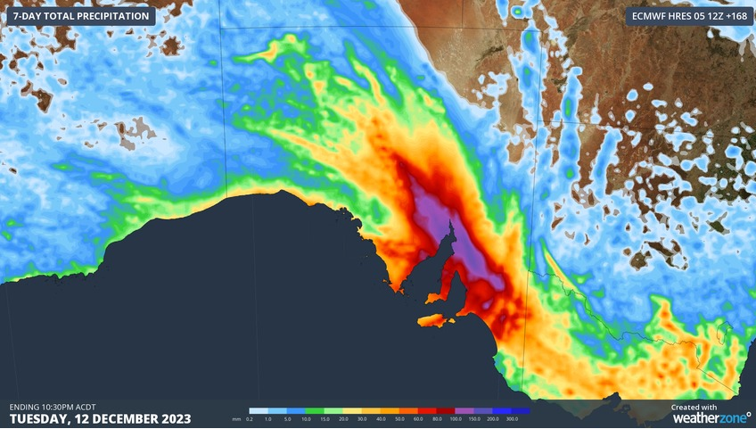
The model below predicts the accumulated 7-day rainfall from this Wednesday to next Tuesday inclusive. It goes without saying that you don’t expect to see zones of purple or blue (representing 100 mm to 200 mm of rainfall) in South Australia during summer.

The contrast between the midweek and weekend weather will be particularly dramatic around the apex of Spencer gulf (the more westerly of SA’s two large gulfs) atop which sits the town of Port Augusta.
Port Augusta should reach the low-to-mid 40s from today through to Friday, before weekend temperatures plummet under cooler southerly winds, with cloudy skies and heavy rain preventing the days warming beyond about 20 degrees – in a month where the average max is 32.2°C.
Adelaide, too, will likely see heavy rain this weekend and top temps that struggle to exceed 20°C.
As mentioned, this is an unusual summer weather pattern for SA, and for an understanding of the bigger picture behind the coming weekend’s weather, please read our story from Tuesday about twin omega blocks in the Australian and South Pacific regions.
A reminder too to check our warnings page if you’re in South Australia this weekend as flooding and other hazards are highly likely in some areas.
You can’t control the weather, but you can gain precision insights to optimise your response. What lights us up is providing your energy business with tailored weather information to reduce your risk and keep you moving ahead of the curve.
Our services cover all aspects – from wind and solar generation to demand forecasts, wholesale markets to retail so, no matter where your company sits, we have solutions for you. We have worked closely with market participants to create products that meet the evolving needs of the sector, aiming to increase safety and profitability for our customers.
Benefit from the timely delivery of accurate weather information, allowing informed and effective decision-making. For more information, please contact us at apac.sales@dtn.com.


