
A record string of warm September days is in store for Melbourne, starting this Tuesday.
While the record Melbourne maximum of 31.4°C is highly unlikely to be broken, Melbourne will likely see its longest September streak of days with a maximum temperature above 20°C.
- The current record for consecutive September days of 20°C or higher in Melbourne is seven
- That has happened twice, in 1907 and 1987
- At this stage, it appears almost certain that the record will be broken, possibly extending to nine days if current forecasts hold up, with a hottest max during the streak of 29°C next Tuesday
- You can find the Melbourne forecast extending out to nine days on the Weatherzone app
- At this stage, our forecast Melbourne max temps are: 22°C (today) 24°C, 26°C, 25°C, 25°C, 23°C, 25°C, 29°C, 20°C (next Wednesday)
The loop above shows the surge of unseasonably warm air heading east.
As Weatherzone meteorologist Ben Domensino explained on Monday, the effects of this September surge of warm air will be felt most strongly in southern and southeastern Australia. Western Sydney will likely reach the mid-thirties by Sunday, while Brisbane will miss the hottest air.
Minimum temps will also be warm for this time of year, with Melbourne dropping to just 17°C on Friday morning.
Melbourne’s September average maximum is just 17.3°C so it’s conceivable that the city could see an entire night that is warmer than the average monthly maximum. That would be highly unusual in any month.
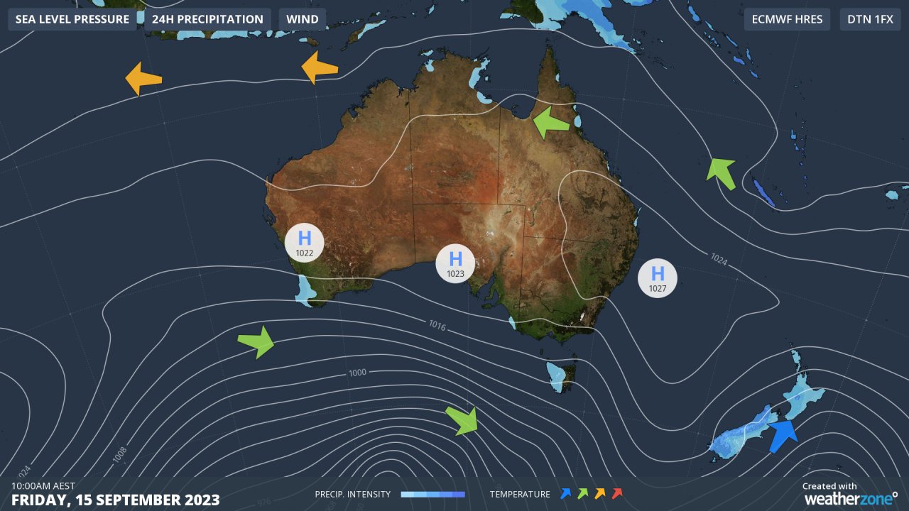
Our synoptic chart for Friday tells the story, with air circulating around the high centred in the Tasman Sea directing northerlies across the southern mainland like a summer pattern. Meanwhile the cold fronts are being forced too far south to cool things down on the mainland.
It’s a far cry from last weekend, when a cold front pushed northwards and the AFL footy finals kicked off with freezing temps at the MCG.
This Friday night’s match between Melbourne Demons and Carlton Blues at the MCG should be played in very mild, dry conditions.
DTN APAC can provide super-rapid forecast updates every 5 minutes so you can stay ahead of the competition. To find out more, please visit our website or email us at apac.sales@dtn.com.


