
Another burst of record-challenging early-season heat will sweep through Sydney in the opening days of October, with temperatures tipped to reach the high thirties in some suburbs on Sunday.
A large mass of hot air that is currently building over central and western Australia will drift towards Australia’s east coast from this weekend, ahead of a broad low pressure trough. This hot air mass has already broken records in parts of WA on Wednesday.
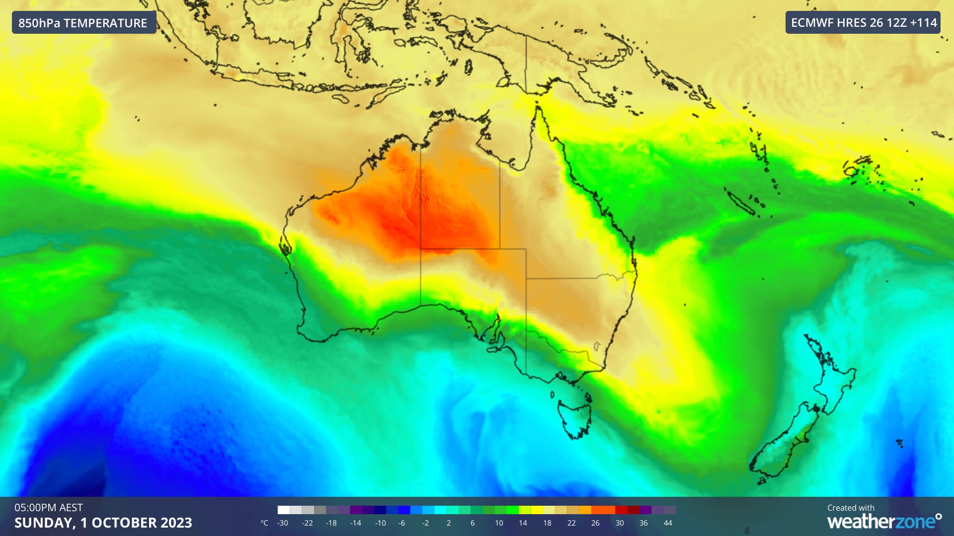
Image: Forecast 850 hPa temperatures on Sunday, October 1, according to the ECMWF-HRES model. This shows a hot air mass spreading from central Australia towards the nation’s east coast.
The approaching weather patter will cause the Sydney region to experience several days of abnormally hot weather in the opening days of October, with a chance some suburbs could see their highest temperatures on record for this early in spring.
Parts of western Sydney are forecast to reach around 36ºC on Sunday, October 1 and 37 to 38ºC on Tuesday, October 3. If any Greater Sydney weather station exceeds 37.3ºC in the first three days of October, it will be the Sydney Basin’s highest temperature on record this early in spring.
While temperatures in the city should be slightly cooler than the western suburbs in the opening days of October, this Sunday could reach around 35ºC in the CBD. If the temperature manages to climb above 34.6ºC on October 1, it will be the city’s hottest day on record this early in spring.
The impending burst of warmth comes less than two weeks after Sydney and other areas of southeastern Australia experienced record-breaking September temperatures during another early-season heatwave.
Weatherzone operates Opticast, an ultra-local forecasting system, independently proven to be the best performing of its type in Australia. Providing an unprecedented level of accuracy and precision, Opticast rapidly updates every 10 minutes, intelligently adapting to local observations, and corrects forecasts based on historical evidence. Wherever you are based, we can provide you with the most accurate nowcasting and forecasting data out to 14 days so that you can mitigate operational and safety risks, and plan to make the most of severe weather windows. For more information, please contact us at apac.sales@dtn.com.


