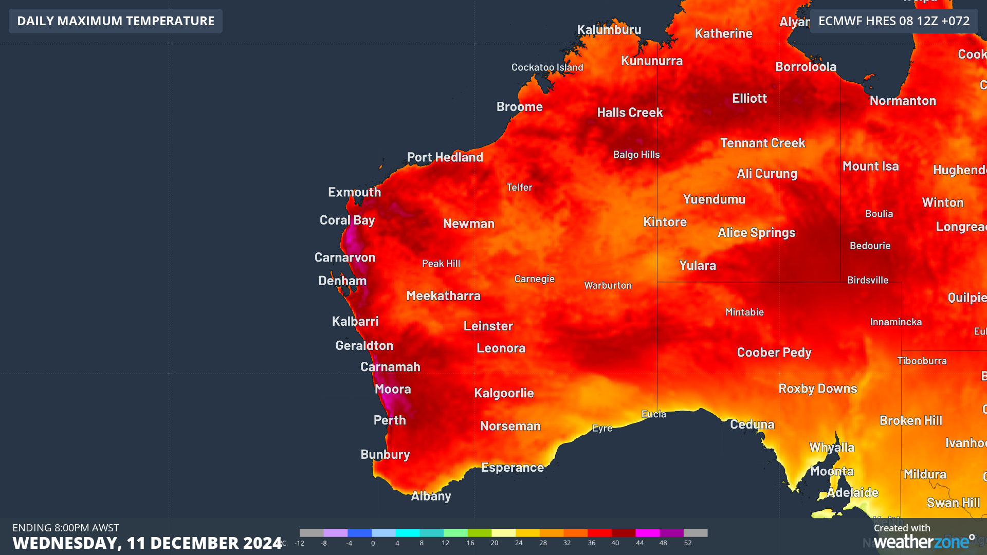
A severe heatwave is impacting Perth, with daytime temperatures soaring into the mid to high 30s and possibly the longest stretch of hot December nights in decades.
This prolonged period of extreme heat is being caused by a stubborn high-pressure system in the Bight which is directing hot northeasterly winds from central Australia towards the west coast.
Consequently, severe heatwave conditions are forecast for the Lower West, including Perth, Central West, Central Wheatbelt, and Gascoyne districts, with temperatures reaching the mid 30s to low 40s in the coming days.
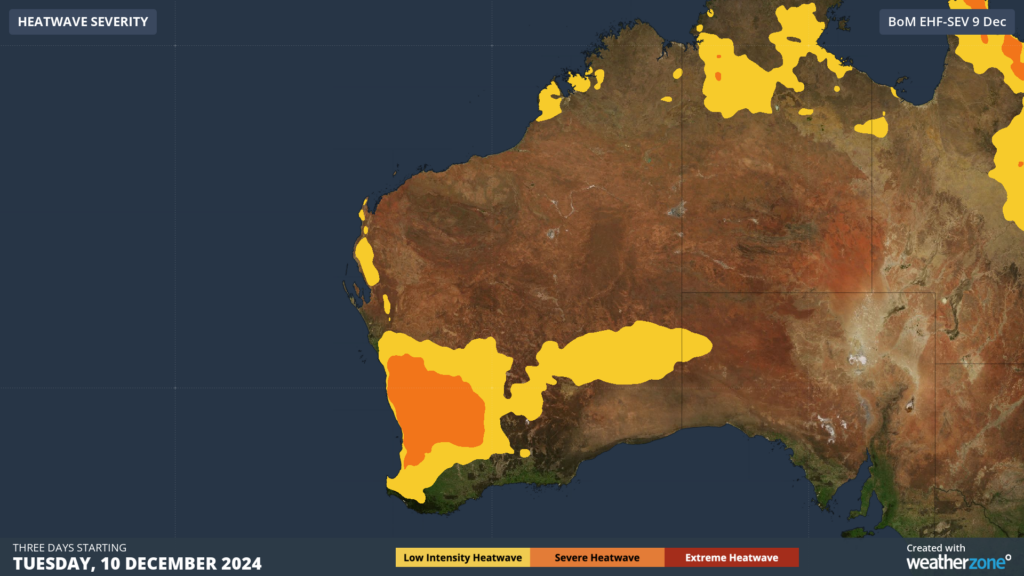
Image: Heatwave severity for the three days beginning on Tuesday, December 10. Source BOM
Perth will see a run of five days in the mid to high 30s with the heat forecast to peak at 38°C on Wednesday, December 11. Night-time temperatures will also be warm for three consecutive nights from Wednesday, with the Bureau forecasting that the temperature won’t drop below 24°C. This would be the longest run of December nights at or above 24°C that the city has seen in 59 years.
However, if a pleasant seabreeze, affectionately known by locals as the Fremantle Doctor, flows over the city during these days, the temperature most likely will cool below 24°C just before midnight. If we saw the minimum temperature stay at or above 23°C for three consecutive nights, it would be the longest stretch for December since 1972.
Fortunately, there will be some relief on the weekend, with temperatures finally dropping into the 20s after a week-long stretch in the 30s.
DTN APAC supplies precise weather intelligence to over 75% of the National Energy Market (NEM); and is the trusted provider for the Australian Energy Market Operator (AEMO).
Weatherzone’s next-generation nowcasting and forecasting system, OpticastTM, is independently proven to outperform other industry models, allowing energy traders to respond rapidly to changing conditions. From 14 day forecasting to seasonal outlooks, you have access to complete and powerful weather intelligence giving you the confidence to make the best call.
Meeting the needs of the changing market, Weatherzone utilises high-resolution modelling and local knowledge to provide 5-min granularity observations and forecasts, optimising your market bidding and maximising your profits. These, coupled with briefings from our energy meteorologists, give you full awareness of the associated risk.
Benefit from specialised indices such as apparent temperature, Cooling/Heating Degree Days (CDD/HDD) and Effective Degree Days (EDD) to help accurately predict demand. You can get a clear picture of forecast conditions across the market and quickly assess heat/heatwave potential from 14 days out to 12 months
No matter where your energy trading focus lies, we have the power generation and weather insights to inform your critical decisions, keeping you ahead of the curve. For more information please visit our website or email us at sales.apac@dtn.com.


