A band of thunderstorms marched across northern Tas and the nearby waters on Monday, with Total Lightning Network capturing thousands of strikes.
This band of rain and thunderstorms stretched 1200km between southern NSW and Tas ahead of a strong cold front which passed over the region early Tuesday morning, April 2.
The animation below shows thunderstorms sweeping across northern Tas on Monday afternoon.
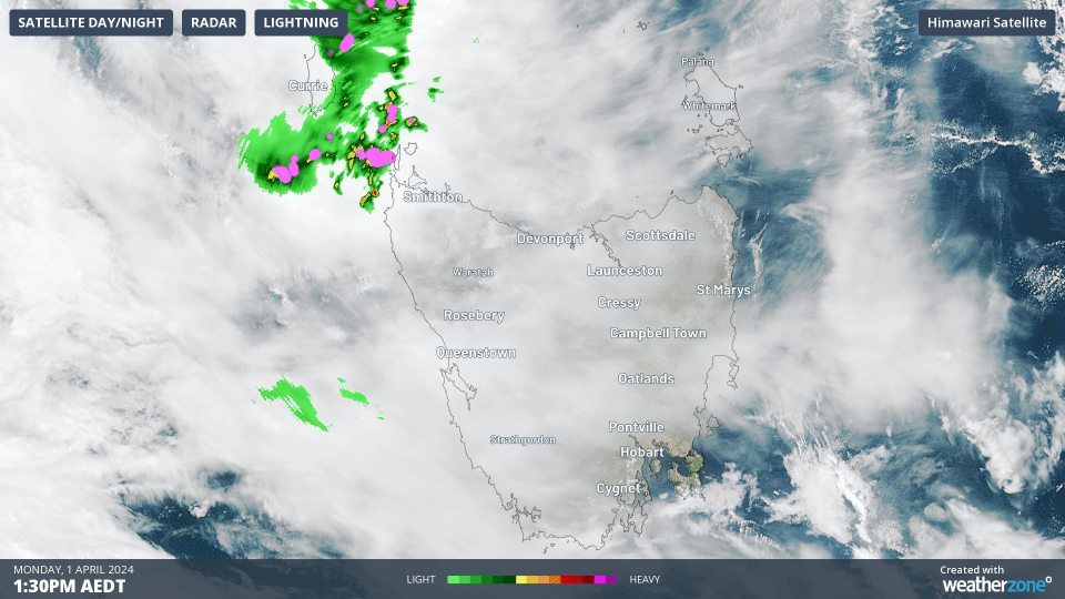
Image: Himawari-9 satellite image showing lightning (pink) and rain on the radar (green shades) during the three hours leading up to 4:30pm AEDT on Monday, April 1.
Total Lightning Network captured 11,648 lightning strikes over Tas and the nearby waters on Monday, April 1.
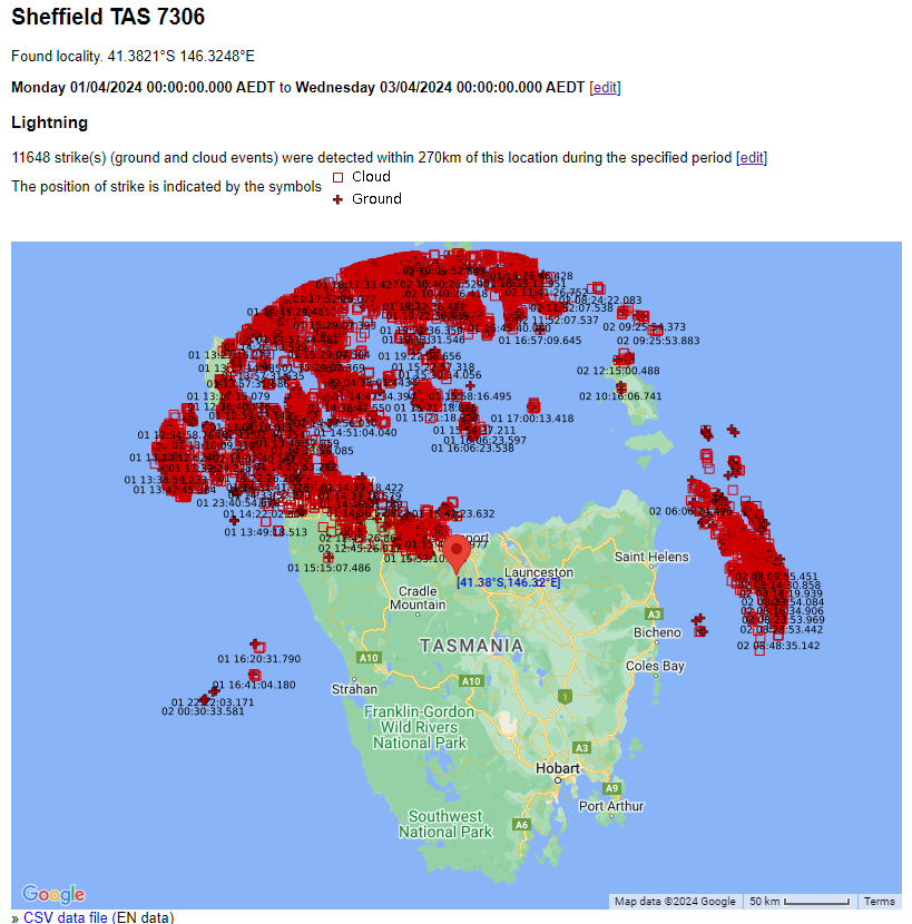
The map above shows that the state’s north copped the brunt of the heavy rainfall and thunderstorms, with Western Creek at Banktown Road recording 87mm in the 24 hours leading up to 9am on Tuesday, April 2. During the same period, Sheffield Farm School in the state’s north recorded its wettest day in 27 years of records, with 66.4mm falling.
These thunderstorms occurred over locations that typically see around 1-2 lightning days a year on average. The map below shows the annual lightning density over Australia with the most lightning occurring across northeastern Tas, with around 5-10 lightning days per year recorded in some areas.
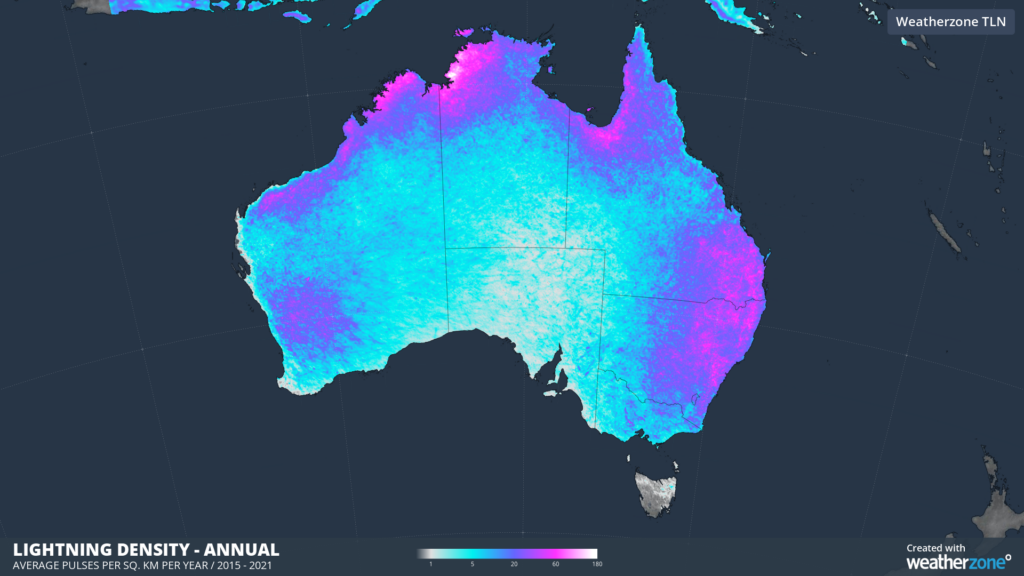
Image: Annual lightning density showing average pulses per sq.km per year between 2015-2021 captured by Total Lightning Network (WZTLN).
While lightning is not as frequent across parts of Tas as it is in NSW, southeast Qld and the tropics, thunderstorms can be severe when they do hit, potentially damaging your assets.
DTN APAC, a DTN company, offers precise weather intelligence and alerting to protect your utilities network when severe weather, floods and fires threaten.
Over 80% of Australian transmission and distribution networks already rely on our proven nowcasting and forecasting out to 15 days. You can rest assured yours is protected by market-leading analysis. With this foresight you can gain lead time to prepare for possible outages, reduce risk and protect your people and profits.
You will never be left in the dark when conditions suddenly worsen. We deliver reliable, up-to-the-minute weather forecasts and analytical tools that give you the power to enhance your operational management and response to weather risk. Our Total Lightning Network is a globally proven solution that accurately identifies and alerts you to lightning strikes within your defined thresholds, supporting the safety of your team.
Your customisable interface has GIS mapping, showing multiple weather layers over your utilities network and offering full situational awareness. You can quickly recognise any threat to your assets in real-time. 24-hour asset monitoring allows you to track lightning, bushfires and other severe weather systems that approach your service territory.
Advanced and actionable analytics allow you to act decisively and improve your planning and outage response strategy. For more information, please contact us at apac.sales@dtn.com.