
The next cold front to impact southeastern Australia late this week will see gas demand increase as cloud and cool winds put on the chill.
Over the next few days, a cold front crossing southwest WA will interact with moisture streaming in from the northwest. This will setup a Northwest Cloudband that will sweep over the southeast over the coming days. Furthermore, a cut-off low will form in the Bight from Tuesday helping to push the cold air into the southeast and provide significant wind chill.
Temperatures are forecast to remain in the single digits for most of inland Vic, NSW and SA on Wednesday and Thursday. Windchill is expected to make temperatures feel 2-4 degrees cooler than actual on Wednesday and 3-6 degrees colder on Thursday.
Melbourne is forecast to reach 12°C around noon on Thursday but may struggle to warm above 8°C during the afternoon hours with rain. Similarly, Sydney, Canberra and Hobart are all expecting earlier maximums, with cloud moving in during the afternoon. Adelaide will likely have a later maximum of 14°C after a cold and wet morning, although its unlikely to feel any warmer than 9°C during any part of the day.
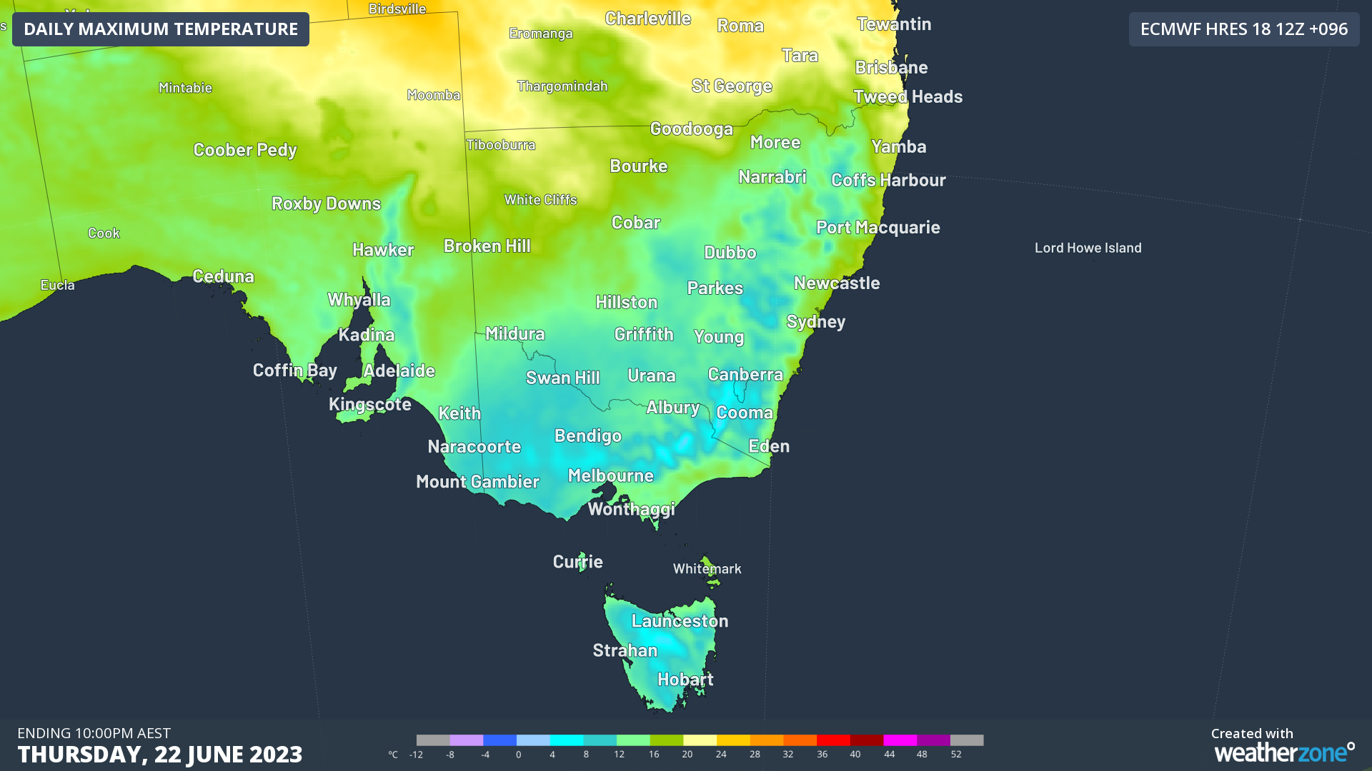
Image: Forecast maximum temperatures on Thursday over the southern NEM
This effect of the cloud will be particularly noticeable given that Wednesday is the Winter Solstice: the shortest day of the year. This also is the day that the sun is the lowest in the sky, making it harder than normal for light to penetrate through the cloud. Thursday is expected to be nearly completely overcast for Melbourne and more broadly over the southern NEM, with mostly above 80% cloud coverage. Even Brisbane and southeast Qld will see increased cloud cover, substantially limiting both rooftop and utility-scale solar.
. 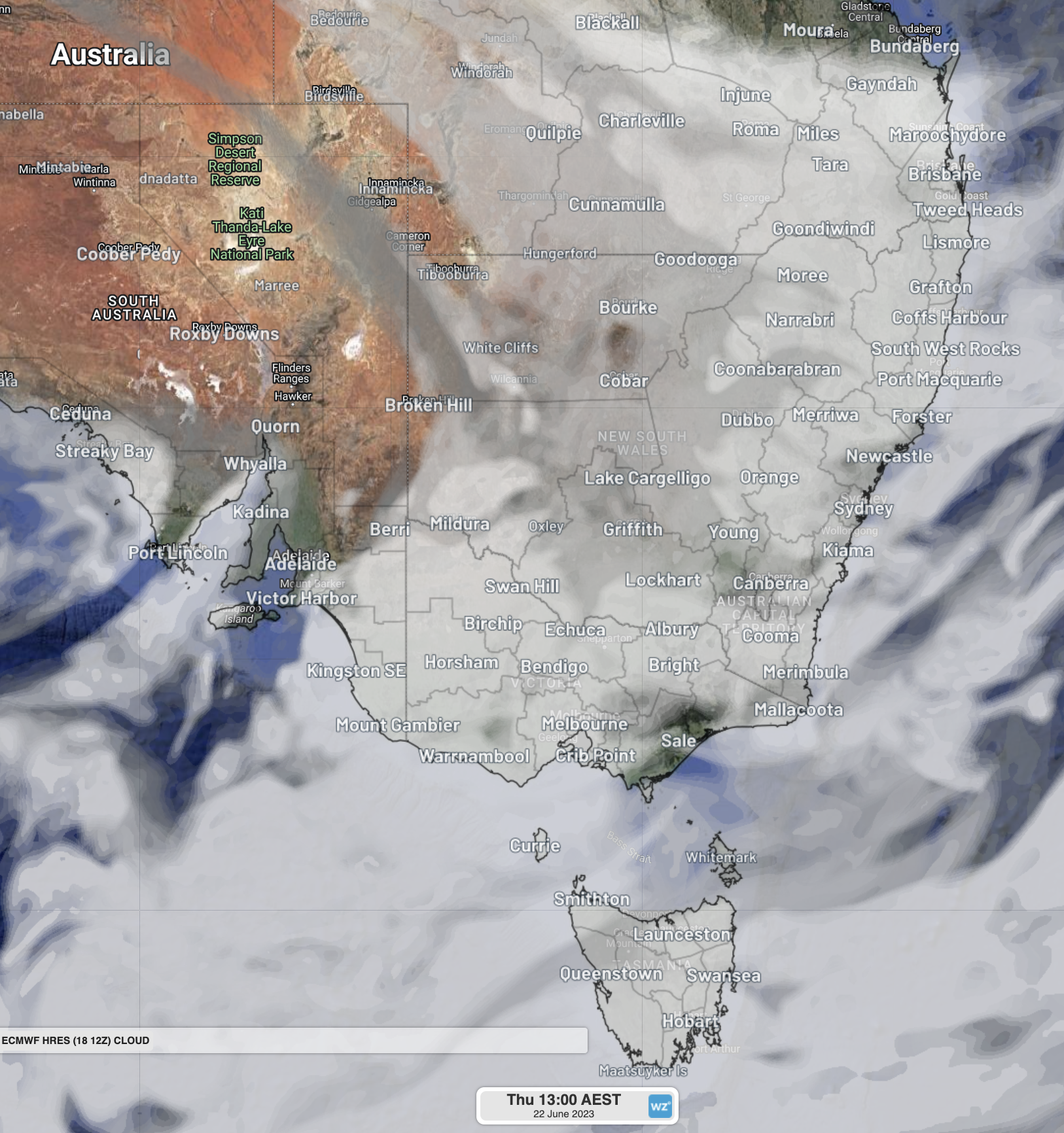
Image: Forecast cloud cover over the NEM at 1pm Thursday 22nd. Cloud will be particularly thick over Tas and western Vic, but most areas will be cloudy.
While solar output will be greatly reduced, wind power will be able to pick up some of the slack. A cut-off low will form in the Bight from Tuesday, providing moderate to fresh northerly winds over southern NSW, Vic, Tas and eastern SA. Some of the wind power may not be reliable for the rest of SA on Thursday, as wind gusts exceeding 70km/h are forecast, potentially exceeding the safe operating threshold for some wind farms.
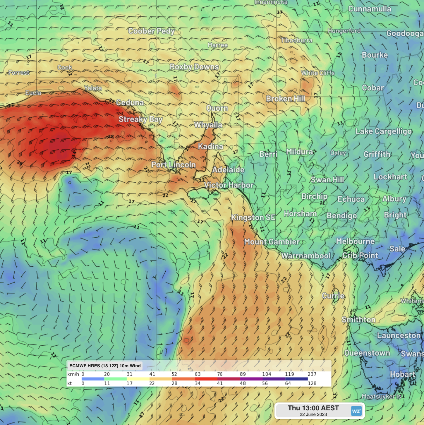
Image: Forecast surface sustained winds over southeast Aus at 1pm Thursday 22nd. Green and yellows are the moderate to fresh winds expected, while the orange and reds show strong winds.
All of these aspects coming together this week mean an increased dependence on gas for warmth and energy, particularly on Wednesday and Thursday this week. It is also a good idea to keep an eye on the AEMO Market Notices for any Lack of Reserve (LOR) conditions that may be forecast over the coming days.
DTN APAC provides detailed wind, solar and energy forecasts to our energy clients across Australia. For more information, please visit our website or contact us at apac.sales@dtn.com.




