

Prosper in a dynamic world
Search

Melbourne’s coldest six-day May spell in 42 years

Melbourne has just had its coldest six-day period in May for 42 years, with more cold weather to come.

  • For six days straight between last Tuesday and Sunday, Melbourne’s maximum failed to exceed 15°C. That hasn’t happened since May 1981.
  • The warmest day of the chilly six-day run was Saturday with a max of exactly 15°C while the coolest days were Tuesday and Thursday which both had tops of 13.7°C.

As any Melburnian knows, these are not particularly cold maximum temperatures this close to winter. Indeed, Melbourne’s average May maximum is 16.7°C, so we’re only talking about days which were two or three degrees below average.
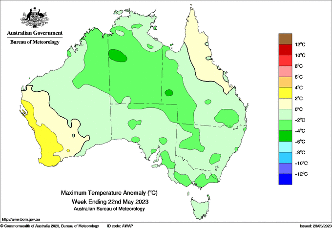
Image: Weekly maximum temperature anomaly

But to have a run of cold days lasting almost a week is definitely unusual and can be attributed to a series of Southern Ocean cold fronts which have swept over Victoria. Another front is due Thursday, and this one might be the strongest of the lot. Thursday is expected to be a wet one in Melbourne with a top of 15°C, and showers will persist with a biting wind on Friday that makes the top of 13°C seem considerably colder.

There’s a slight warming trend on the cards for the early part of next week, but we’re only talking maximums of 17°C or so. That means that Melbourne’s average maximum for May 2023 could end up being slightly cooler than the historical average – a very rare statistic these days.

  • As things stand now, Melbourne’s running average max temp for May 2023 is 16.4°C.
  • That’s 0.3°C lower than the long-term average of 16.7°C.

We’ll have a full wrap of Melbourne’s May weather at the end of the month, so stay tuned.

To find out more about DTN APAC and our forecasting services, please visit our website or email us at apac.sales@dtn.com.


Latest news

Satisfy your weather obsession with these news headlines from around the nation, and the world.

Signs of a positive Indian Ocean Dipole, but it may not follow the textbook

Waters off Indonesia have cooled in recent weeks, an indication that a positive Indian Ocean Dipole (IOD) event could be developing. It’s an important climate driver for Australia, and it could shape rainfall and temperatures heading into summer, with flow-on effects for farmers, energy and other industries.  What is the Indian Ocean Dipole?  The IOD […]

1.3 million lightning strikes and a record September downpour: the storms testing WA’s Goldfields

Leonora, WA, had its wettest September day on record earlier this month. Three weeks later, more than 1.3 million lightning pulses were detected within 800 km of the town in 48 hours. Why is a stalled trough delivering storms to mining country, and what it could mean for operations?  The DTN Total Lightning Network detected […]

A very low wind power week, likely to continue

A stubborn blocking high over southern Australia will make for a very quiet week for wind generation and the pattern behind it isn’t a one-off.   It’s the seasonal signature of a super (very strong) El Niño combined with a positive Southern Annular Mode (SAM), and both the historical record and the current seasonal forecast suggest it’s likely to keep recurring through spring before a potential switch from November.  The setup right […]

Fastest strengthening El Niño on record: Impacts on Australian monsoon timing and wet season planning

Australia’s Mining and Resources sectors are bracing for a wet season shaped by one of the most rapidly developing El Niño events on record.    Looking back at how the strongest El Niño events in Australian history have played out, it becomes apparent that mining operations in Australia should be planning for a later monsoon […]

