Prosper in a dynamic world
Search

Lowest temps of 2023 in parts of NSW, QLD, NT

Parts of central and eastern Australia experienced their coldest morning so far this year on Monday, with more wintry temperatures on the way later this week.

The first morning of May was a fittingly cold start to the final month of autumn for large areas of NSW, Qld and the NT.

The cold morning was caused by a combination of clear skies, relatively light winds and lingering cool air mass, which allowed temperatures to drop steadily throughout Sunday night into the early hours of Monday morning.

Lowest temps of 2023 in parts of NSW. QLD. NT

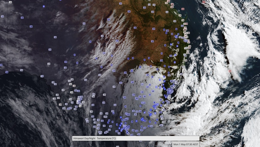
Image: Observed surface air temperature and cloud cover at 7:30am AEST on Monday.

Sydney cooled to a minimum temperature of 10.6ºC at 7:00 am on Monday, making it the city’s coldest morning since November 2022. Further inland, Moree (3.7ºC) and Bourke (4.5ºC) both had their coldest morning since last September.

A few places in Qld registered their lowest temperature in nine months on Monday, including Thargomindah (8.1ºC), Emerald (9.7ºC) and Oakey (2.1ºC).

In the NT, the temperature at Alice Springs dropped to 4.9ºC just before 7:00 am on Monday, its coldest morning since September.

Monday’s cold start came a day after Melbourne cooled to 5.0ºC on Sunday morning, its lowest temperature in seven months.

Looking ahead, a pair of cold fronts will bring more cold weather to a broad area of southeastern Australia later this week. This is likely to include more lowest temperatures of the year, along with a wintry mix of blustery winds, rain, hail and snow.

Lowest temps of 2023 in parts of NSW. QLD. NT

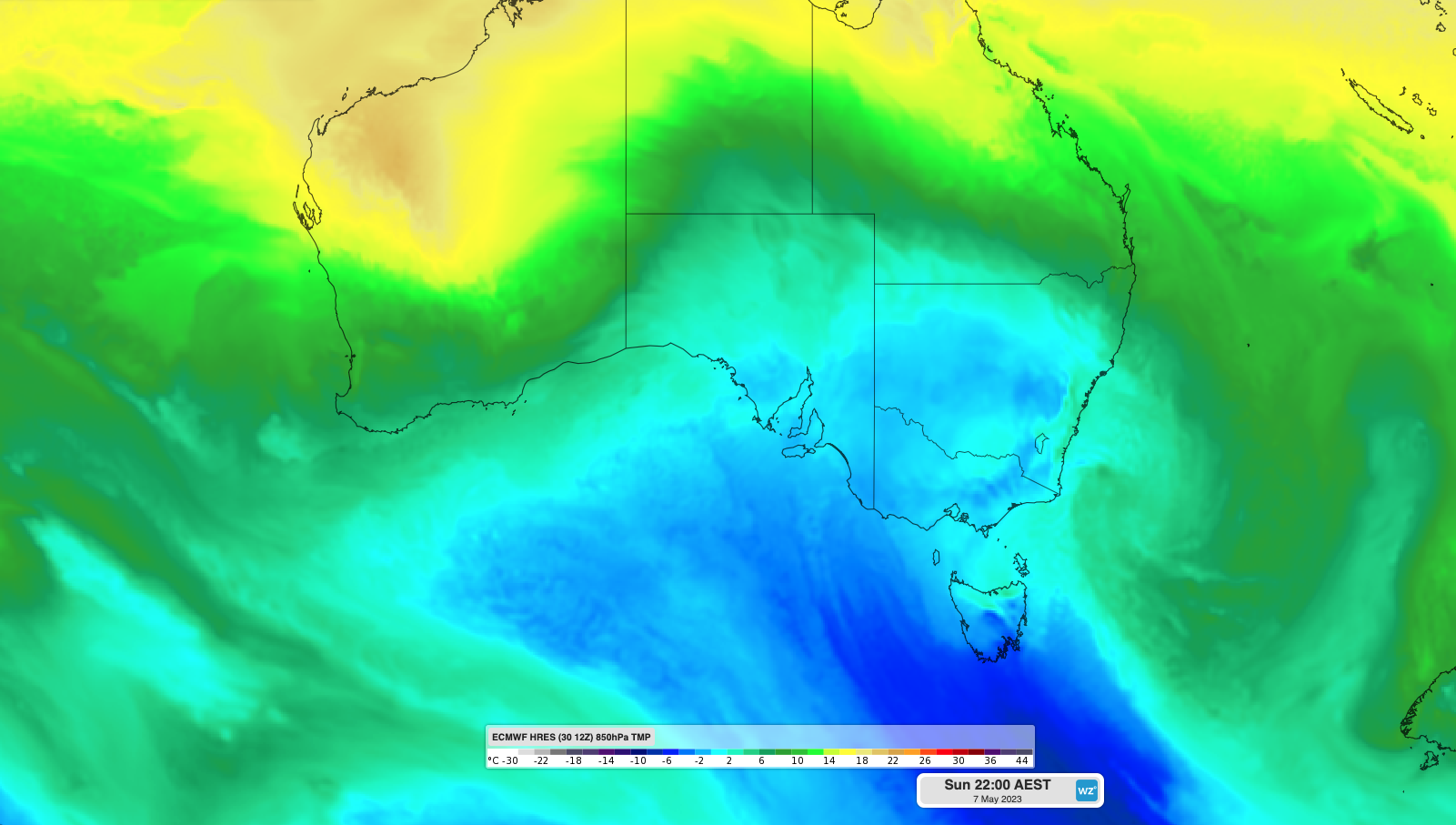
Image: Forecast 850 hPa temperature this Sunday night, showing a large cold air mass over southeastern Australia.

To find out about Weatherzones temperature forecasts, visit our website or email us at apac.sales@dtn.com.

Latest news

Satisfy your weather obsession with these news headlines from around the nation, and the world.

Negative Indian Ocean Dipole officially underway – here’s what it means for Australian businesses and industries

A negative Indian Ocean Dipole (IOD) event is now underway, increasing the likelihood of above average rain over large parts of Australia in the coming months. What is the Indian Ocean Dipole (IOD)? The IOD is an index used to monitor sea surface temperatures across the tropical Indian Ocean. It’s an important index for the […]

La Niña more likely this year after BoM switches to new index – what does this mean for Australian businesses?

The likelihood of La Niña occurring in 2025 has increased due to a change in the way the Bureau of Meteorology calculates sea surface temperature anomalies in the tropical Pacific Ocean. What is La Niña? La Niña refers to a distinct pattern of sea surface temperatures across the tropical Pacific Ocean. When La Niña is […]

Southern Hemisphere’s polar vortex is weakening – here’s what this means for Australian weather

Stratospheric warming high above Antarctica could cause the Southern Hemisphere’s polar vortex to weaken at an unusually fast pace over the coming weeks. This weakened polar vortex has the potential to affect weather patterns across Australia and other parts of the Southern Hemisphere. What is the polar vortex? The polar vortex is a large circulating […]

Severe thunderstorms, tornadoes and flooding rainfall lash out over NSW businesses and industries

Severe thunderstorms, tornadoes and flooding rainfall have disrupted transport, rail, aviation and many other industries across NSW as a low pressure system tracked over the state. Severe thunderstorms and tornadoes in western NSW A tornado was observed near the town of Young on the South West Slopes of New South Wales around 3:30pm on Wednesday […]