
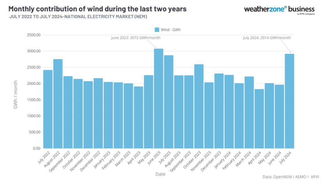
After a prolonged wind drought in Autumn, July 2024 was the windiest month in just under a year for the National Electricity Market (NEM).
The slack winds in autumn were caused by blocking high pressure systems sitting over southern Australia forcing cold fronts and associated wind away from Australia.
The map below shows that during autumn many parts of southern Australia saw below average wind (blue) in response to the high pressure pattern.
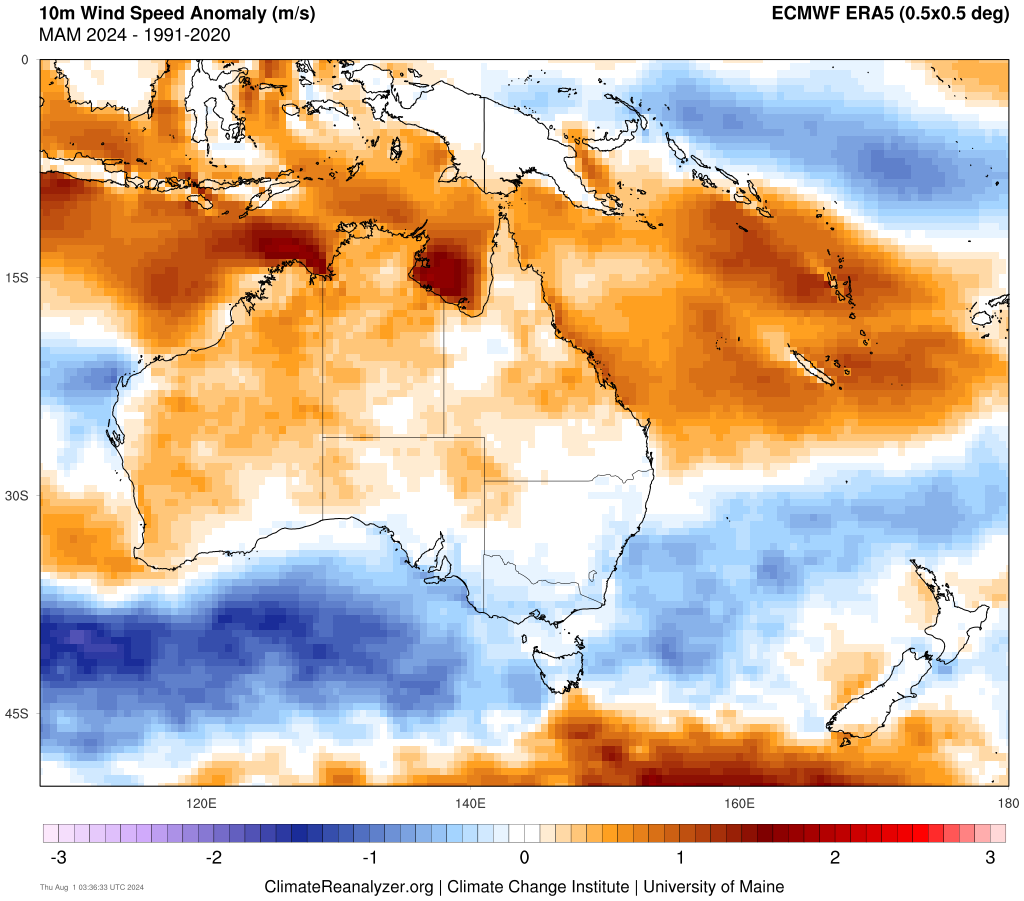
Image: 10m wind speed anomaly (m/s) for Autumn 2024 vs climate of 1991 to 2020. Source: Climatereanalyzer
During July, this stagnant weather pattern was well and truly interrupted as a long-wave trough influenced the region, sending frequent cold fronts and gusty winds over southeastern Australia
The map below shows that during July 2024, wind contributed 2914 GWh/month, the windiest month since June 2023.
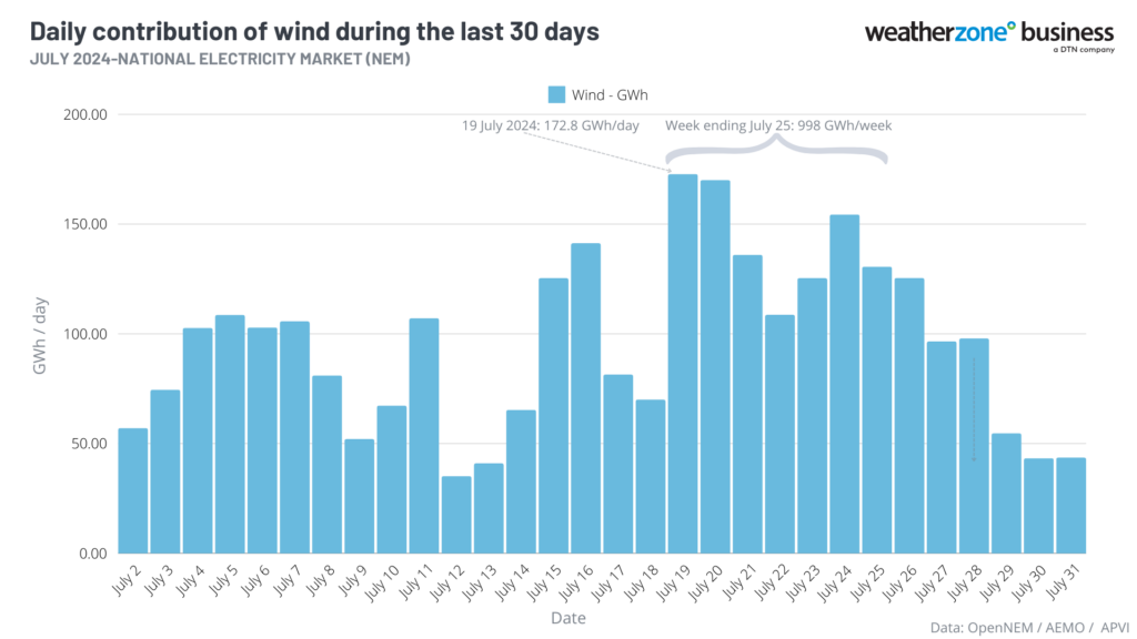
During July 2024, the NEM also saw its windiest week since wind power originated, with wind producing 998 GWh in the week ending, July 25.
The map shows that the windiest day of this week was Friday, July 19, when a strong cold front swept across the NEM.
While a cold front is crossing southeastern Australia in the next 48 hours, it is not particularly strong and most likely won’t bring high wind power to the NEM.
The Wind Farm Output forecast for the NEM shows that wind power should be strong for several days from Thursday, August 8.
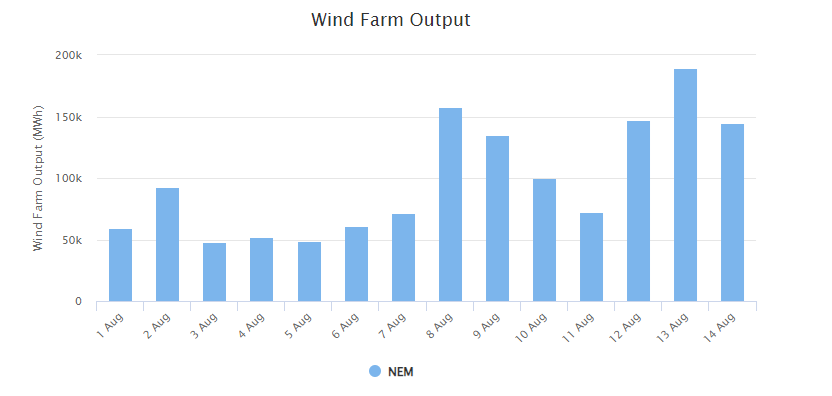
Image: Weatherzone’s 14-day wind farm output forecast for the NEM.
The uptick in wind power forecast during mid-August is in response to the negative southern annular mode strengthening in the Southern Hemisphere.
The SAM has recently dipped into a negative phase in response to stratospheric warming above Antarctica. Forecast models suggest that further stratospheric warming will take place in the opening fortnight of August, causing the current negative SAM to get even stronger.
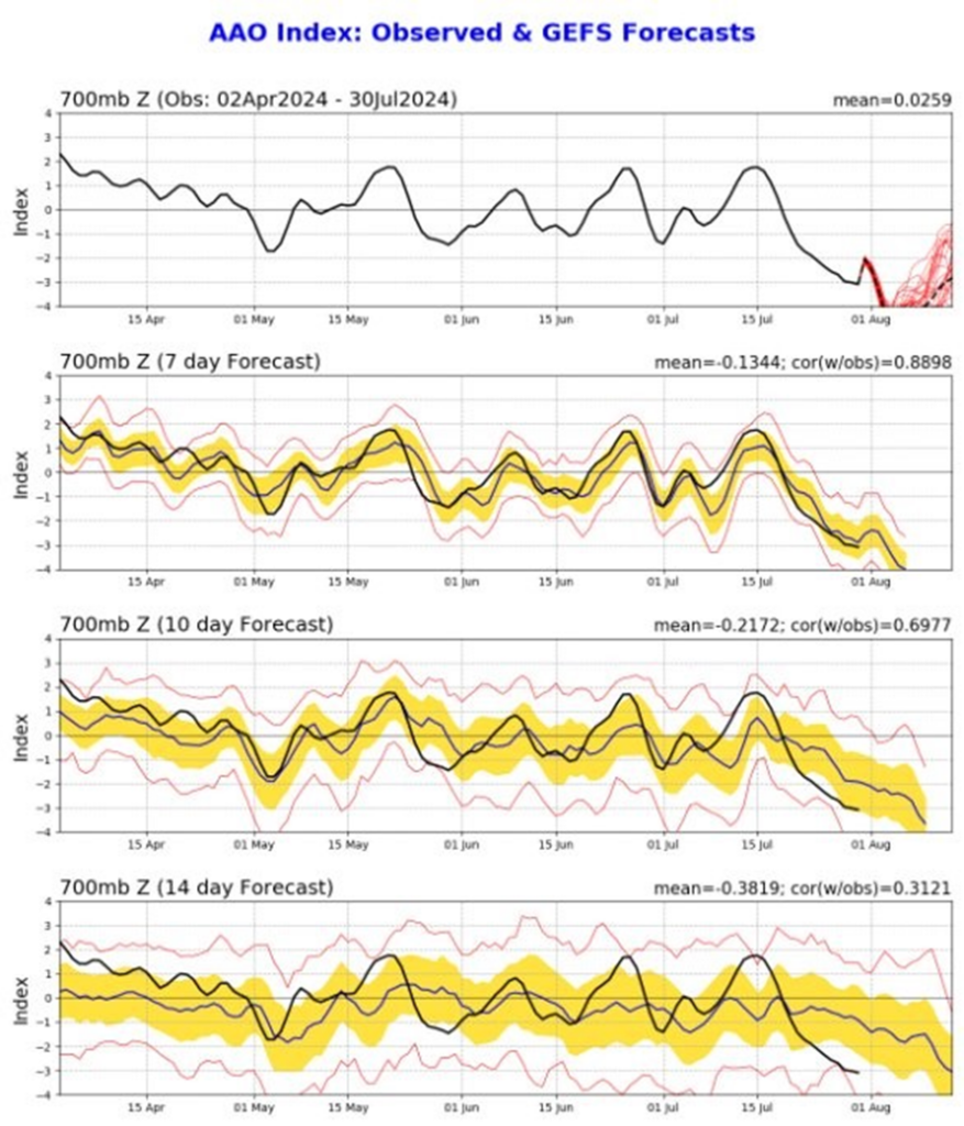
Image: SAM (also called the Antarctic Oscillation or AAO) index observations and forecast, showing a strong negative SAM phase underway that is expected to persist into August.
Some models are suggesting that this negative SAM could linger into spring, increasing wind across the NEM.
However, it’s too early to know if, and how, this stratospheric warming event will continue to influence weather patterns in the Southern Hemisphere into late spring and summer.
We will be keeping a close eye on the stratospheric warming and negative SAM event in the coming months, regularly updating our clients with seasonal briefings and forecasts. To find out more, please visit our contact page or email us at apac.sales@dtn.com.


