Heavy and intense rainfall is forecast across southeast Qld in the next 72 hours, bringing hundreds of millimetres to the region.
The satellite image below shows thick cloud over Qld and northeast NSW on Monday afternoon.
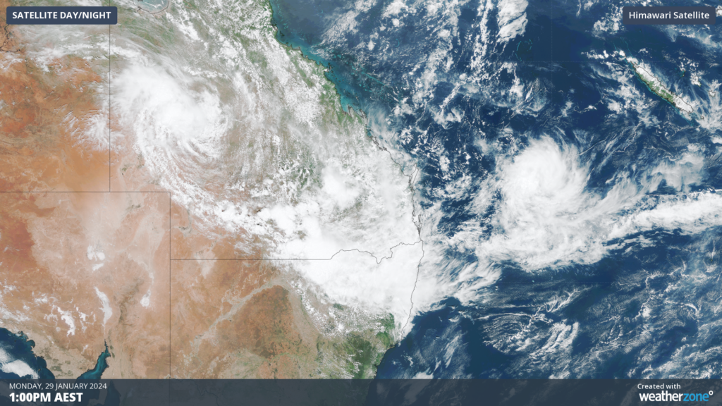
Image: Himawarri-9 satellite image at 1pm AEST on Monday, January 29.
A coastal trough is expected to develop in the next 24 hours bringing further heavy rainfall and thunderstorms which could lead to flooding in the states southeast.
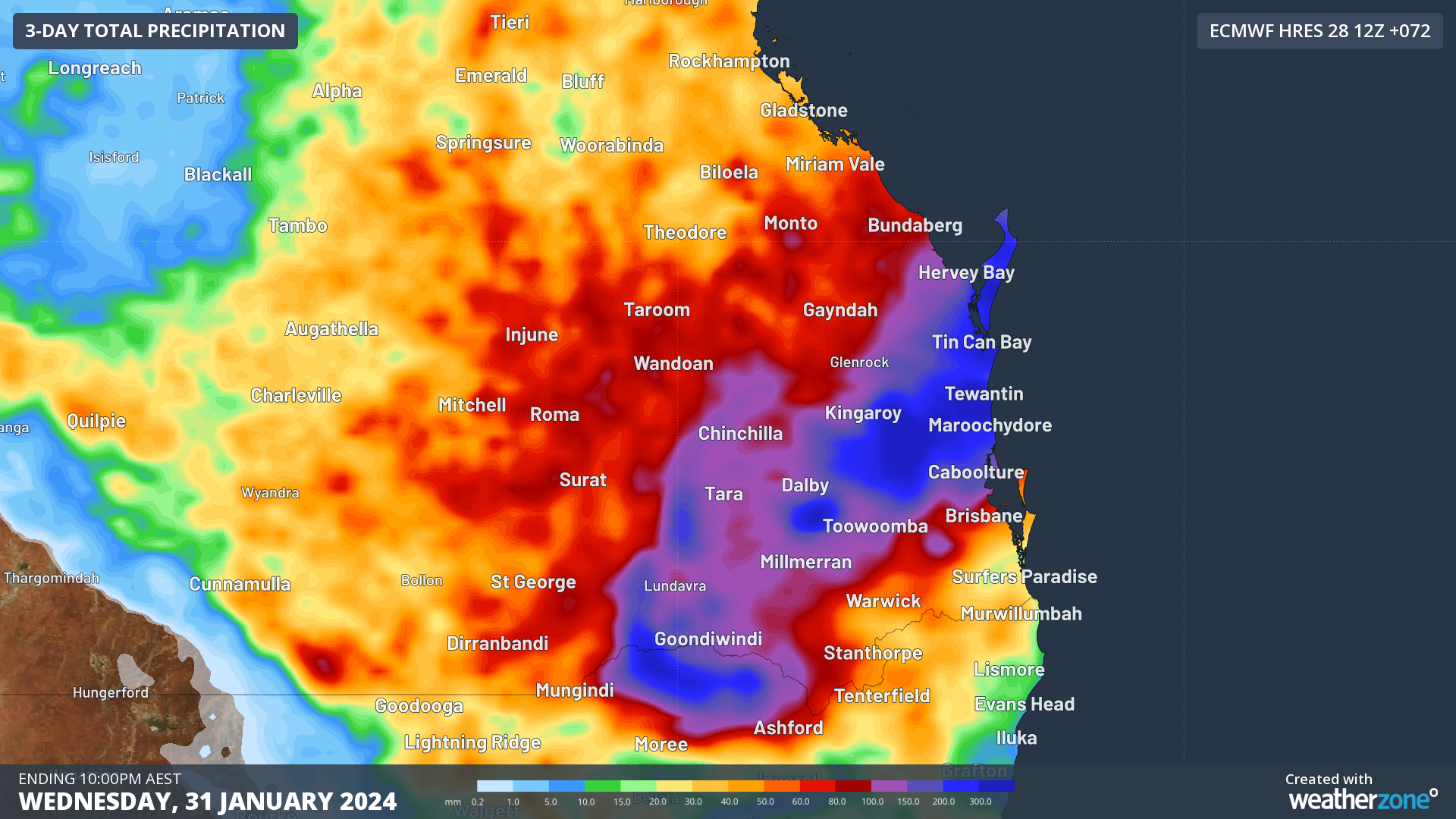
The maps below shows the rainfall forecast in the next three days in the region by two different computer models.

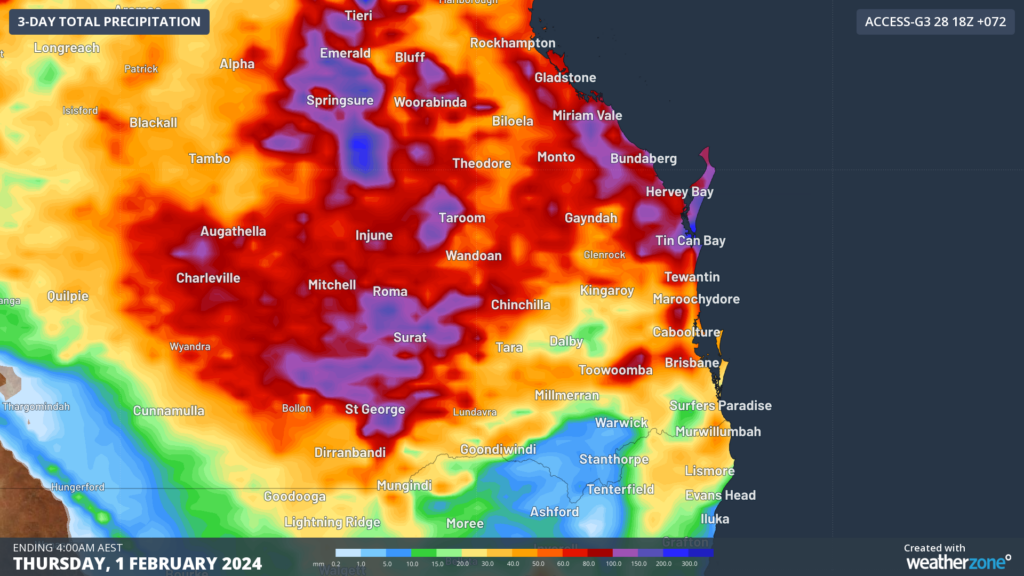
Images: 3-day accumulated rainfall leading up to late Wednesday or early Thursday morning, according to the ECMWF model (top) and ACCESS-G model (bottom).
Widespread falls of 100-150mm are forecast by both models between the Gold Coast and Gladstone area in the next 72 hours, with isolated pockets around 150-300mm. Some locations could exceed 300mm in thunderstorms.
The most intense rainfall is expected between Tuesday evening and Wednesday morning, as a low-pressure system develops within the trough.
🧵The latest Brisbane Airport weather balloon shows just how saturated the atmosphere is around SEQ. The precipitable water value (a measure of how much water is in the air) is 70.8mm this morning, just below the record of 70.9mm in March 2017. pic.twitter.com/gFdNviUHLk
— Bureau of Meteorology, Queensland (@BOM_Qld) January 29, 2024
This low should move away from the Qld coast later this week, with rainfall expected to ease from Thursday. Despite this low moving into the warm Coral Sea, it has a low chance of developing into a tropical cyclone at this stage.
We will be watching this system closely as it evolves in the coming days, please keep an eye out for warnings and forecasts. For more information, please contact us at apac.sales@dtn.com.


