
Snow has fallen across the high country of Tasmania, Victoria, New South Wales and the ACT, with the hydropower season officially beginning.
Snowfalls totals were in the light to moderate range depending on the location in the mountains. Perisher ski resort in NSW is calling 25 cm on the ground, with most other resorts reporting about half that.
As this was a relatively marginal system temperature-wise when most of the moisture was around during Tuesday and Tuesday night, the lower resorts didn’t receive much snow at all, with the ground still largely grassy on Wednesday morning at mainland Australia’s two lowest ski hills, Selwyn in NSW and Mt Baw Baw in Vic.
But overall, snow lovers will be glad to see the ground looking like this:
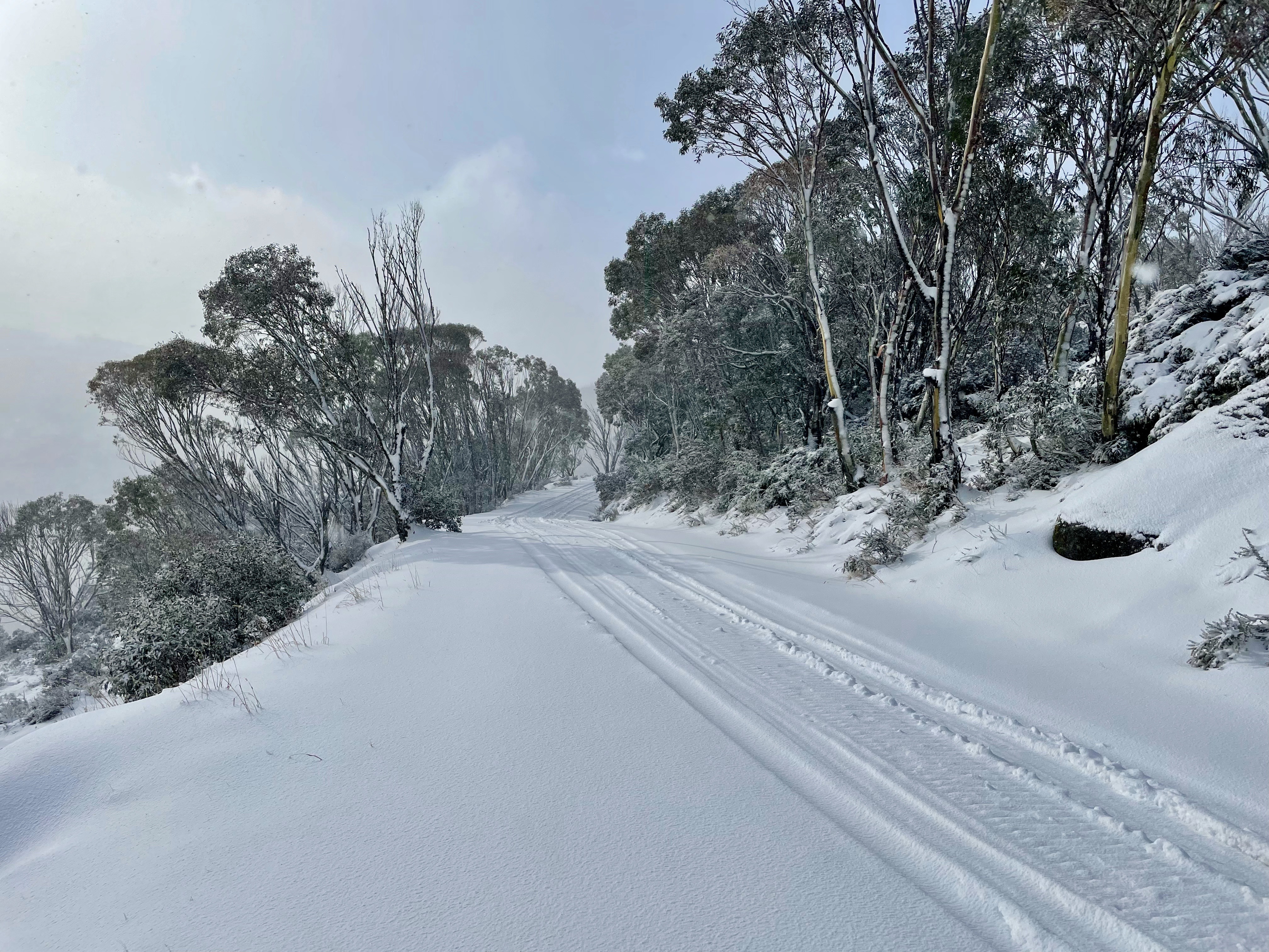
Image: Not the worst spot for a morning stroll. Source: Robbo at ski.com.au.
And this:
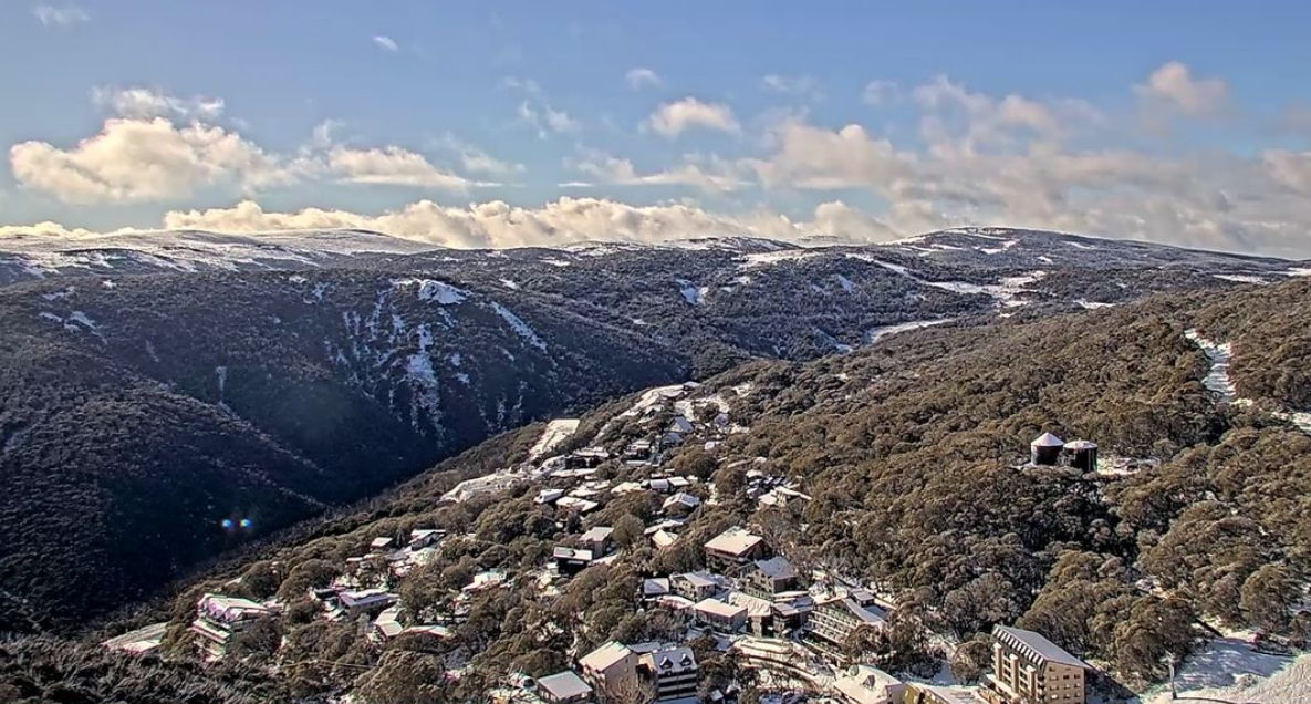
Image: Falls Creek looking nice this morning after the Vic ski resort reported 17 cm. Source: FallsCreek.com.au
And this:
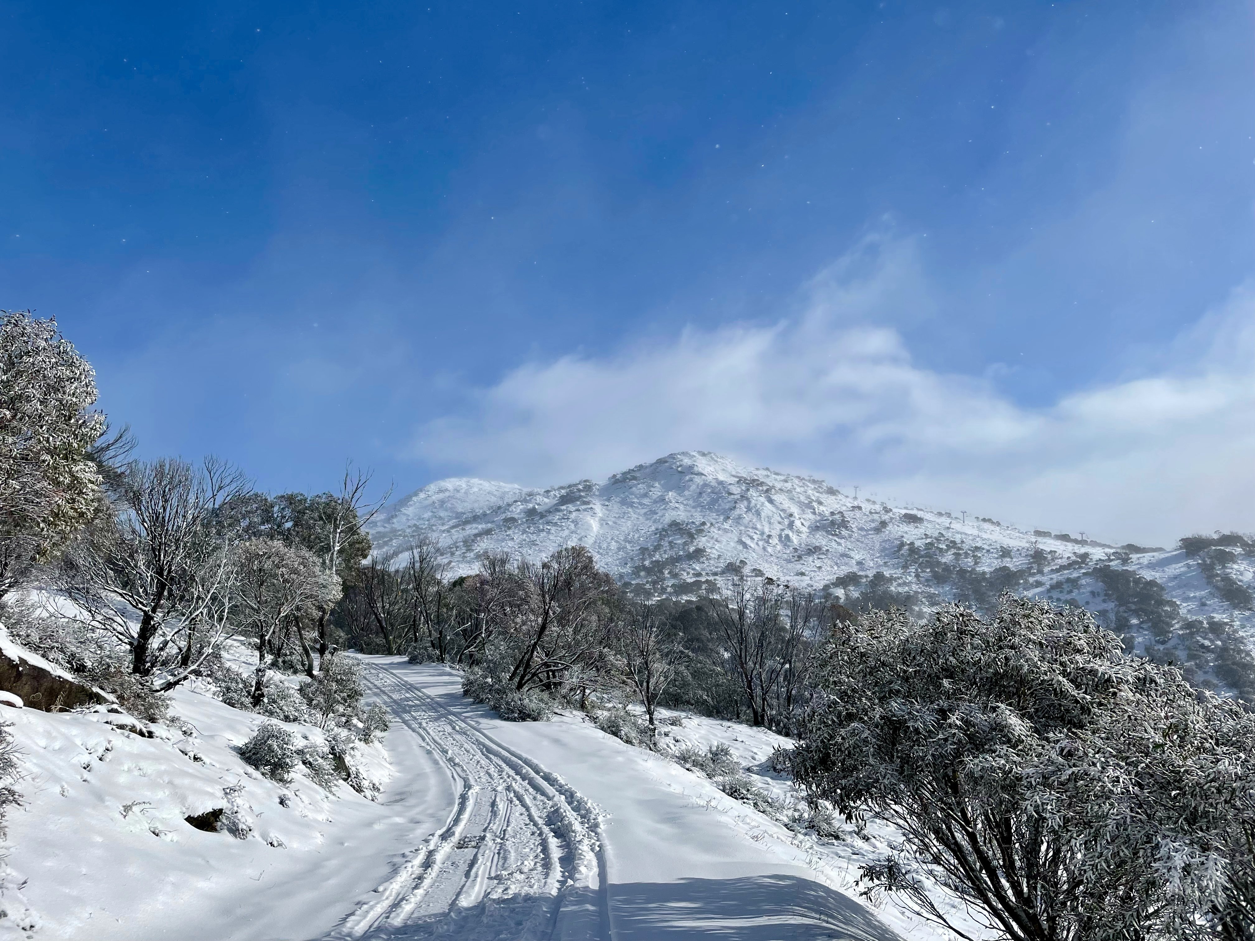
Image: A beautiful view of Mt Blue Cow at Perisher resort. Source: Robbo at ski.com.au.
The air behind the front is by far the coldest airmass to make its way to mainland Australia this winter, and snow was even recorded falling at Cooma in NSW.
While the gateway town of 7,000 residents is synonymous with the Snowy Mountains, it stands at an elevation of just 800 metres and snow there generally only occurs once or twice each winter.
Take a look at the three-hour loop from 7 am to 10 am Wednesday. The speckled airmass with polar origins is a tell-tale sign of cold air.
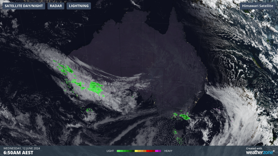
As Weatherzone meteorologist Ben Domensino explained in a story a couple of years ago:
“These clouds form when very cold air moves over a relatively warm area of ocean, causing a large number of individual cumulus clouds to develop over a broad area. Each of these cloud cells can produce rain, hail, snow and thunderstorms, with patches of clear sky in between.”
Strong wind gusts are inevitably a feature of winter cold fronts too, and there were some wild old winds in the wee hours of Wednesday morning.
- Mainland Australia’s southernmost point, Wilsons Promontory, copped a gust of 139 km/h just after 4 am.
- A gust of 98 km/h at Mt Boyce in the NSW Central Tablelands just before 4 am.
- Winds fell just short of 100 km/h, but not by much, with a gust of 93 km/h at Thredbo Top Station, Australia’s highest weather station.
Speaking of Thredbo Top Station, it was –3.7°C up there at 10 am Wednesday with southwesterly winds of 30 km/h and a “feels like” temp of –12°C. The Kosciuszko Chairlift to top station isn’t open for skiing yet but it was open for scenic rides. Probably not the worst idea to wear a beanie!
Meanwhile a Severe Weather Warning for damaging winds is in place for the Illawarra, South Coast, Central Tablelands, Southern Tablelands and Snowy Mountains NSW forecast districts, with winds expected to ease in the afternoon.
Hydropower
Using Opticast’s nowcasting and forecasting capabilities, you will have long-term outlook covering rainfall and extreme heat events out to 12 months. This can significantly improve your planning as you integrate the data with site-specific hydrological parameters.
With renewables making up more of Australia’s energy mix every year, we want to support your business to make informed critical decisions and improve your overall generation and safety. For more information please contact us at apac.sales@dtn.com.


