
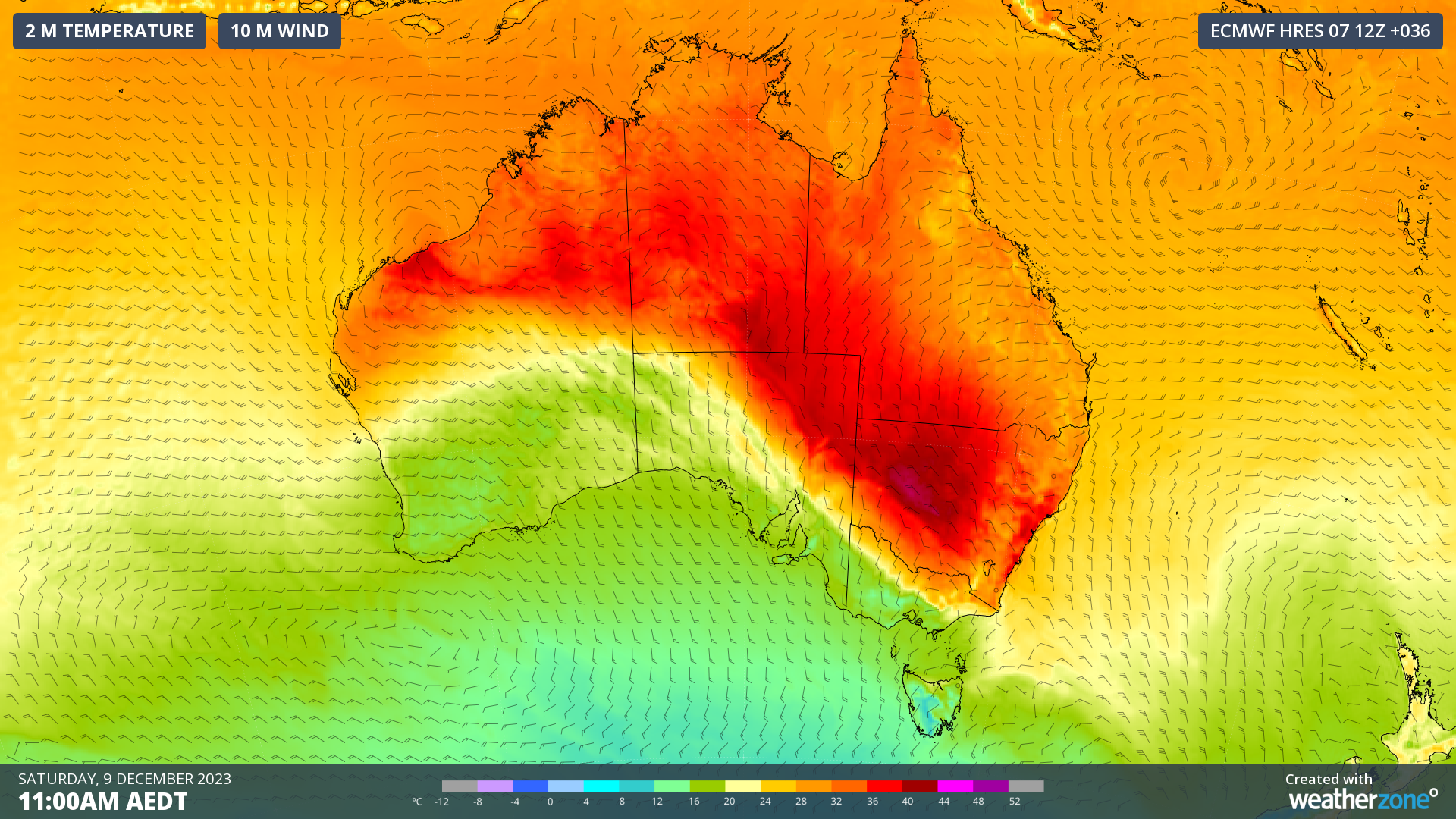
A strong cold front will sweep across southeastern Australia in the next 48 hours, bringing a dangerous mix of damaging winds, severe thunderstorms and catastrophic fire danger ahead of a welcome cool change.
The satellite image below shows a trough extending from WA down to SA, generating a massive line of thunderstorms stretching 700km across SA. The image also shows a cold front in the Bight, with some cold air that is producing a large field of speckled cloud over the Southern Ocean.
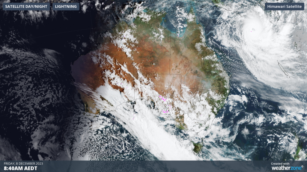
Image: Himawari-8 satellite image at 9am AEDT on Friday, December 8
The cold front will move further north and east on Friday and the weekend, with the colder air pushing against much hotter air in SA and VIC.
The image below shows the forecast air temperatures around 1.5km above sea level on Saturday afternoon, showing the stark temperature contrast between the air to the north and south of the cold front.
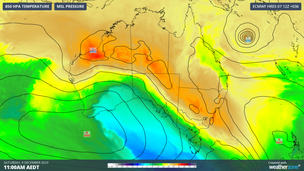
Image: Forecast 850 hPa temperature at 11am AEDT on Saturday, December 7, according to the ECMWF model
On Saturday, Melbourne will be cool, while in Sydney the city will swelter through extreme heat. The forecast maximum temperature difference between the cities is 24 °C, with western Sydney expecting a top of 44 °C and Melbourne 20 °C.
The approaching cool airmass and its interaction with much hotter air sitting over the Australian continent will produce a dynamic mix of weather:
- Thunderstorms are likely to affect parts of SA, NSW, ACT, Vic, TAS on Friday and NSW and the ACT on Saturday.
- Some storms will become severe with damaging or destructive winds the most likely threat, particularly about SA, Vic and southwestern NSW on Friday.
- Blustery northwesterly winds ahead of the front, with damaging gusts possible in parts of SA, elevated areas of Vic, NSW and the ACT in the next 48 hours. The southerly winds will also be strong and gusty.
- Very hot and windy conditions ahead of the front will bring extreme-to-catastrophic fire danger to SA on Friday 8th, the worst fire danger since the 2019/20 black summer.
- Extreme fire danger is forecast in parts of NSW and VIC on Friday and Saturday, while high fire danger is forecast for parts of Qld.
Severe weather warnings have been issued in several states and territories, which you can read here.
In addition to the cold front, a low-pressure system will develop near SA on Sunday bringing heavy rainfall from the northwest to the southeast of the state.
The map below shows that 3 day accumulated rainfall to Monday afternoon in SA, with widespread totals of 40-80mm and isolated parts of the Eyre Peninsula and West Coast could see falls exceeding 100 mm with the system. This rainfall could lead to flooding, particularly in areas that are typically much drier.
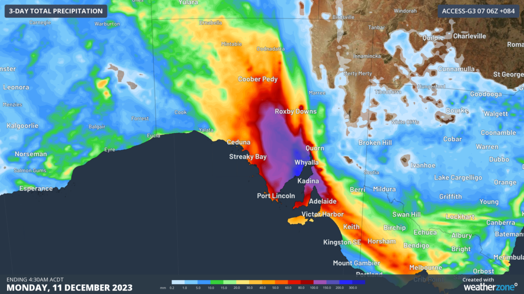
Image: Accumulated rainfall for 3 days leading up to 4:10am ACDT on Monday, December 11, according to the ACCESS-G model.
At this stage, the rainfall should ease from Monday as the low-pressure system moves over the Bight. However, showers will continue to stream into SA along the western flank of the low early next week before the system finally progresses east.
We will be watching this system closely as it evolves, so please keep up to date with any warnings issued for this heavy rainfall and storm event.
DTN APAC provides a suite of services tailored towards the insurance industry. From severe weather ‘heads-up’ from our meteorologist team, to detailed warnings and extreme observation alerts, to post-event reporting, we can cover any major weather event. To find out more, please explore our website or email us at apac.sales@dtn.com.




