
Sydney and other areas in eastern NSW are in the middle of a severe heatwave that’s making the end of spring feel more like the middle of summer. This early-season heat was so intense on Wednesday morning that the Sydney Basin briefly became the hottest place in the world. So, why is it feeling so hot this week?
As clocks ticked over to 10am in Sydney on Wednesday, temperatures were already well well above 30°C in a number of the city’s suburbs. The highest running temperatures at the time were:
- 34.7°C in Richmond
- 34.5°C at Sydney Airport
- 34.2°C at Penrith
By 11am, Penrith’s temperature had risen to a sweltering 36.5°C. This made Penrith not only the hottest place in NSW or Australia, but the hottest place in the world at that time.
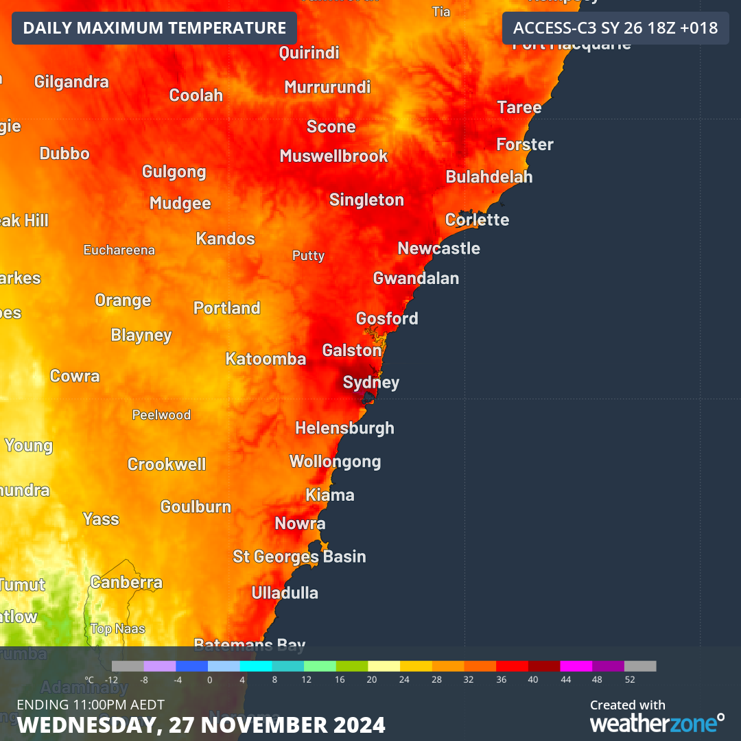
Image: Modelled maximum temperatures over eastern NSW on Wednesday.
There are a few reasons why western Sydney became the hottest place in the world on Wednesday morning:
- A low pressure trough sitting over Australia’s eastern inland is feeding a warm air mass towards eastern NSW.
- The urban heat island effect combined with the foehn effect allowed the Sydney Basin to become warmer than surrounding areas of central eastern NSW.
- At 10am AEDT, Sydney has already been under the warming influence of the sun for hours, while other heat-prone areas of Australia, like WA and the NT, hadn’t had as much solar heating yet (the sun rises about 2-3 hours later in WA than NSW).
- While it is near the start of summer in the Southern Hemisphere, the Northern Hemisphere is approaching winter and is therefore much cooler at this time of year.
- Other heat-prone areas in the Southern Hemisphere, such as Africa and South America, were at a cooler point in the day/night compared to Australia at 11am Sydney time.
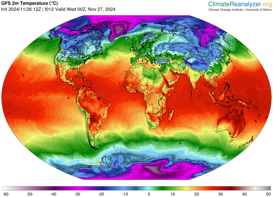
Image: Modelled surface air temperature at 11am AEDT on Wednesday, November 27, showing Australia’s standing out as a global hot spot. Source: ClimateReanalyzer.org
Parts of Sydney are likely to reach close to 40°C on Wednesday and high volumes of atmospheric moisture will add to the muggy feeling of the day in parts of the Sydney Basin.
This will be followed by a warm night and another hot day in the Sydney region on Thursday, although increased cloud, rain and thunderstorms will help limit the heating compared to Wednesday. For detailed forecasts on the heat and humidity please visit our website or email us at sales.apac@dtn.com.


