
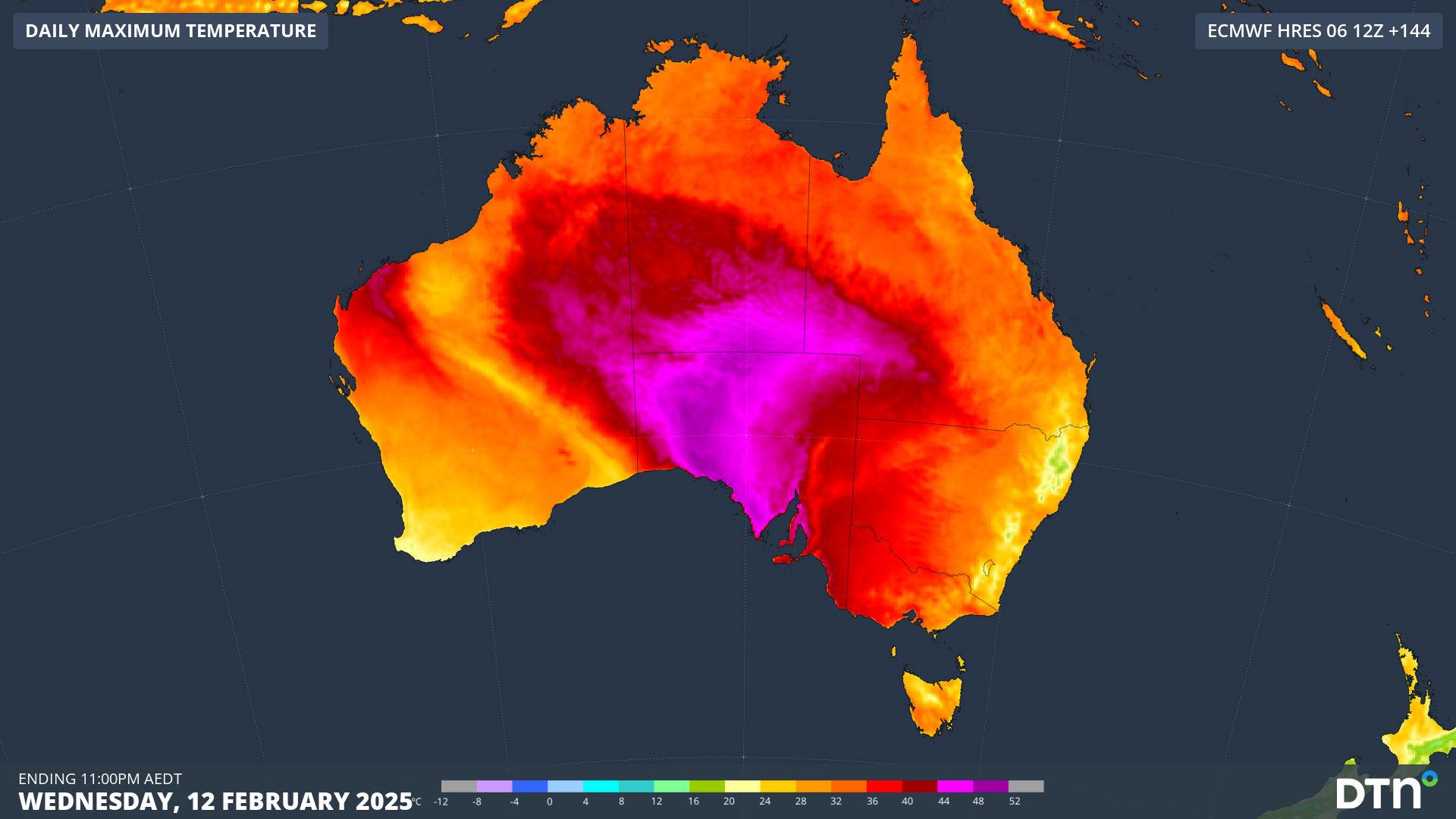
Another burst of intense heat will impact the southern National Electricity Market next week, with unusual humidity and uncomfortably warm nights increasing energy.
This heatwave will likely stretch between Monday and Thursday next week, with the most blistering heat expected across parts of SA and central Australia.
The prolonged period of oppressive heat will be generated by a blocking high pressure system over the Tasman Sea, which will direct a hot airmass over the country’s southern states for several days. In the image below you can see hot northwesterly winds ahead of a cool southwesterly change, which will be approaching SA on Wednesday evening.
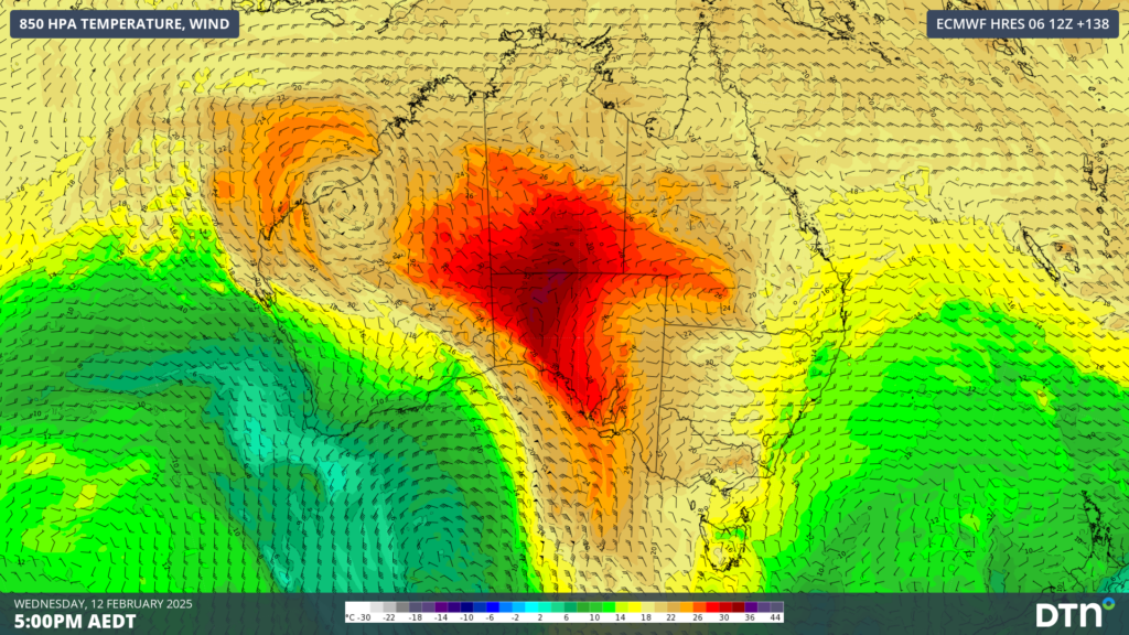
Image: 850hPa wind and temperature forecast for 5pm AEDT on Wednesday, February 12, according to the ECMWF model.
The lingering hot airmass will cause the mercury to soar into the high 30s to mid 40s for several days in SA, while Vic and Tas will see the heat peaking around the mid to high 30s.
The heat will likely peak in SA on Wednesday ahead of the southerly change, with temperatures soaring into the high 40s.
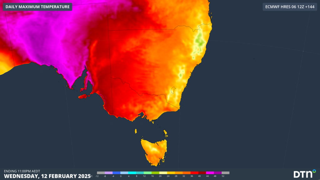
Image: Maximum temperature forecast for Wednesday, February 12, according to ECMWF
Australia’s southeastern state capital cities will also feel the punch next week;
- Adelaide could see its warmest run of days and nights this summer. The city is forecast to see a run of four to five days above 30°C beginning Sunday, with the heat peaking on Tuesday and Wednesday in the low 40s.
- Melbourne should see a run of three days in the low to mid 30s from Tuesday, peaking at 35°C on Wednesday.
- Hobart’s maximum on Thursday could reach 34°C, which would be the second time the city has been this hot this month.
Unusually humid conditions will accompany this heat, with Adelaide and Melbourne’s expected to feel 1 to 2°C warmer than the actual temperature, especially when seabreezes arrive.
Warm nights will also chaperone this oppressive run of days, particularly in Adelaide, where overnight temperatures should reach around 10°C above the February average. The temperature in Adelaide shouldn’t drop below 23°C for three consecutive nights from Monday, likely staying warmer than 27°C on Tuesday night.
Fortunately, there is relief in sight, with the cooling southerly change expected Wednesday night or Thursday morning in Adelaide, Thursday afternoon or evening in Melbourne and early Friday morning for Hobart. The timing of the change remains uncertain, which could impact the maximum temperature forecast across these states on Wednesday and Thursday, so be sure to keep an eye on the latest forecasts.
DTN APAC supplies precise weather intelligence to over 75% of the National Energy Market (NEM); and is the trusted provider for the Australian Energy Market Operator (AEMO).
Weatherzone’s next-generation nowcasting and forecasting system, OpticastTM, is independently proven to outperform other industry models, allowing energy traders to respond rapidly to changing conditions. From 14 day forecasting to seasonal outlooks, you have access to complete and powerful weather intelligence giving you the confidence to make the best call.
Meeting the needs of the changing market, Weatherzone utilises high-resolution modelling and local knowledge to provide 5-min granularity observations and forecasts, optimising your market bidding and maximising your profits. These, coupled with briefings from our energy meteorologists, give you full awareness of the associated risk.
Benefit from specialised indices such as apparent temperature, Cooling/Heating Degree Days (CDD/HDD) and Effective Degree Days (EDD) to help accurately predict demand. You can get a clear picture of forecast conditions across the market and quickly assess heat/heatwave potential from 14 days out to 12 months
No matter where your energy trading focus lies, we have the power generation and weather insights to inform your critical decisions, keeping you ahead of the curve. For more information please visit our website or email us at sales.apac@dtn.com.




