Thursday evening will see heavy rain fall over Adelaide, potentially leading to fallen trees and power outages.
As we mentioned yesterday, a northwest cloudband and cold front are crossing WA on Tuesday. Quite a bit the pre-frontal cloud can be seen streaming over SA this afternoon.
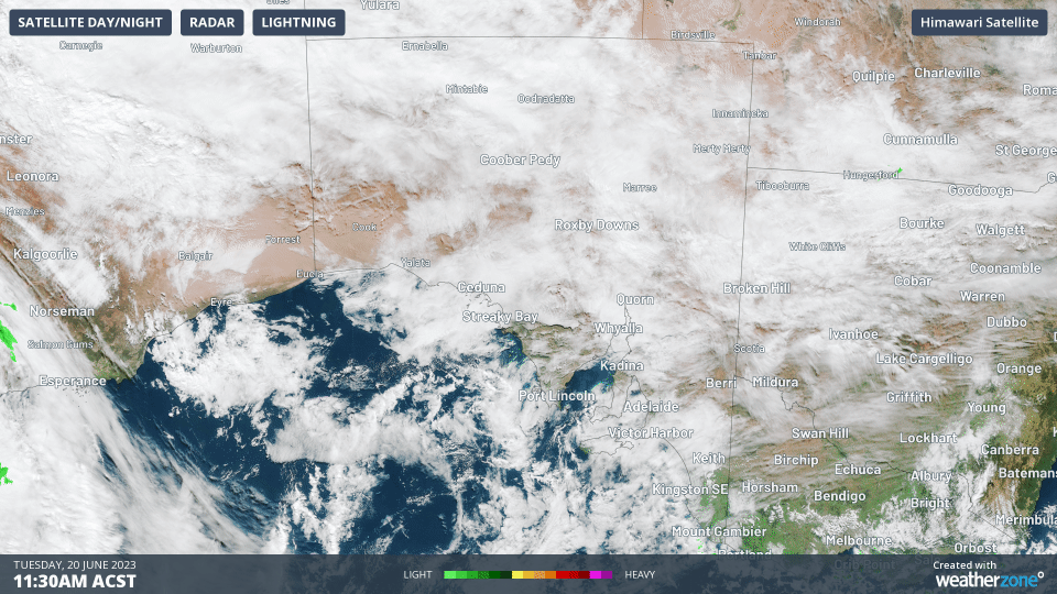
As this system tracks east, it will form a low pressure system over the eastern Bight, slowing down the system so that the cold air can catch up with the moisture. From Thursday morning, this combination will bring moderate to heavy falls over large parts of SA.
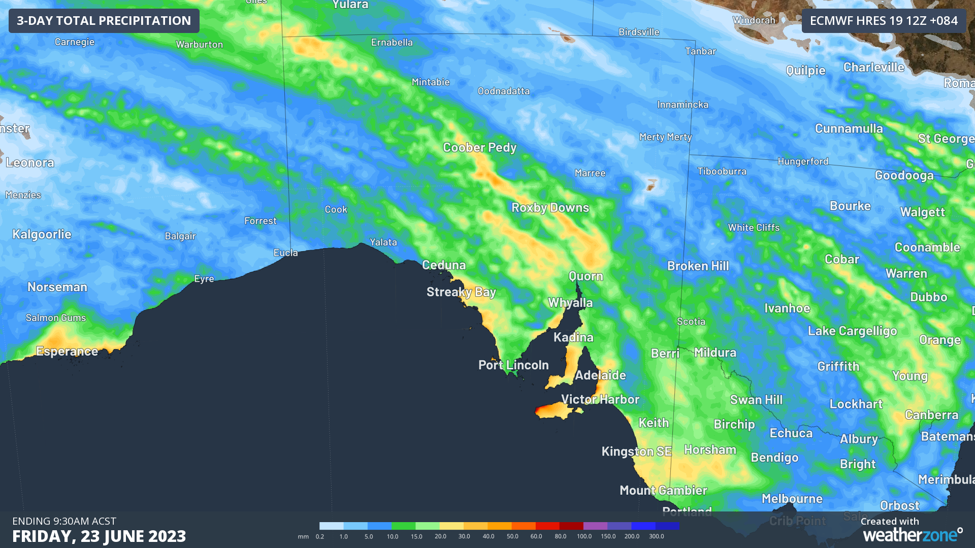
Image: Rainfall expected over SA on Thursday and Friday morning. Green and yellows indicate moderate rainfall of 15-30mm.
Rainfall will be quite a bit heavier around Adelaide, the Mount Lofty Ranges and Kangaroo Island due to orographic uplift. Orographic uplift occurs when an airmass meets a mountain range that it cannot go around. It is forced to lift to go over the top, but this cools the air in the process, forcing extra moisture to rain out.
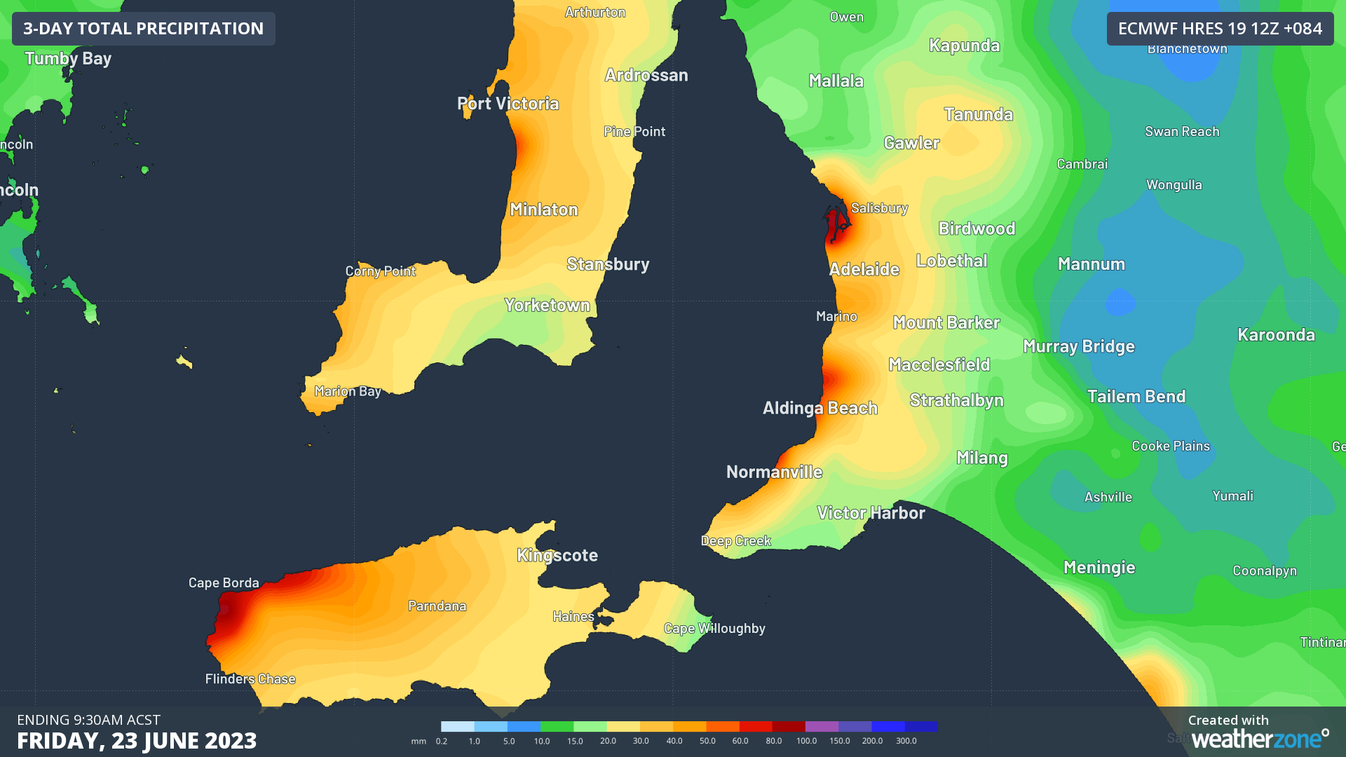
Image: Forecast rainfall for Adelaide and surrounds on Thursday and Friday. Oranges and reds indicate heavy rainfall.
Adelaide is forecast to see 20-40mm of rain fall in the 24 hours between 9am Thursday and 9am Friday. Some suburbs could see 50-70mm falling in this time, matching what is also possible along the Gulf St Vincent Coast and the northern edge of Kangaroo Island.
Along with the rain, winds are expected to be gusty, getting up to around 75km/h for this area, and up to 85km/h for West Coast near the low. While these winds by themselves tend to cause only minor damage, the combination with the rain can act to destabilise the roots of large trees, making them more likely to fall. These falling trees can easily cause damage to homes, cars and bring down powerlines.
This type of damage was seen last year on the 5th June, when Adelaide received 43mm of rain along with 69km/h winds gusts. This combination led to a slew of power outages that took several days to repair.
What a weekend of wild weather! Our crews attended more than 450 jobs, where 17,000 customers were impacted. Trees can come off second best to the weather and bring down poles and wires. If you see any fallen powerlines, stay 10m away and call 13 13 66. 👉https://t.co/dvCko4YlYJ pic.twitter.com/zlNzlocT3J
— SA Power Networks (@SAPowerNetworks) June 6, 2022
Looking ahead, another cold front and low in the Bight is expected to impact the region again this coming weekend. Some models suggest that the Greater Adelaide region could be in for another widespread 20-40mm with isolated 60+mm of rain and winds gusts exceeding 60km/h. Stay up to date with the latest forecasts for SA, Adelaide and the latest warnings issued at Weatherzone.com.au.
DTN APAC mixes our expert knowledge, data inflows and artificial intelligence to convert our weather forecasts into a forecast of power outages through our Storm Impact Analytics (SIA). This system compares historical outages with a custom high-resolution forecast to determine where, when and how many power outages are expected during an event. To find out more, please email us at apac.sales@dtn.com.


