
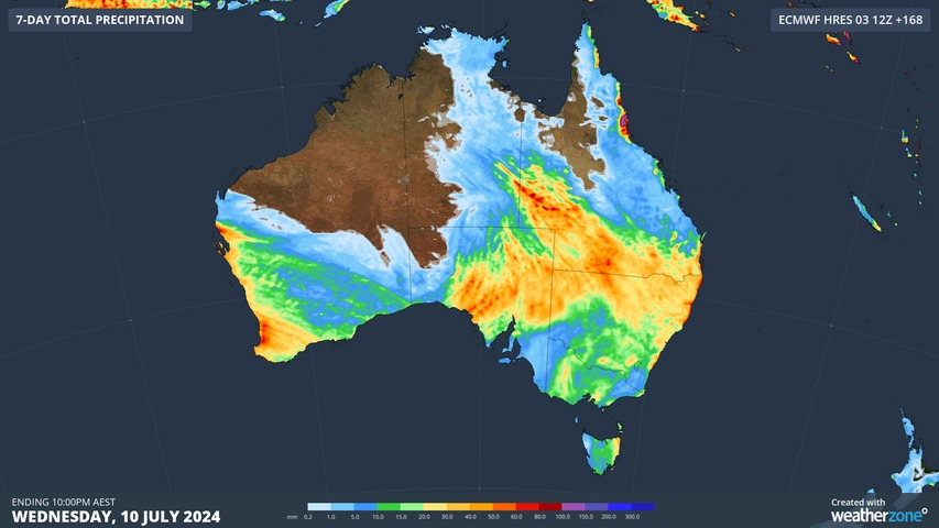
An entire season’s worth of rain could soak parts of the Australian outback during the next few days as a cut-off low causes heavy rain over several states and territories.
An unusually strong high pressure system centred to the south of Australia will cause moisture-laden air to flow over Australia from the east in the next few days.
This airborne moisture, which is coming off unusually warm seas to the east of Australia, will clash with a cut-off upper-level low pressure system as it passes over the continent. The interaction of the upper low and the atmospheric moisture will cause unseasonably heavy rain over a broad area of central and eastern Australia.
Cloud can already be seen building over parts of SA and Qld as moisture begins to increase over the continent. This cloud will cause rain to increase over parts of SA and central Australia on Friday and Saturday as the upper-low becomes more established. Rain is then expected to spread further east across NSW and Qld from Sunday into early next week.
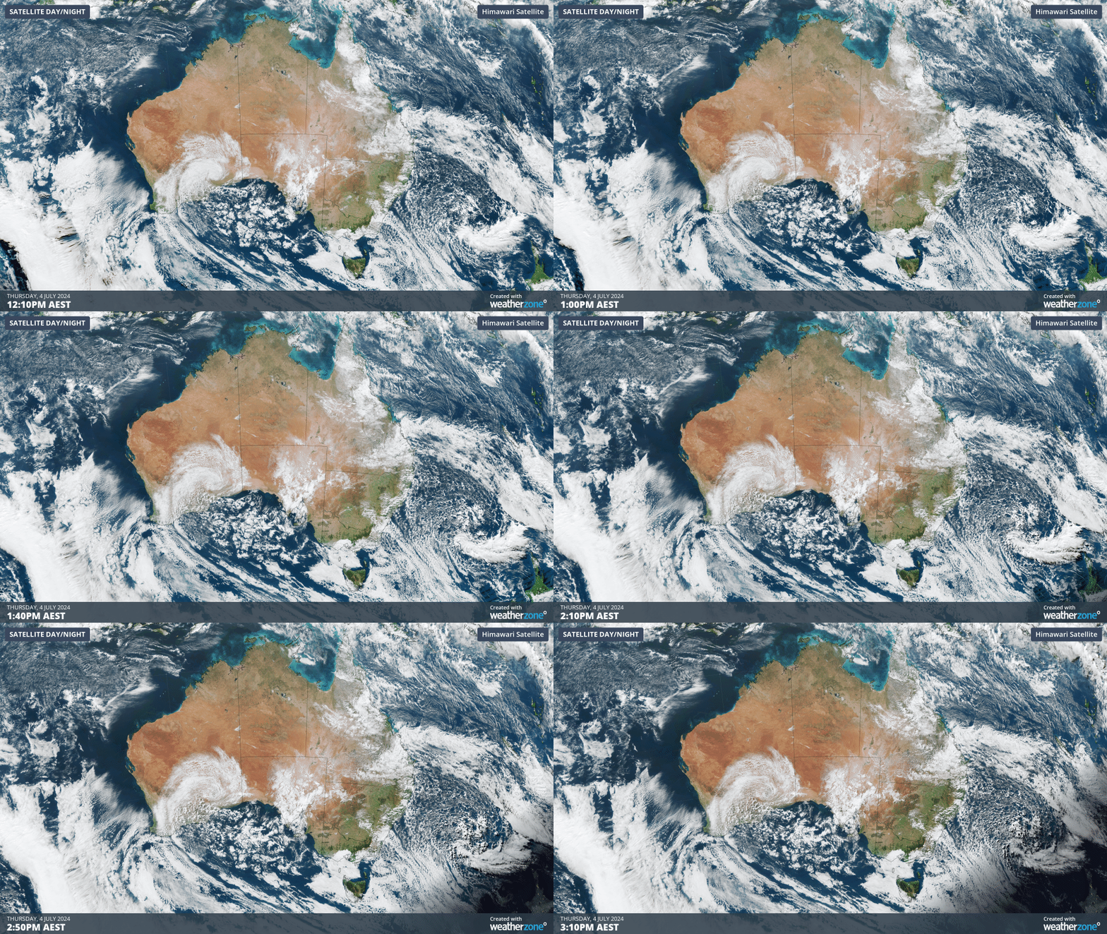
Video: Visible satellite imagery showing cloud building over SA and Qld on Thursday, July 4.
This cloud is expected to cause low solar output across several states and territories solar farms in the coming days.
Forecast models suggest that widespread falls of 20 to 40 mm are likely in SA, southern and western Qld and northern NSW from this system, with isolated falls above 60 mm. Most of this rain will fall between Friday and Tuesday.
The map below shows how much rain is expected to fall during the next seven days according to one computer model.
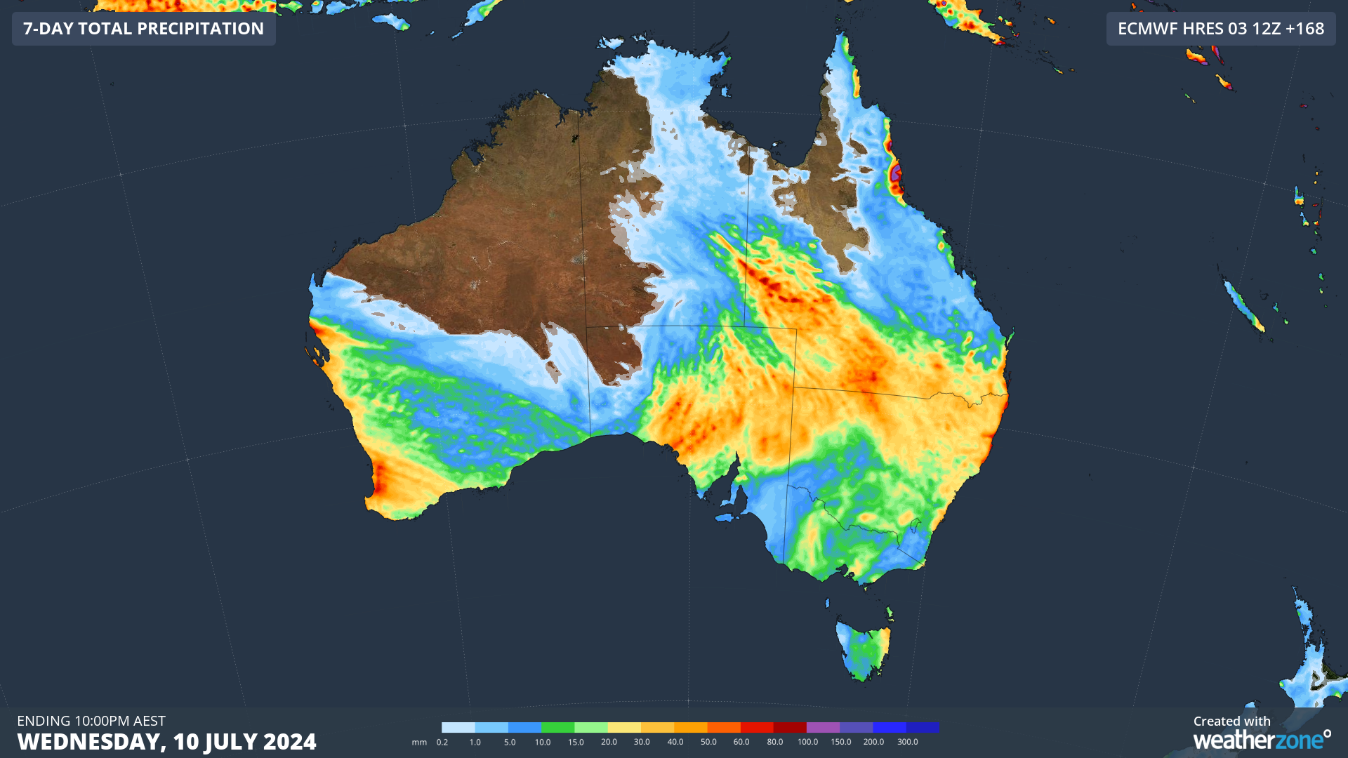
Images: Forecast accumulated rain over the next seven days according to the ECMWF-HRES model
Much of this rain will be falling in relatively flat areas of the Australian outback and its vast network of dirst roads, which increases the likelihood of flooding and road and rail closures. Be sure to stay up to date with the latest warnings and transport updates in the coming days.
Rail and transport networks are exposed to severe weather risk, every day. Our services significantly improve efficiency, safety, and planning. DTN APAC, a DTN company, specialises in building customised weather monitoring and alerting solutions. These guide transport operators to plan and respond effectively. We tailor our data and
analytics to your exact requirements. To find out more, please visit our contact page or email us at apac.sales@dtn.com.




