Summer is heating up, with heatwaves declared in five states, as well as the ACT, as a large high pressure directs a northerly airflow over the southern half of the country.
The heat will not be too extreme by many people’s standards. For example, no 40-degree day is forecast for any capital city. So why is this forthcoming hot spell classified as a heatwave?
To understand that, you need to get your head around the BoM’s definition. On its Heatwave Assessment and Forecast page, the BoM states:
“The Bureau of Meteorology defines a heatwave as three or more days in a row when both daytime and night-time temperatures are unusually high – in relation to the local long-term climate and the recent past.”
The BoM goes on to state that there is no single temperature threshold for a heatwave in Australia. So it’s not like: OK, we’ve hit 40°C. Ding! Heatwave declared! Instead, a heatwave is a relative thing.
By the BoM’s own criteria, the coming weather for parts of WA, SA, NSW, Vic, Tas and the ACT is going to be both significantly hotter than the long-term average, and also hotter than what we’ve seen over the last month – both by day and night. That makes it a heatwave.
There are three heatwave categories: extreme, severe, and low-intensity. Most of what’s coming is in the low-intensity range, with smaller severe heatwave areas, as the map below for NSW and Vic shows.
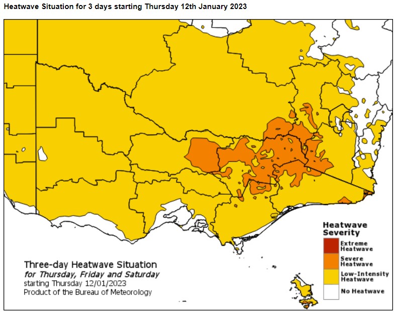
Image: Melbourne is just on the fringe of the heatwave, with bayside suburbs likely to miss the hottest weather. Source: BoM.
So how hot will it get?
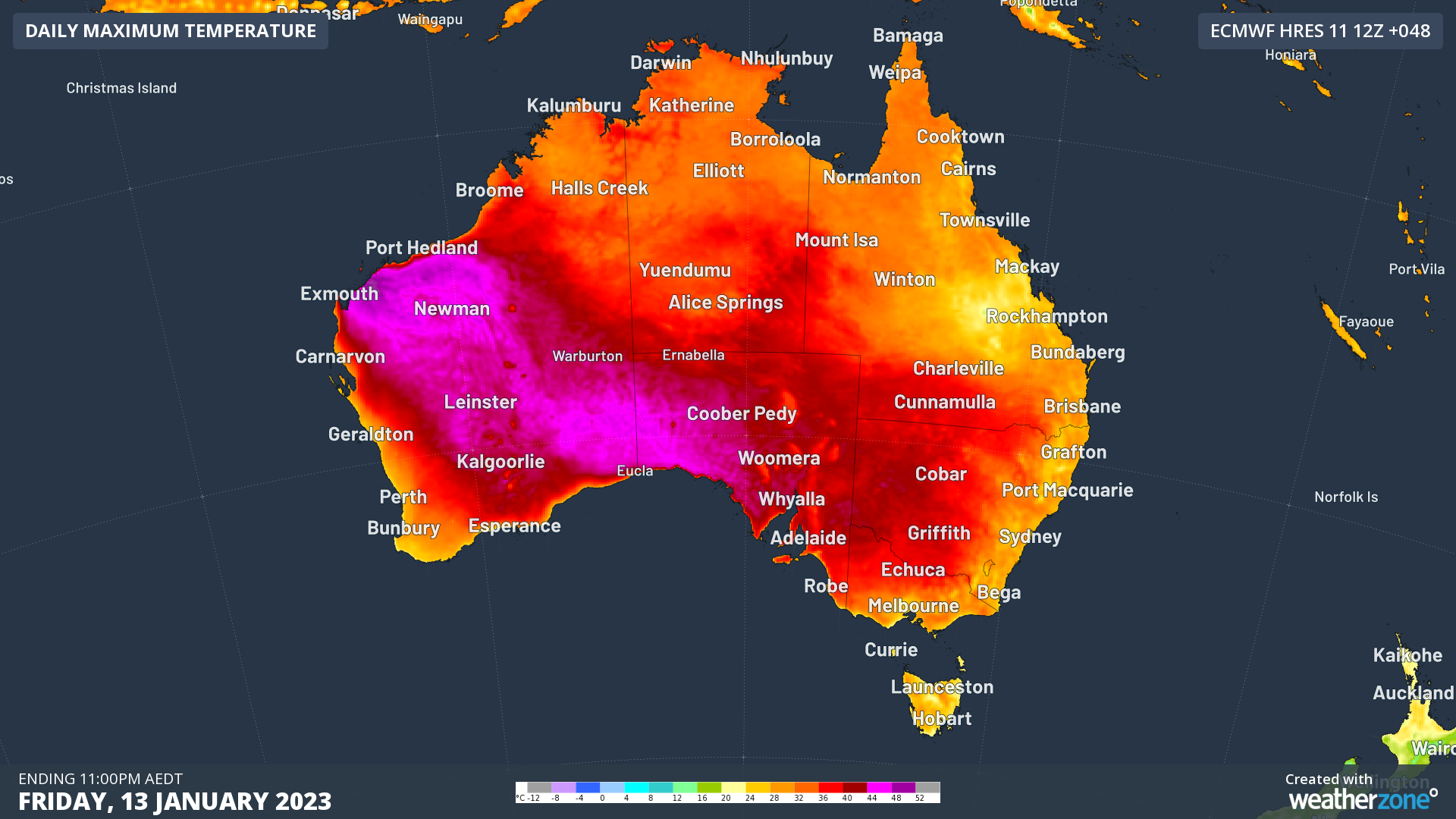
Temps of 40-plus can definitely be expected in coming days in eastern WA, northern SA, western NSW, and the northwest corner of Vic. But as mentioned, the capital cities will be spared the worst of the heat.
- Adelaide can expect 37°C and 38°C on Friday and Saturday respectively.
- Melbourne could also reach as high as 37°C on Saturday.
- Sydney will mostly dodge the heat along its coastal fringe but the outer western suburbs can expect to climb to 35°C by Sunday.
- Hobart should see its first 30-degree day of 2023, and its second this summer, with a top of 31°C on Saturday.
So as mentioned at the top of this story, these are not extreme temperatures by Australian standards, but it’ll be a lot hotter over a very wide area of the southeastern part of the country than it has been for much of the 2022/23 summer to date.
It’s also worth mentioning that temperatures will feel a lot hotter in some areas due to humidity that could also cause widespread thunderstorms this weekend.
Be sure to slip, slop, slap, and don’t forget to check our Warnings page.


