
The mercury is on the rise over Southeast Queensland and Northeast New South Wales as a cold front down south pushes hot air over the region.
This severe heatwave kicked off with a sweltering Tuesday night. Maryborough stayed above 25.4°C all night, making it is hottest night in six years, while Rockhampton’s low of 25.7°C was its hottest in five years. Brisbane fell to 25.3°C equalling last year’s hottest night.
These uncomfortable temperatures are being exasperated by high humidity. While it is normal for humid-heat to stick around Queensland in summer, dew-point temperatures are sitting higher than normal. Add on the extra heat caused by this heatwave and the ‘feels-like’ temperature becomes 3-6 degrees warmer than the actual temperature.
The Sunshine Coast and Noosa in particular are feeling the excessive humidity. At 1:30pm Tewantin was a modest 29°C, but with the relative humidity at 90%, it felt closer to 35°C.
Temperatures look to peak in the mid-thirties for most locations over the coming days, but Friday looks to be the hottest day overall after a ‘cold’ front sweeps over the region. Temperatures are forecast to reach 38°C at Grafton, 37°C at Ipswich and 35°C at Brisbane, although the mercury could climb a few degrees higher than that depending on the timing and strength of the westerly winds moving in.
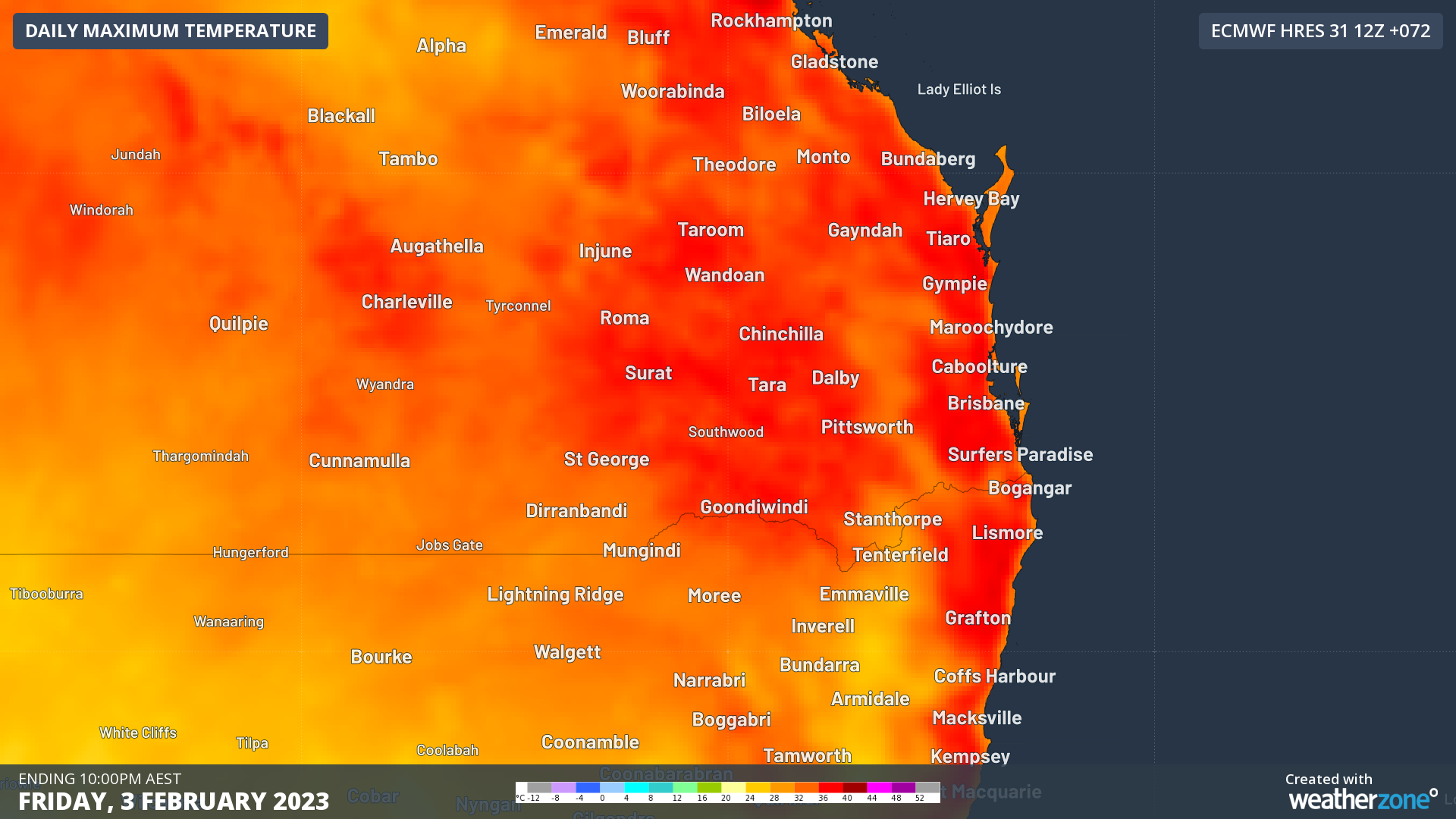 Image: Forecast maximum temperatures on Friday from ECMWF. The red stretching all the way to the coast shows how a seabreeze will not be strong enough to stop the hot temperatures for many places.
Why is it warmer after a cold front?
The secret is all in the wind direction. Before the front, winds will arrive from the north. That is a favourable direction for a cooling northeasterly seabreeze to form in the afternoons.
After the strong cold front, the winds will turn to a westerly direction. This direction directly combats the cooling seabreeeze, preventing or delaying it from forming.
Another reason why a westerly wind is warmer is due to the Foehn Effect (pronounced like ‘fern’). This effect occurs when a strong wind blows off a mountain range and descends the other side. When the air descends, it heats up rapidly at a rate of about 10°C for every 1000m it drops (known as the dry adiabatic lapse rate). For the east coast, the mountain range involved is the Great Dividing Range, allowing westerly winds to warm up the region quickly.
When will it end?
The heatwave is expected to last until Saturday when a southerly change starts to move up the NSW and southern Qld coast. However, it will still take a day to kick in and remove the high heat and humidity, so Sunday is expected to be the first day back near average.
DTN APAC provides temperature forecasts all around Australia up to 14 days in advance through its Opticast forecasting system. To find out more, please visit our website or email us at apac.sales@dtn.com.




