
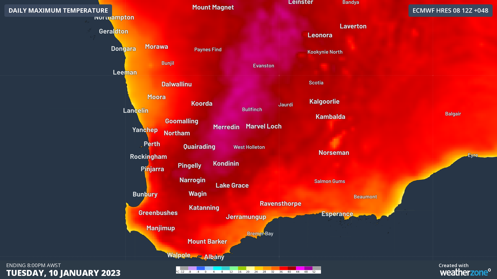
Southwestern parts of Western Australia are in for a wild 48 hours as extreme heat, strong winds, extreme fire danger and thunderstorms are all expected to hit the region.
A trough over the southeast is drawing heat in from the interior. Daytime temperatures are fairly similar to last week’s burst of heat, with many locations expected to reach the high thirties and low forties.
Strong winds are being fanned by a firm ridge of high pressure in the Bight, that will help Tuesday morning to be particularly gusty. Easterly winds are expected to gust to 70-90km/h over the Perth Hills in the early hours of Tuesday morning. Consequently, extreme fire danger (orange) is forecast for seven districts on Tuesday, with the remaining southwest expected to see high fire danger (yellow).
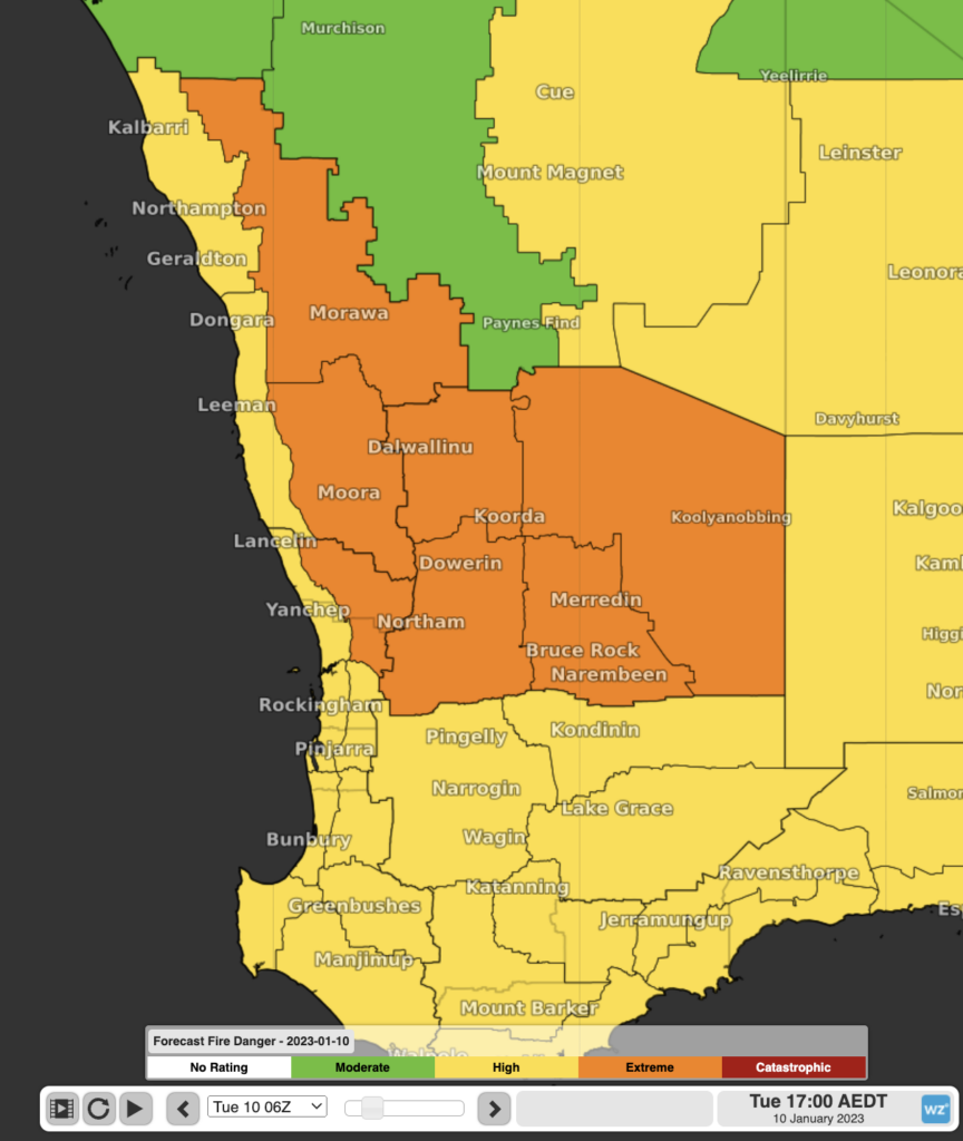
Image: Fire Danger Ratings for Tuesday, showing extreme in orange and high in yellow
The incoming heat is also being met with increased humidity, thanks to the monsoon that has been affecting northern WA over the last two weeks. As a result, temperatures will stay hot and sweaty overnight. Monday night is expected to stay warmer than 25 degrees in Perth as the humidity helps to trap the heat in.
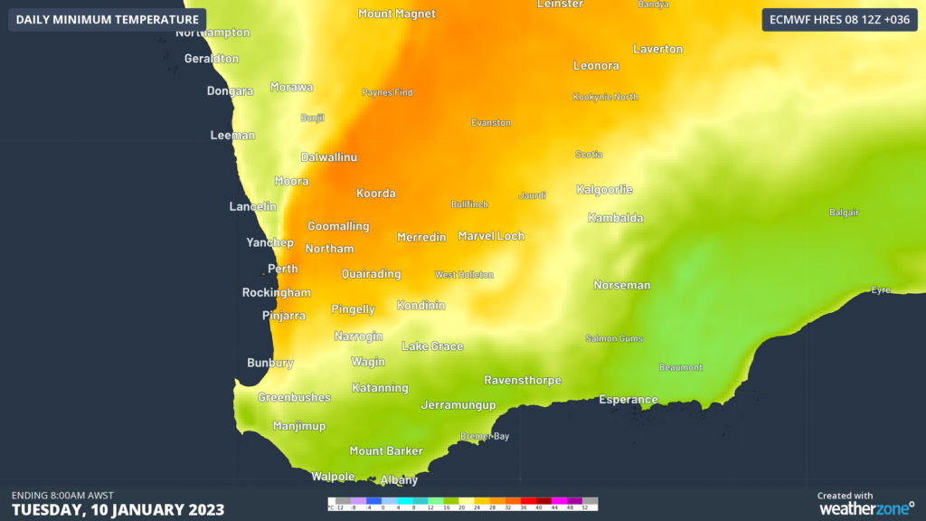
Image: Minimum temperatures on Monday night and Tuesday morning
The extra humidity is adding to the risk of storms into the mix as well. Thunderstorms are expected to develop in the Gascoyne and Central West on Monday afternoon, and progressively head south during the night and during Tuesday. Perth could see a storm in the late evening or early hours of tomorrow. Tuesday afternoon will likely see storms scattered across much of the south and interior in southwest WA. Many of these storms could be severe, with large hail being the most likely, but damaging winds and heavy rainfall are also possible.
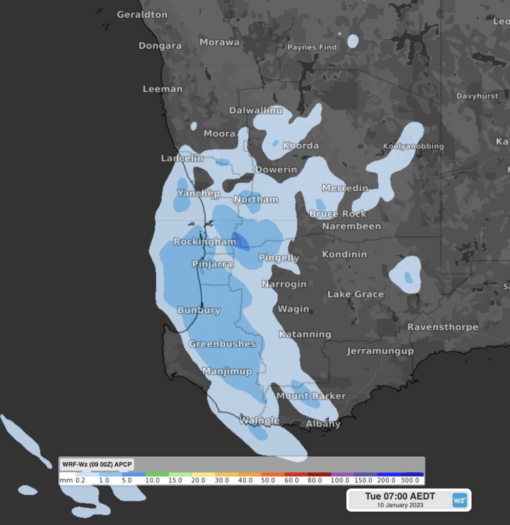
Image: 6-hour rainfall forecast from Weatherzone’s WRF model to Tuesday 4am WST, indicating the potential for thunderstorms.
Worryingly, some locations could see dry lightning, where a thunderstorm produces little or no rainfall. These types of thunderstorms are commonly associated with starting bushfires and were prolific during the Black Summer bushfires in 2019-20.
Fortunately, this congregation of severe weather events will be short-lived, with a cold front crossing on Tuesday, drawing the heat and excess humidity away from the region. That said, plenty of severe weather, fire and thunderstorm warnings could be issued over the next two days, so stay up to date here.
DTN APAC offers a wide range of forecasting tools, from automated forecasts, to in-depth forecast and guidance from our talented meteorologist team, to alerting of storms and fires near your assets. To find out more about what services can benefit your business, please email us at apac.sales@dtn.com.




