No South Australian needs to be told that it has been desperately dry in recent months across most of the state, and especially in southern parts.
“Adelaide is so dry my lawn is like brown dry paper that crunches when you walk on it… Where is our rain???” asked Weatherzone Facebook community member Mara Gemini on one of our recent posts.
The answer to the question “Where is our rain?” is that it has been blocked by the unrelenting blocking high pressure systems which have been centred south of the mainland for the last month or more.
These systems have prevented Southern Ocean cold fronts from surging northwards to South Australia on a regular basis and delivering much-needed autumn rain. And those strong highs have caused something else too: exceptionally cold water off the SA coastline.

Source: BoM.
Take a look at the chart above. It shows sea surface temperature anomalies in South Australian waters – or in other words, the current water temps compared to the average. As you can see, they are up to six degrees colder than usual for this time of year.
Why is the ocean off SA so much colder than usual?
- As mentioned, it’s all to do with those persistent highs.
- Because of their location south of the mainland, the highs have been consistently funnelling southeasterly winds in the direction of the SA coast.
- Because of a phenomenon called Ekman Transport, water moves at an angle of approximately 90 degrees to the left (in the S Hemisphere) of the prevailing wind.
- That means that water off the SA coast has been deflected out into the Southern Ocean
- When surface water is deflected away from the coast, it is replaced by an upwelling of colder water. And that explains the purple zone of super cold water around Ceduna and Streaky Bay in the image above.

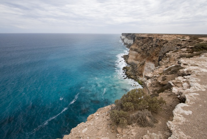
Image: Probably not the best week to take a dip along the Nullarbor coastline. Source: iStock.
What do the unusually cold ocean waters mean for SA weather?
Not good things, unfortunately.
- Cold fronts moving aross the ocean towards pick up more moisture from warmer waters and less moisture from colder waters. So when the fronts start arriving in southern SA more regularly this winter, rain-starved parts of southern SA can expect less rain than they’d see if sea surface temps were warmer.
- Without wanting to cause alarm, it’s still worth noting that an upwelling of nutrient-rich cold water tends to attract fish, which in turn attarcts sharks. There are probably not too many swimmers or even surfers in the chilly SA waters right now, but it’s still something to be aware of.
Meanwhile the graph below shows the last 12 motnhs worth of rainfall in Adelaide. You can see how the taps basically turned off after January and unfortunately, there’s no rain on the horizon over the next seven days.

The shifting climate is bringing increased complexity and greater risks to businesses worldwide. We are here for you, delivering trusted weather solutions to optimize your operations and profitability.
DTN APAC is a diverse team, with global forecasting, product development and analytics expertise. Couple this with extensive industry experience spanning Aviation to Energy, and we are primed to assist you in strengthening your response to weather
impact.
We work hard to identify your operational pressures and tailor our services and products to meet your needs. Concise communication, giving you full situational awareness exactly when you need it, is our focus. We want to reduce weather risk in your operations, every day.
We deliver clear and comprehensive weather data, personalised risk assessments and briefings to you and your team, so that your critical decisions can be made with confidence.
We are available 365 days a year, so you always have the timely guidance you require, especially when severe conditions hit.
You have our insights to rely on to see you through complex situations, minimising potential loss of profit and maximising the safety of your staff and assets. For more information, please contact us at apac.sales@dtn.com.


