
Damaging winds will continue to affect multiple states and territories across southern and southeastern Australia during the next five days.
A large and slow-moving low pressure system passing between Australia and Antarctica will cause a vigorous stream of westerly winds across Australia’s southern states in the coming days.
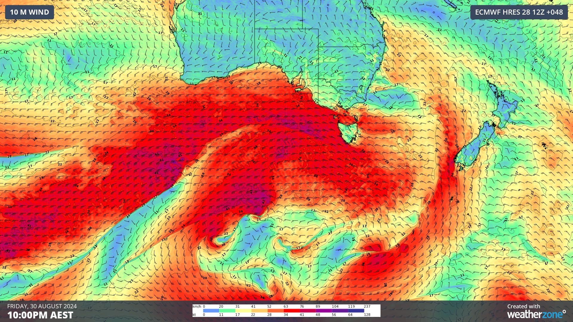
Image: Forecast wind speed and direction on Friday evening, according to the ECMWF-HRES model. This map shows wind circulating a large low pressure system to the south of Australia, with a vigorous stream of westerly winds between Australia and the low.
These powerful westerlies and a series of embedded cold fronts will cause damaging wind gusts in parts of WA, SA, Tas, NSW and the ACT between now and Monday. As of 2pm AEST on Thursday, severe weather warnings were in place for parts of these five states and territories.
In WA, damaging winds are possible along parts of the state’s southern coastline on Thursday in the wake of a cold front. Thursday’s winds will also combine with inland heat to produce Extreme Fire Danger in parts of the South Interior and Eucla districts. Wind and fire danger should ease into Thursday evening and Friday as the front moves further east.
This cold front will pass over SA on Thursday afternoon and night, causing a prolonged period of vigorous west to northwesterly winds from Friday and Sunday. Damaging wind gusts will be a risk over the state’s south and southeast throughout this blustery three-day period.
Tasmania will be buffeted by powerful winds, squally showers, thunderstorms and periods of snow between Thursday night and Monday. The entire state was under a severe weather warning on Thursday and there won’t be much respite from the wind in the next five days. These ferocious winds will combine with highland snow at times to cause blizzards. Rain-softened soil will also increase the risk of falling trees over the next five days, while ongoing heavy rain is likely to cause flooding in some parts of the state, particularly in the north and west.
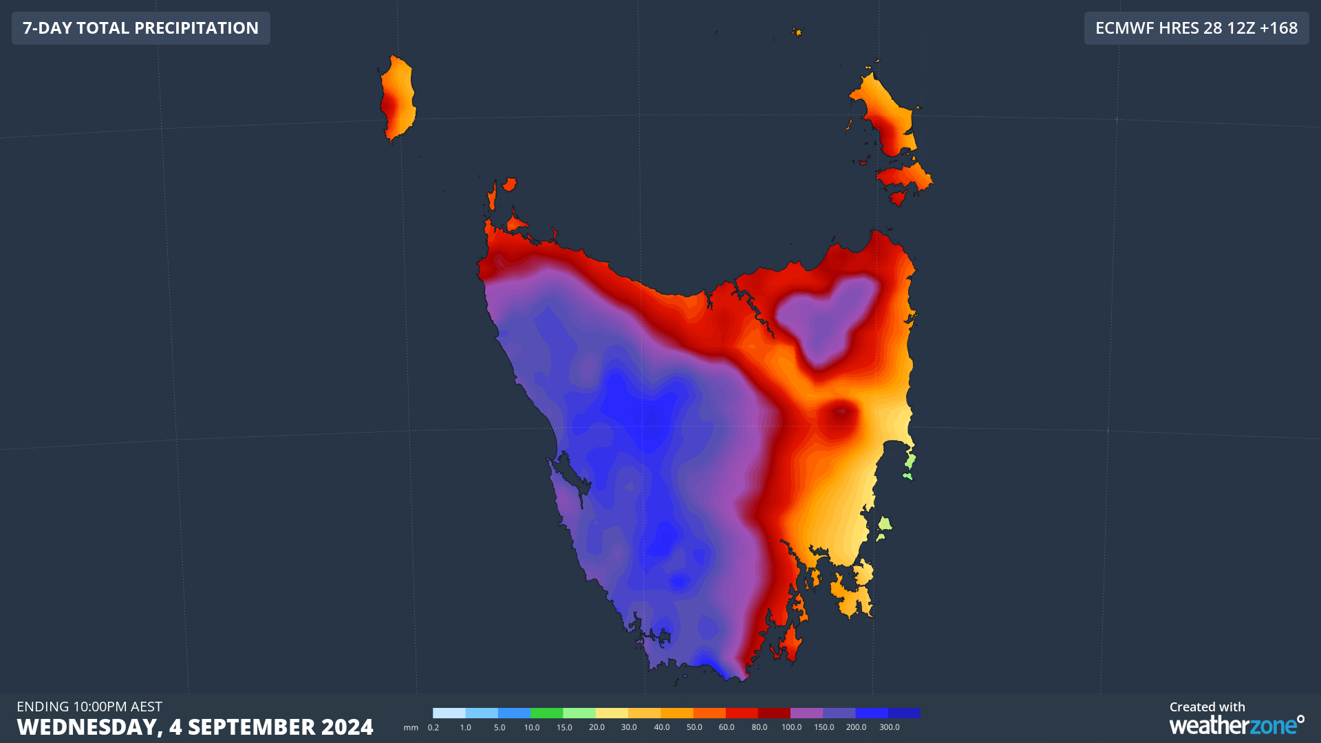
Image: Forecast accumulated rain during the 7 days ending on Wednesday, September 4, according to the ECMWF-HRES model.
Victoria will also experience further rounds of damaging winds between Thursday night and Monday. The strongest winds will occur in elevated and coastal areas, while places exposed to northwesterly winds will also experience frequent showers in the next five days. A severe weather warning has also been issued for damaging surf and abnormally high tides along most of the state’s coastline between Friday and Monday.
In NSW, vigorous winds and damaging gusts are likely from Thursday night through to Monday, most likely over the southern and central ranges and some parts of the coast. These potentially damaging winds will also affect parts of the ACT.
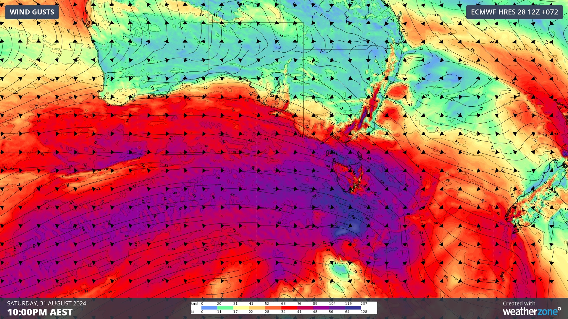
Image: Forecast wind gust speed and direction on Saturday night, according to the ECMWF-HRES model.
This system will cause a dangerous five-day period of weather in southern and southeastern Australia. As this event unfolds, please check the latest forecasts and warnings. To find out more, please visit our contact page or email us at apac.sales@dtn.com.


