
While Monday’s national weather focus is on Severe Tropical Cyclone Megan in the Gulf of Carpentaria, another big system is looming down south that will impact southern Australia in coming days.
The first strong cold front of autumn 2024 is heading the way of southeastern Australia and Tasmania and will bring strong blustery winds along with a significant drop in temperatures.
- Adelaide is already experiencing the warmth ahead of the front this Monday with a top of 30°C on the cards, ahead of a Wednesday max of 21°C, which would be the coolest day of 2024 to date.
- Melbourne will drop from a maximum of 32°C on Tuesday to a top of 18°C on Wednesday.
- Hobart should reach 29°C on Tuesday before a much chillier max of just 17°C on Wednesday.
- Canberra is heading for a top of 20°C on Thursday after a minimum of 5°C overnight, both of which would be the coolest readings for the year to date after what has been a very warm start to 2024 for the national capital.
- Sydney is an interesting one. Its maximum temp alone doesn’t reveal the full picture, as after Wednesday’s predicted high of 27°C is recorded, a strong afternoon southerly could drop temps by around ten degrees within a very short period.
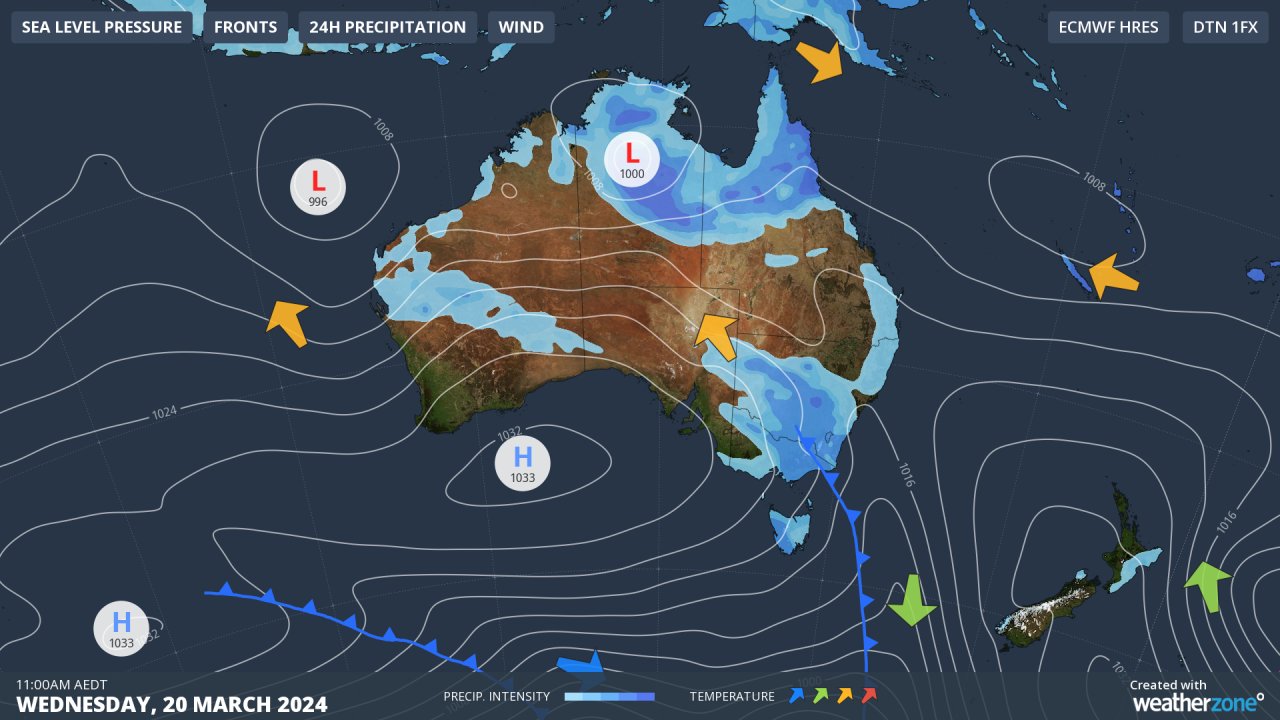
You can see the cold front sweeping across the southeast on Wednesday in our synoptic chart above, and while this particular system is not quite cold or moist enough to deliver the first autumn snow to the mainland high country, there’s a chance of a few snow flurries at higher elevations in Tasmania.
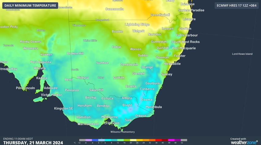
Thursday morning will then potentially be the coldest of the year in many locations as the dewpoints/humidity behind the front will be considerably lower. This is reflected in the chart below showing the predicted minimum temps.
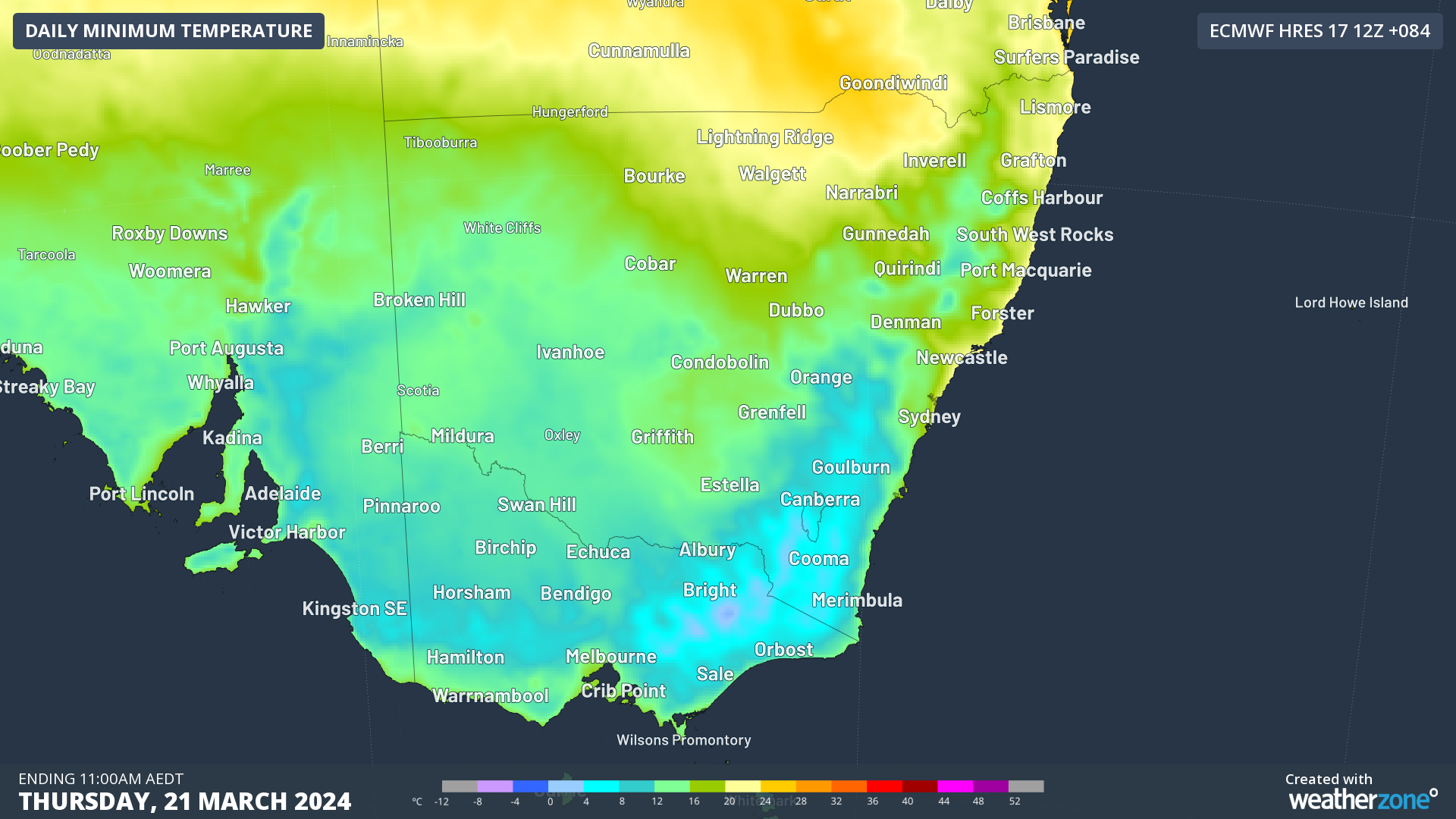
Anything with a shade of pale blue indicates single-digit overnight lows, while in the mainland ski resorts and the highlands of Tasmania it’ll be a properly frosty one, with subzero lows in store.
Blame SAM for the change in weather…
One of the main reasons behind a lack of cold fronts in southern Australia thus far in 2024 has been the consistently positive SAM (Southern Annular Mode) which refers to the north-south shift of rain-bearing westerly winds and weather systems in the Southern Ocean compared to the usual position.
When the SAM is positive, the systems tend to be further south. But the SAM has just gone into a negative phase, and while that is no guarantee of frontal activity affecting southern Australia, it makes the sort of weather coming this week a lot more likely.
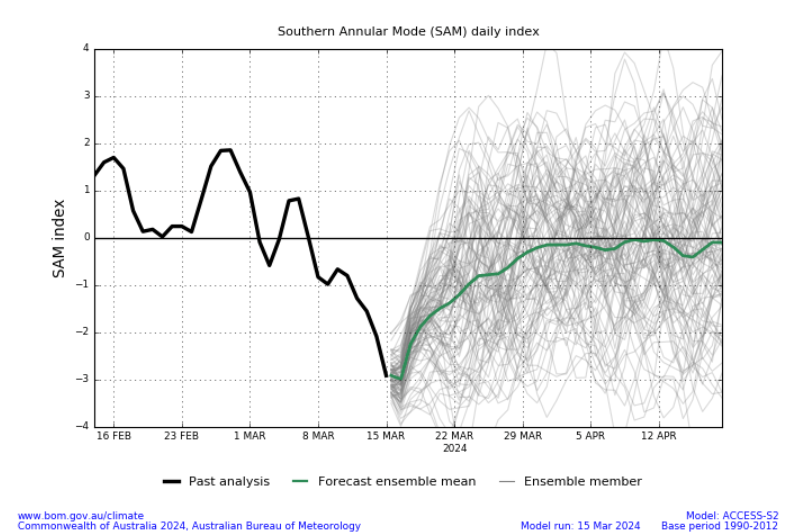
Image: The black line shows where our old mate SAM is at. Source: BoM.
READ MORE: What the negative SAM means for Australia
For more information on our energy forecasts, please contact us at apac.sales@dtn.com.




