
After months of warmer than average temperatures, southwest WA is seeing a colder than average week.
The mild beginning to the week in the southwest has been caused by cooler southwesterly winds behind a cold front which marched across the state on Monday.
This comes after a warm October, with the average maximum temperature of 26.2°C, nearly 5°C above average.
While the southwest of the state is enjoying mild spring temperatures, the cooler airmass did not make its way to the north of the state. Severe heatwave conditions are occurring as a result in the south and north interior of the state in the coming days.
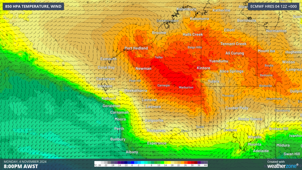
Image: 850 hPa temperature and wind at 8pm on Monday, November 4, according to ECMWF, showing a cooler airmass over the southwest and warmer over the north.
Daytime and nighttime temperatures dropped to around 2 to 3°C below average in the southwest from early Monday in response to this cooler airmass.
Perth’s minimum temperature dropped to 12.2°C early Monday morning, with the maximum in the afternoon only reaching 21.9°C which is well below the November average of 24.6°C.
The maximums will continue to be below average until Friday, meanwhile Thursday and Friday mornings will be chilly.
The image below shows the maximum temperature contrast across the state on Tuesday afternoon.
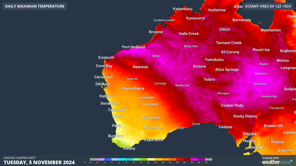
Image: Maximum temperature forecast for Tuesday, November 5, according to ECMWF
Perth’s maximum temperature should reach:
- 22°C Tuesday
- 21°C Wednesday
- 22-23°C Thursday
- 24-25°C Friday
The overnight temperature will plunge to around 9 to 10°C early Thursday morning, which is around 4°C below average. The minimum should be around 12-13°C later in the week before returning to the average of 14°C early Monday morning.
Looking ahead, maximums will finally tend to above average from early next week and are expected to be hot this summer, with an increased risk of extreme heat.
Weatherzone Business has grown to become the outright leader within the Australian energy market, serving wind, solar, hydro, trading, utilities and network companies.
You can’t control the weather, but you can gain precision insights to optimise your response. What lights us up is providing your energy business with tailored weather information to reduce your risk and keep you moving ahead of the curve.
Our services cover all aspects – from wind and solar generation to demand forecasts, wholesale markets to retail so, no matter where your company sits, we have solutions for you. We have worked closely with market participants to create products that meet the evolving needs of the sector, aiming to increase safety and profitability for our customers.
Benefit from the timely delivery of accurate weather information, allowing informed and effective decision-making. For more information please visit our website or email us at apac.sales@dtn.com.


