
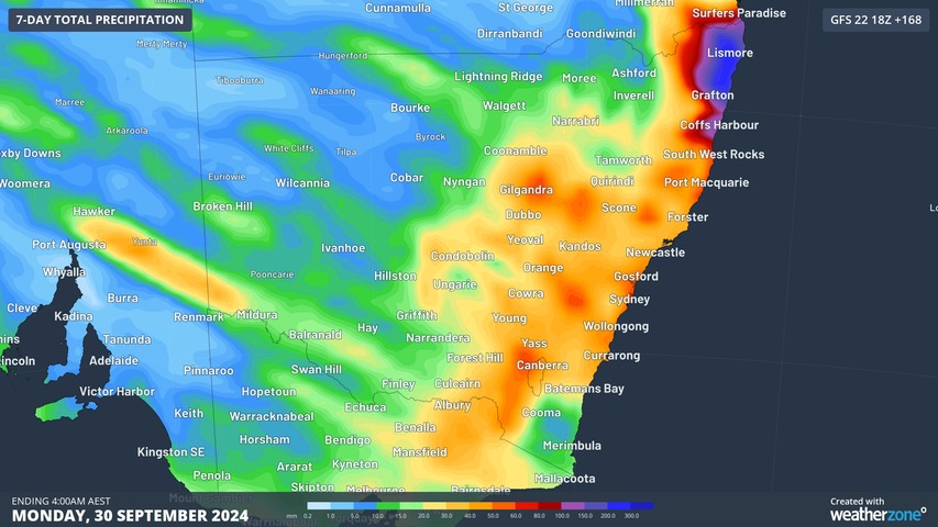
Rain is coming from Wednesday and Thursday to virtually all of New South Wales, most of which has been parched during the first three weeks of September. But before the welcome soaking, a burst of early spring heat with strong winds will bring elevated fire danger.
This is the chart showing accumulated rainfall totals in the coming week, according to GFS (America’s Global Forecast System model).
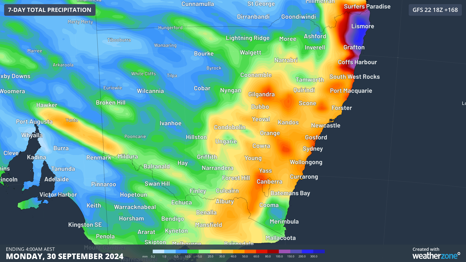
As the chart shows, rain will be heaviest in central and eastern parts of the state, with the possibility of especially heavy falls in the northeast corner, where totals exceeding 100 millimetres can be expected as a coastal trough forms later this week.
The rain will arrive with a cloudband from the northwest – and whenever weather systems cross NSW from that direction in spring, warm air from the interior of the country tends to precede it.
Winds will also be gusty, hence the elevated fire danger midweek in the state’s east, with a high fire danger forecast for the Great Sydney Region and the Illawarra/Shoalhaven Region just south of Sydney.
The dangerous fire weather comes after a hazard reduction burn (called a “planned burn” or “prescribed burn” in other states) raged out of control on Sydney’s Northern Beaches on Saturday due to strong winds. That fire has since been contained.
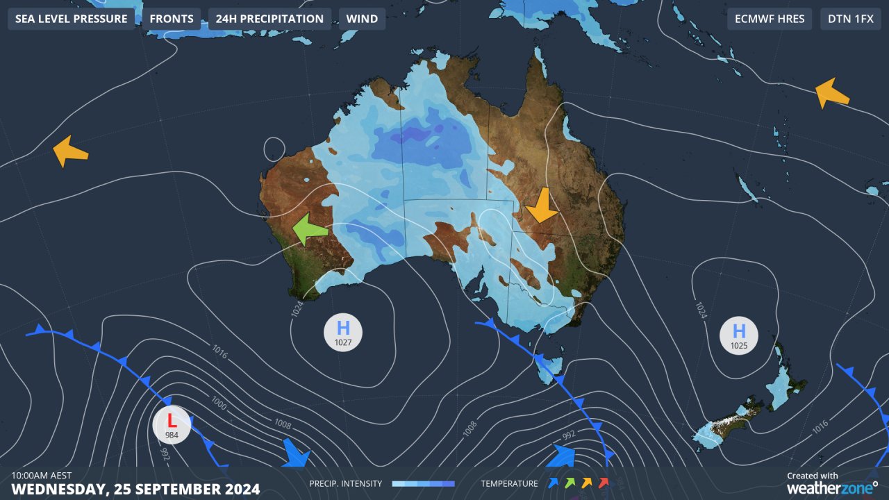
You can see the influx of warm air (indicated by the orange arrow) on Wednesday’s synoptic chart. The other main feature of the chart for the southeast of the country is the strong cold front down south.
Dramatic temperature fluctuations can be expected this week as the front sweeps northwards. Sydney’s maximum will likely drop by as much as 12 degrees within two days – with a maximum that could reach as high as 30°C on Wednesday, before plummeting to 18°C on Thursday as much cooler air and showers kick in with a southerly change.
As for rain, it will be welcome wherever it falls (assuming it is not so heavy that localised flooding occurs).
- Sydney is just one spot that has been extremely dry this month. While the harbour city exceeded its annual average rainfall in June after a very wet start to the year – and while most parts of NSW also had near-average or above-average rainfall in the first half of 2024 – things started drying out statewide in August.
- In NSW, rainfall across the state was 26.1% below the long-term average in August 2024.
In the first three weeks of September, most of the state has seen only a few drops of rain. Here are running totals, as at September 23, for Sydney plus four towns/cities in different parts of NSW:
- Sydney: 2 mm (monthly average 67.6 mm)
- Bega: (South Coast) 5.4 mm (monthly average 35 mm)
- Bourke: (Upper Western) 0 mm (monthly average 19.4 mm)
- Albury: (Riverina) 11.8 mm (monthly average 57.8 mm)
- Kempsey: (Mid North Coast) 19.2 mm (monthly average 43.1 mm)
In a best case scenario, parts of NSW will see warm weather followed by soaking rain this week, but there is definitely the chance of both fires and dangerously heavy rainfall, especially in the state’s east, so please keep checking the Weatherzone warnings page.
DTN APAC serves the forestry, fire, safety and emergency sectors, delivering trusted weather data and severe weather alerting to maintain safety, protect your assets and underpin your planning. Some of our key products are:
- Access to the Total Lightning Network, delivering unparalleled accuracy of lightning strike data
- Fire hotspot tracking and alerting through Stormtracker, so new fires can be assessed and controlled nearly immediately after they form
- Seasonal briefings by our expert meteorologists and climatologists customised to your business to better tailor your preparedness for the upcoming seasons
For more information, please visit our website or email us at apac.sales@dtn.com.




