
A very dangerous outbreak of severe thunderstorms will continue across southeastern Australia on Friday, with NSW, Vic and the ACT in the crosshairs for potentially destructive storms.
A low pressure system and cold front will cross southeastern Australia on Friday while interacting with an upper-level trough and abundant atmospheric moisture. This set-up will create an environment that is conducive to explosive thunderstorm activity, with the most dangerous variety of thunderstorms – supercells – a good chance of occurring in some areas.
We have already had a preview of the type of destructive storms this system can produce. On Wednesday night, a likely supercell thunderstorm toppled electricity transmission towers to the south of Broken Hill in NSW. On Thursday, another flurry of powerful storms produced wind gusts exceeding 100 km/h at five separate weather stations in SA, the highest being 137 km/h at Port Pirie on the eastern coast of Spencer Gulf.
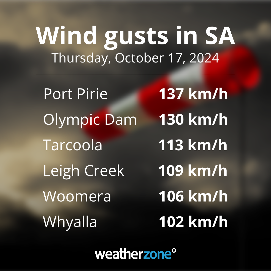
Image: Peak wind gusts observed in SA on Thursday, October 17, 2024.
Thunderstorms will develop over a broad area of southeastern Australia on Friday, likely stretching from southern Qld down through NSW/the ACT and into Vic. There could also be some storms in Tas and extending northwards up through the NT and into the Kimberley and Top End.
The most intense thunderstorm activity on Friday is expected to occur over the central and southern inland of NSW, the ACT and northeast Vic during the afternoon and early evening. In this storm-ripe environment, copious instability and ample wind shear are likely to cause rotating supercells, which increases the risk of destructive wind gusts (exceeding 125 km/h), giant hail (exceeding 5cm diameter), intense rainfall and tornadoes.
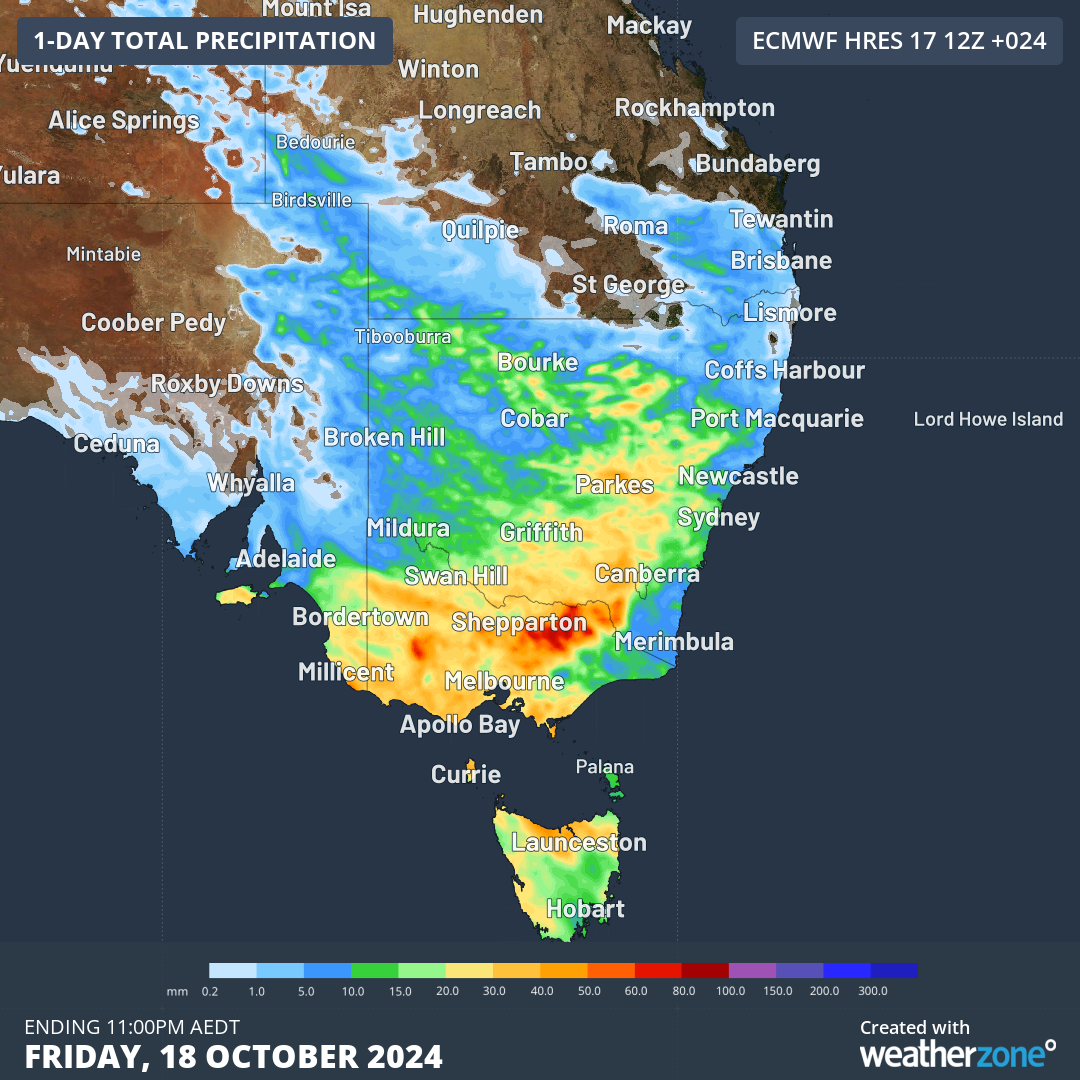
Image: Forecast accumulated rain on Friday, showing the general area where rain and storms will occur.
Sydney, Melbourne and Canberra could all see storms on Friday, although Sydney probably won’t see them until the late afternoon or evening. Of these three capital cities, Canberra has the highest risk of being hit by severe storms during Friday.
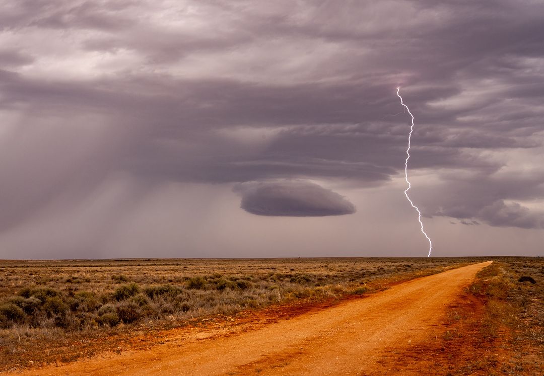
Image: Lightning strikes the ground near Broken Hill on Thursday, October 17, 2024. Source: @vlatkosphotography / Instagram
Anyone in southeastern Australia on Friday should monitor the latest severe thunderstorm warnings for the most up-to-date information. Checking the radar will also help you keep track of storms as they develop.
DTN’s Total Lightning Network is your key to precise detection and alerting, giving you time to protect your people and assets.
The shifting climate is bringing increasingly severe weather events, so it’s time to safeguard your business against the potential damage lightning can cause.
Our Total Lightning Network is the intelligent solution that goes above and beyond to increase your lead time before the storm hits.
We ultilise a vast global sensor network, created with our partner Earth Networks. Over 1200 sensors in 40+ countries provide a worldwide view of both intra-cloud (IC) and cloud-to-ground (CG) lightning strikes, enabling businesses to plan and respond with the most precise insight available.
Offering unsurpassed accuracy, with real-time detection to <200m, we integrate with your existing systems to keep your enterprise operating within your defined severe weather thresholds.
Leave nothing to chance. Be confident working outdoors with the most sophisticated lightning alerting system, delivering intelligence to any device across your business network.
To find out more visit our contact page or email us at apac.sales@dtn.com.


