
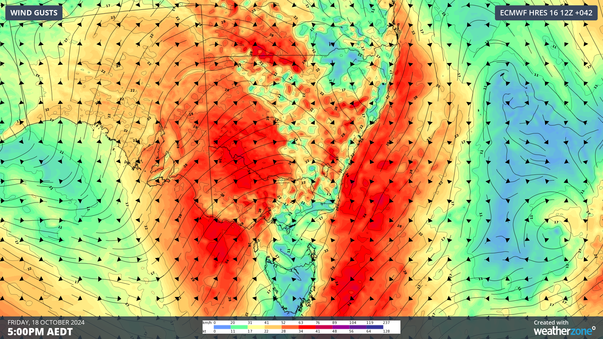
A dangerous mix of damaging winds and widespread severe thunderstorms will impact the southeastern states in the next 48 hours, elevating wind power across the region.
A deepening low and associated cold fronts and troughs entered SA on Thursday morning and are expected to sweep east towards Vic and NSW during Thursday and Friday bringing severe weather to the states.

Image: Himawari-9 satellite image, radar and lightning at 12:10pm AEDT on Thursday, October 17
You can see on the satellite image above that there are already widespread thunderstorms generated by this system, which are expected to become severe later today into Friday.
Thunderstorms will continue over a broad area of southern and southeastern Australia on Thursday and Friday and severe thunderstorms are likely in multiple states on both days. These thunderstorms have the potential to cause locally destructive winds in the regions.
Damaging winds developing in SA
Damaging winds are forecast to develop across West Coast, Flinders, Mid North, North West Pastoral and parts of Eastern Eyre Peninsula and North East Pastoral districts on Thursday morning. Average winds of 60 to 70km/h are forecast with gusts reaching 90 to 100 km/h in these districts.
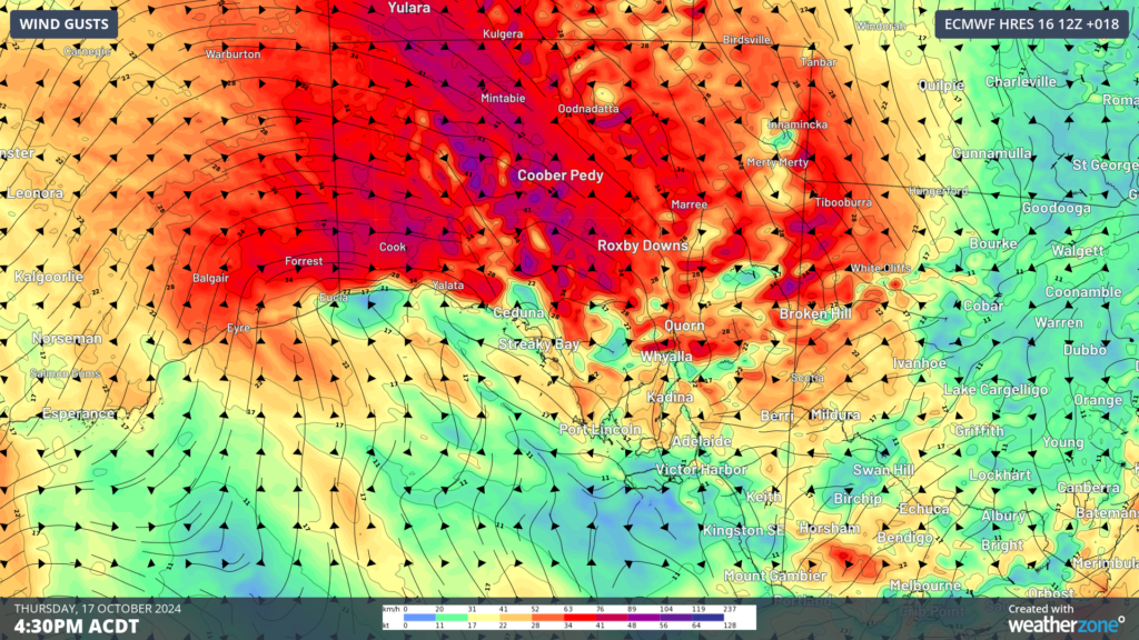
Image: Instantaneous wind gust forecast at 4:30 ACDT on Thursday, October 17, according to ECMWF
While winds will ease later in the evening across much of the warning area, the Flinders and Mid North districts will continue to see damaging winds until early Friday morning.
The strong northwesterly winds are also dragging a hot airmass across SA on Thursday with maximum temperatures expected to exceed 40°C across northern SA, with Adelaide expected to reach the high 20s this afternoon.
Damaging winds to impact NSW, Vic from late Thursday into Friday
The low pressure system will move over Vic early Friday morning, bringing blusterous northwesterly winds to parts of NSW and Vic.
Damaging winds will develop overnight Thursday across the Grampians and the Central ranges, with wind gusts reaching around 90km/h in the area, before easing later Friday morning. Meanwhile Melbourne should experience some strong gusts, possibly just below warning strength.
The fierce winds will also impact the ranges and eastern slopes in NSW on Friday, before a strong a gusty southerly change moves up the coast.
Ahead of the change, Brisbane will see temperatures peaking at around 33 to 34°C on Saturday.
The extremely windy days are set to bring great wind generation to the NEM, with Vic’s generation peaking on Friday, October 18.

Image: DTN’s National Electricity Market (NEM) wind farm output for the NEM (orange) and Vic (blue), NSW (black) and SA (green for the next 5 days.
Winds will ease on the weekend as a high pressure system moves into the front’s wake, with models suggesting winds could increase again mid next week.
DTN APAC delivers industry-leading weather and power generation forecasting and real-time alerting to inform your critical decision-making. Together we can keep your staff and assets safe, and efficiency high.
With lightning strikes, severe weather, flood and fire posing risk to wind farms across Australia, we have tailored solutions that can significantly improve your oversight and response.
Total Lightning Network comprises of regional and global sensors to detect intra-cloud (IC) and cloud-to-ground lightning (CG) strikes within your proximity thresholds. It provides unparalled detection accuracy (<200m) and real-time lightning alerts to any device across your operations team.
Your customizable Energyzone interface and Weatherguard app will provide access to the Total Lightning Network as well as centralized data from state and territory fire agencies, the Bureau of Meteorology, and over 30 national and international private and state organisations. This enables full situational awareness of weather conditions and fire risk, as well as severe weather alerting via text, email and phone call, so your staff can respond effectively when required. To find out more visit our contact page or email us at apac.sales@dtn.com.




