
Southeastern Australia is set to shiver through some of the coolest temperatures in months as an Antarctic airmass sweeps across the region later this week.
A cold front will move through southwestern Australia from Tuesday, causing temperatures to drop around 2-5 degrees below average on Wednesday and Thursday.
The map below shows the cool temperatures forecast for southwestern WA on Wednesday associated with this system.
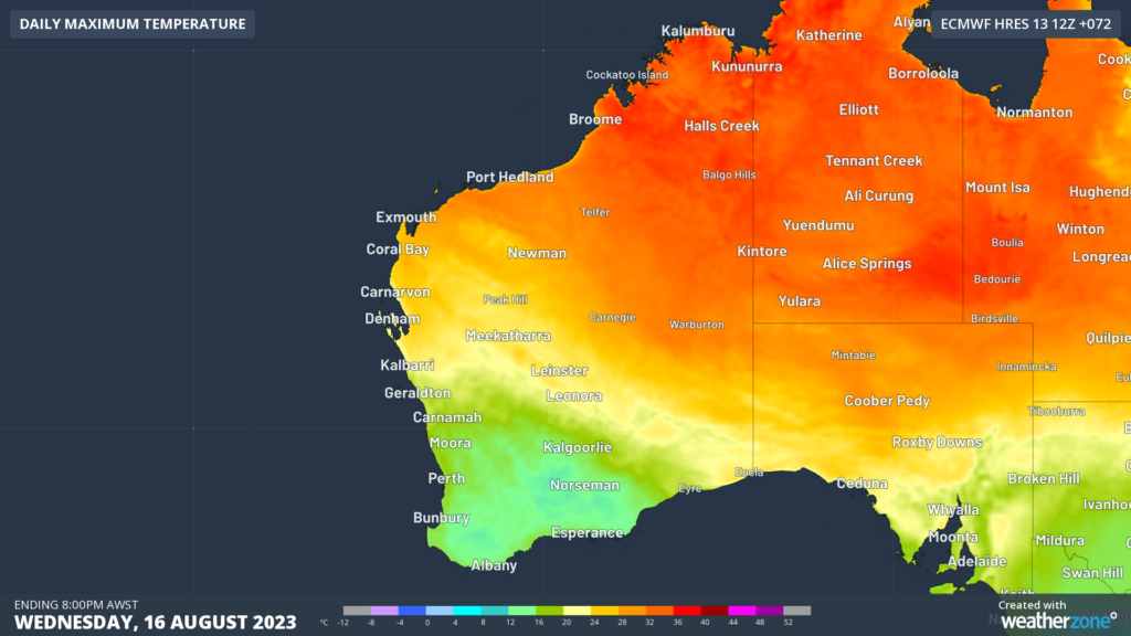
Image: ECMWF maximum temperature forecast for Wednesday, August 16
The system will then cross the southeast of the continent on Thursday and Friday, causing temperatures to plummet in SA, Vic, Tas, the ACT and parts of NSW, even getting cold enough for low level snow in some southeastern states.
The image below shows the cool airmass that is forecast to affect southeastern Australia Friday night, using 850 hPa temperatures, which is looking at the air roughly 1.5 km above sea level.
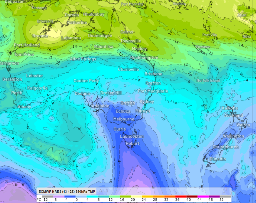
Image: ECMWF 850hpa temperature at 1am Saturday, August 19.
The approaching frigid air could drop snow levels to around 600m in parts of Tas, 1000m in Vic and 1100m in NSW later this week, which could mean the season’s first snowfall on the Central Tablelands in NSW.
This chilly air has arrived after some recent ‘spring like weather’, with record mid-winter warmth recorded In July, which caused snow depths to drop to their lowest level since 2006 in some parts of southeastern Australia.
Melbourne has not seen the maximum temperature drop below 12.5C since June, with cold fronts slipping further south in July. Melbourne could see the coolest temperatures since June move later in the week, with maximums of 12-13C possible on Thursday and Friday.
Overnight temperatures are also forecast to be frosty on Thursday and Friday mornings, with temperatures likely dropping below 0C in some areas. Canberra’s minimum temperatures on Thursday, Friday and Saturday morning could drop to –2 degrees.
The cold front will also bring blustery winds and rainfall, which will make these temperatures feel even colder than the thermometer suggests.
Fortunately, some warmer winter weather will return later on the weekend as winds shift to the northwest ahead of the next cold front.
How can DTN APAC help?
DTN APAC supplies precise weather intelligence to over 75% of the National Energy Market (NEM); and is the trusted provider for the Australian Energy Market Operator (AEMO).
Weatherzone’s next-generation nowcasting and forecasting system, OpticastTM, is independently proven to outperform other industry models, allowing energy traders to respond rapidly to changing conditions. From 14 day forecasting to seasonal outlooks, you have access to complete and powerful weather intelligence giving you the confidence to make the best call.
Meeting the needs of the changing market, Weatherzone utilises high-resolution modelling and local knowledge to provide 5-min granularity observations and forecasts, optimising your market bidding and maximising your profits. These, coupled with briefings from our energy meteorologists, give you full awareness of the associated risk.
Benefit from specialised indices such as apparent temperature, Cooling/Heating Degree Days (CDD/HDD) and Effective Degree Days (EDD) to help accurately predict demand. You can get a clear picture of forecast conditions across the market and quickly assess heat/heatwave potential from 14 days out to 12 months
No matter where your energy trading focus lies, we have the power generation and weather insights to inform your critical decisions, keeping you ahead of the curve. For more information please contact us at apac.sales@dtn.com.


