
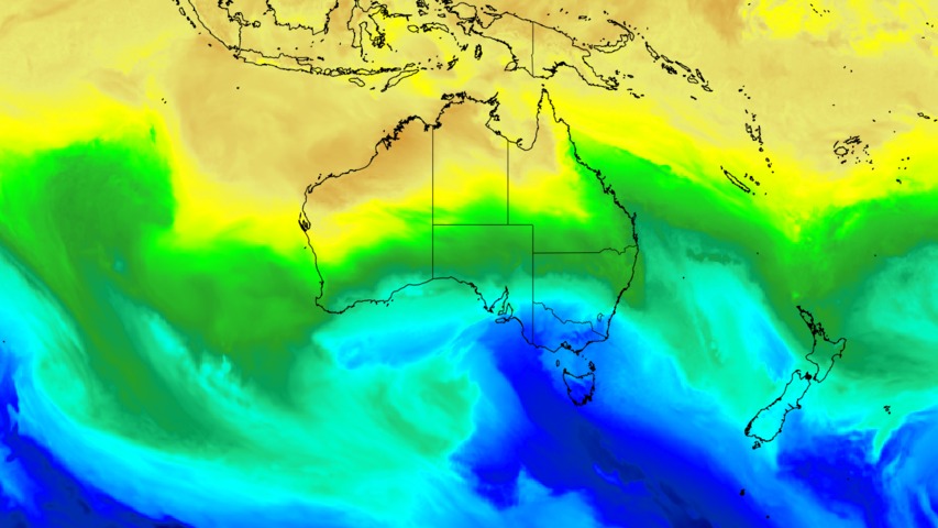
A burst of cold weather will strike southeastern Australia this weekend, causing a wintry mix of low-level snow, icy winds, rain, hail and thunderstorms.
A strong cold front will drag a polar air mass across Australia’s southeastern states on Saturday and Sunday. This injection of frigid air will cause temperatures to plummet across parts of Tasmania, Victoria, SA, NSW and the ACT over the weekend.
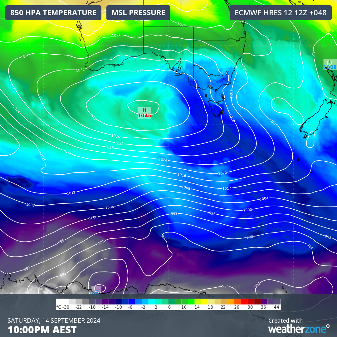
Image: Cold air extending from Antarctica to southeastern Australia on Saturday night.
Tasmania
The coldest weather this weekend will occur in Tasmania, where it should get cold enough for snow to reach around 200 m above sea level on Saturday. These freezing temperatures combined with squally winds and snow will make it unsafe for outdoor activates such as hiking and bushwalking, particularly over the state’s Western and Central Plateau on Saturday, where wind chill will make temperatures feel lower than -10°C at times.
Hobart is only forecast to reach 11°C on Saturday and 13°C on Sunday, although most of Saturday will feel colder than 3°C amid blustery winds and showers. While Sunday will be drier and a bit warmer in Hobart, the city’s temperature should still feel lower than 6°C for most of the day.
Rain, hail and snow will all fall in Tas this weekend, with the heaviest accumulations occurring in the state’s west and south. There could also be a few thunderstorms.
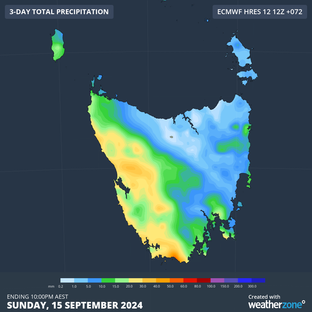
Image: Forecast accumulated rain in Tasmania this weekend.
Victoria
Cold southerly winds will spread across Vic on Saturday and linger throughout Sunday, making the second weekend of spring feel unmistakably wintry across the state. Snow could reach around 700 to 800 m elevation in the state’s south and northeast late on Saturday and early Sunday. There could also be some hail and a few thunderstorms among the showers on the weekend.
Melbourne’s temperature is forecast to reach 12°C on Saturday and 14°C on Sunday, although it will be feeling more like 3 to 6°C from Saturday afternoon through to Sunday morning.
South Australia
Most of SA won’t get too cold from this system, although temperatures will be noticeably chilly in the state’s southeast on Saturday.
Mount Gambier is only forecast to hit 13°C on Saturday but much of the day will feel at least 5°C colder than this due to wind chill. Adelaide should reach about 17°C on Saturday and Sunday.
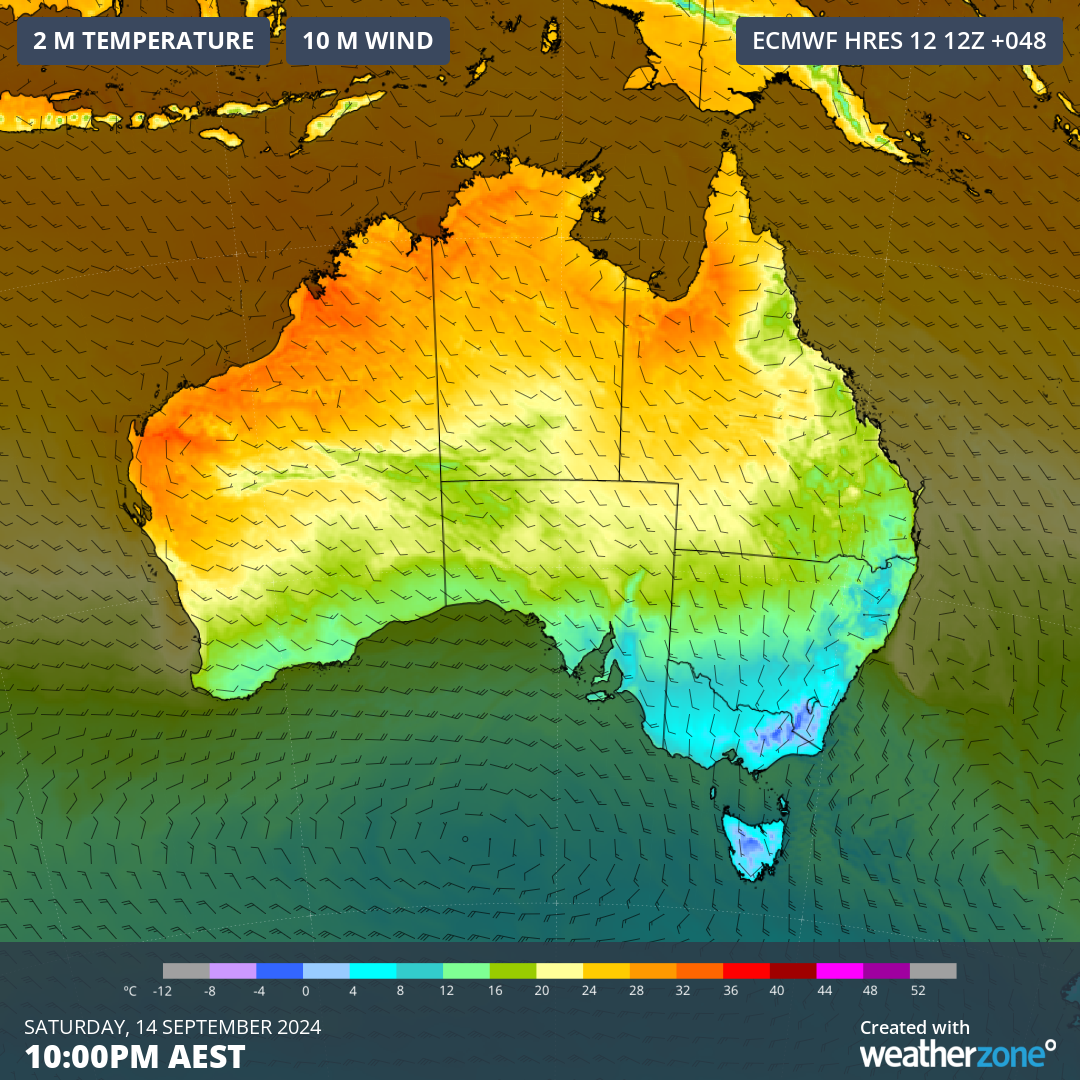
Image: Forecast temperature and wind at 10pm AEST on Sunday, showing southeastern Australia much colder than the rest of the country.
NSW/ACT
The cold air will reach NSW and the ACT from Saturday afternoon and linger into Sunday. It could get cold enough for snow to reach about 1000 m in southern NSW and the ACT on Saturday evening through to Sunday morning. There is also a chance of a few snow flurries in higher areas of central NSW on Sunday morning, most likely on the Oberon Plateau.
Canberra’s temperature will only reach the mid-teens on Sunday and most of the day will feel lower than 8°C.
Sydney will cop a surge of cold southerly winds from Saturday afternoon through Sunday, causing most of Sunday to feel colder than 10°C in the city. Damaging winds could also develop in parts of eastern NSW on Sunday as southerlies strengthen along the coast and ranges.
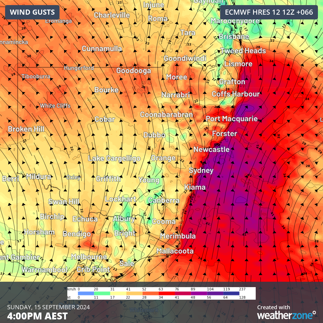
Image: Forecast wind gusts on Sunday afternoon.
Be sure to check the latest forecasts and warnings this weekend if you are in southeastern Australia.
Weatherzone Business has grown to become the outright leader within the Australian energy market, serving wind, solar, hydro, trading, utilities and network companies.
You can’t control the weather, but you can gain precision insights to optimise your response. What lights us up is providing your energy business with tailored weather information to reduce your risk and keep you moving ahead of the curve.
Our services cover all aspects – from wind and solar generation to demand forecasts, wholesale markets to retail so, no matter where your company sits, we have solutions for you. We have worked closely with market participants to create products that meet the evolving needs of the sector, aiming to increase safety and profitability for our customers.
Benefit from the timely delivery of accurate weather information, allowing informed and effective decision-making. For more information, please visit our website or email us at apac.sales@dtn.com.




